Before I talk about the forecast I want to look back at the month of July first. It was definitely a wet month with our area getting 4.6″ above the average rainfall.
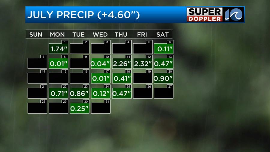
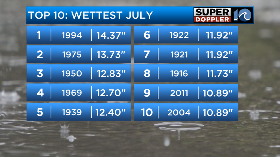
This put our total up to 10.68″ However, this was short of the top 10 wettest Julys on record.
As we had a lot wet weather it did keep the temperatures down on many days below the average. There were some hot streaks, but there were also plenty of cooler days.

So interestingly we ended up only a little bit above the average. This is in contrast to the planet’s temperature which recently had the hottest day on record.
Yesterday we topped off in the mid 90s but the heat index was over 100.
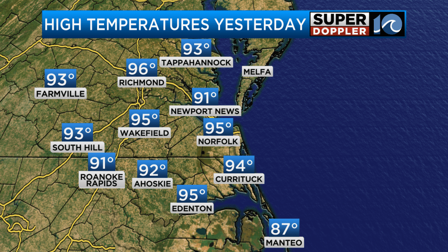
It was so hot that I opted not to go to the pool with my daughter. Today is going to be even hotter. High temps will rise up to the mid-upper 90s.

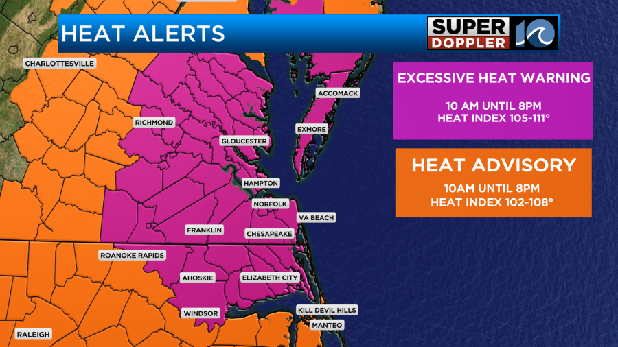
However, the heat index will rise up to between 105 and 111 degrees.
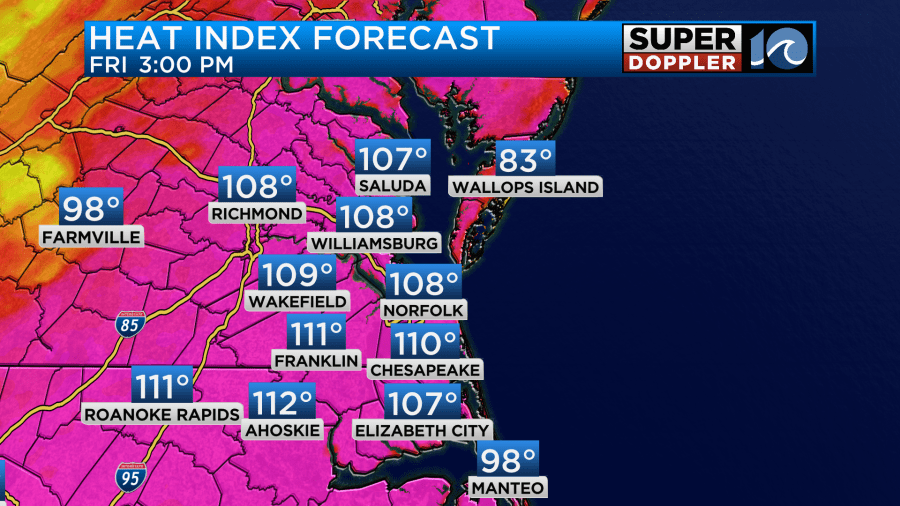
Because of these “feels like temperatures”, there is an Excessive Heat Warning in effect today for most of the region.
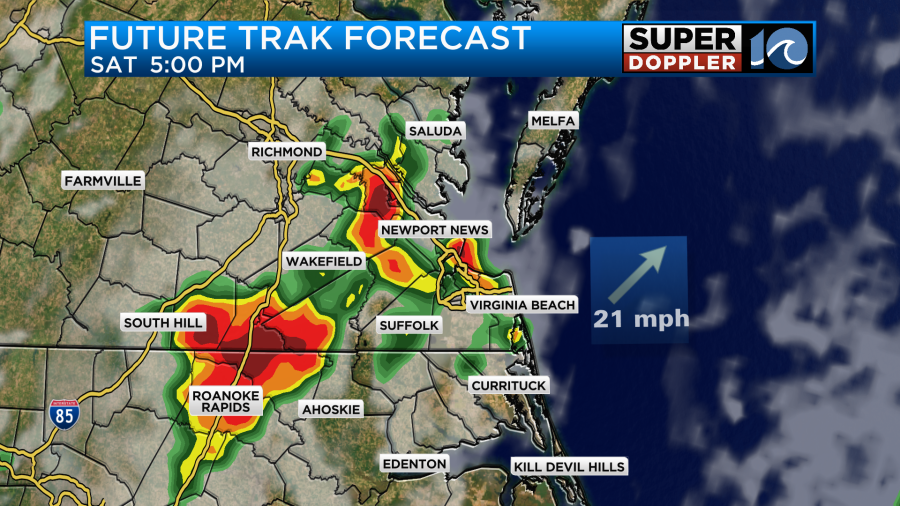
We’ll be partly cloudy for a stretch. Then a few pop-up showers and storms will develop between 3 and 5pm.
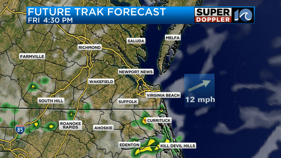
It looks like the storms will pick up some more as we go into the evening.
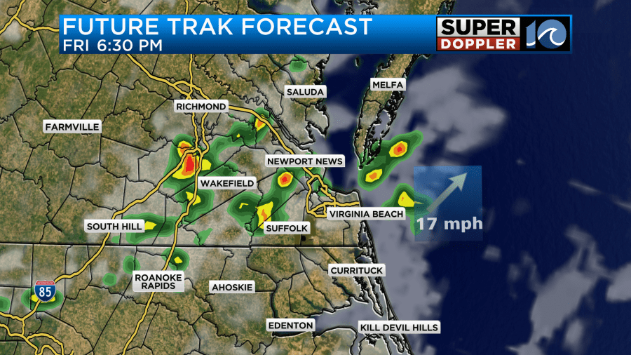
There may be a few strong storms during that time. We do have a marginal risk for severe weather.
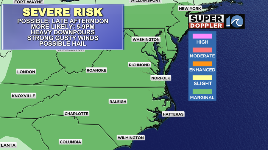
We’ll have a general wind out of the southwest at 5-15mph today, but some stronger gusts could happen in any of the storms that form. Heavy rain will also be possible. These should taper off by the later evening. Then we’ll have some isolated showers or storms overnight.
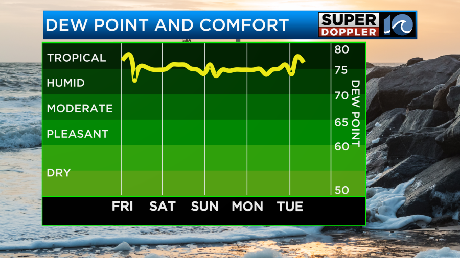
Tomorrow we’ll still be hot and humid. High temps will run up into the mid 90s. The heat index will probably be up to around 105 degrees.
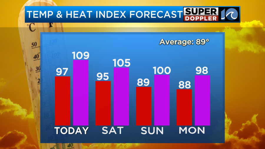
However, we’ll have more clouds, and there will be some scattered showers and storms during the afternoon. This may keep the temps down slightly more than forecast, but not enough that you would notice a difference. There may be some heavy rain and strong storms developing as we get from the mid afternoon into the early evening.
The cool front will be approaching the area on Sunday. It may move into the area and stall out. Hopefully, it cools us down a bit. For now I have high temps in the upper 80s. Even if we cool down though it will not dry out.
The front will probably fall apart on Monday, but we should be a bit cooler. High temps will be in the upper 80s. We’ll have some more scattered storms. However, we should have drier weather for the rest of next week. Of course that will depend on what happens in the tropics.
Today we are closely watching a tropical disturbance near Cuba.
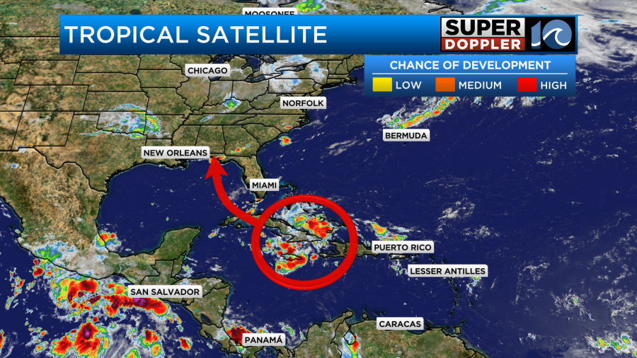
This feature is moving to the northwest at a slow pace. The storms are still disorganized. However, it is likely to move into the Gulf of Mexico over the weekend, and that area is a little more favorable for development.
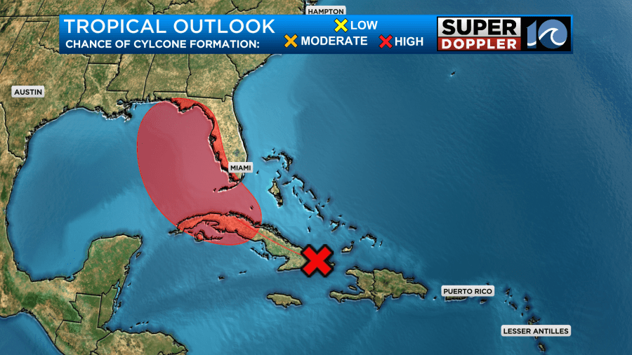
The disturbance is forecast to move up along the west coast of Florida.
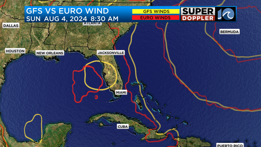
After that point it will probably run into Florida and produce some heavy rain. The models are in pretty good agreement in this scenario.

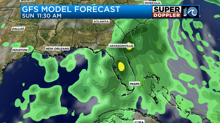
However, after that point there is a lot of uncertainty in the forecast. The trend is for it to move off the east coast of Florida and then strengthen. Then the models mostly have it moving northeast along the southeast coast. However, the models have been bouncing around a lot over the last couple of days. Also…The system hasn’t even formed yet.
The GFS model has the system up off the coast of the Carolinas by the middle of next week. The Euro has trended this way, but it keeps the system much weaker.
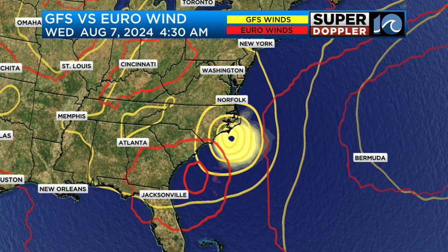
With the high uncertainty after Florida at this point I wouldn’t be too worried about it just yet. However, you should definitely check back for updates this weekend. Especially, if you have plans for a trip to the Outer Banks, or if you live there.
Meteorologist: Jeremy Wheeler


