We had more rain, more storms, and more flooding yesterday. It was quiet for a while with a lot of heat and humidity. Then scattered storms fired up during the afternoon.
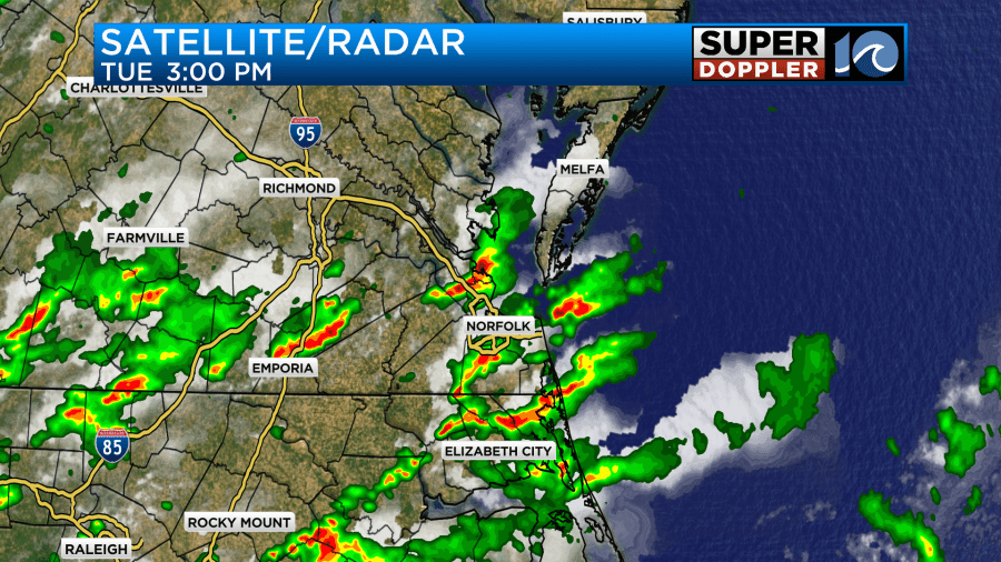
The rain created flooding over several areas. There was flash flooding on the Peninsula and the Southside. It was pretty rough in Portsmouth for a time. Rainfall varied quite a bit. Some areas had about 1-3″ while many others had only about a half an inch.
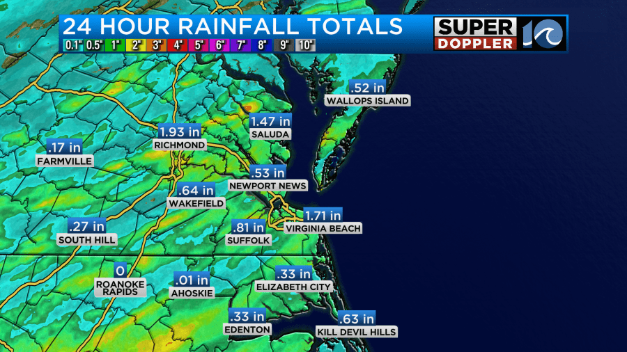
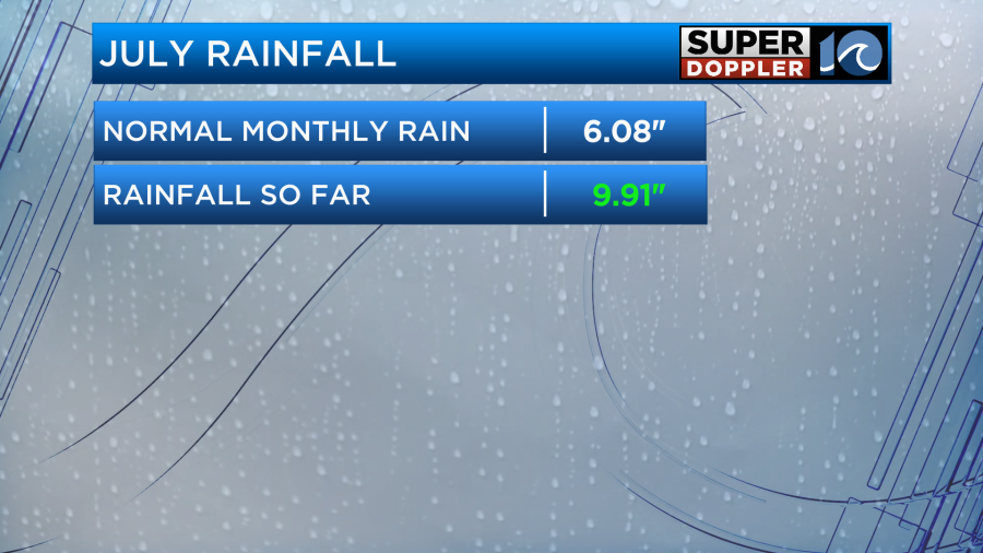
We had more rain this morning over the region. It likely created a lot of the traffic accidents that we had during the AM commute. Luckily, the showers tapered off by 7am. Up to this point we have picked up over 9.9″ of rainfall. This is already well ahead of the average for the entire month of July.
We will likely wind up in the top 10 wettest Julys on record.
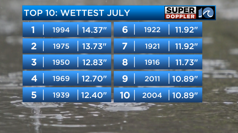
We are stuck in this wet pattern for a couple more days. So we’ll likely get within the top 7 or 8. Today we still have a stationary front in the region with a layer of deep/rich moisture along and southeast of the front.
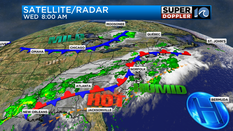
High pressure is offshore. There is a cold front building over the Midwest. So we’ll have a break for a while, but then scattered storms will fire up during the afternoon.
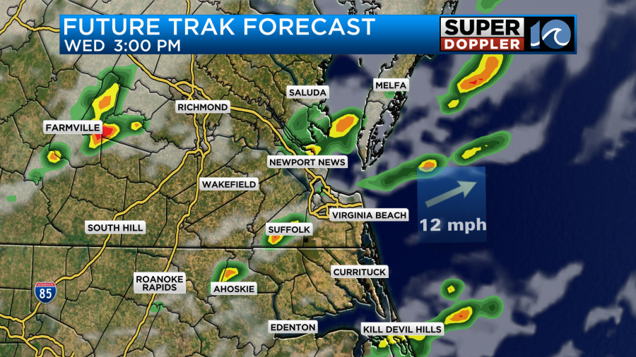
Some of these will contain heavy rain. There may even be some isolated flooding. The scattered storms will continue through the early evening.

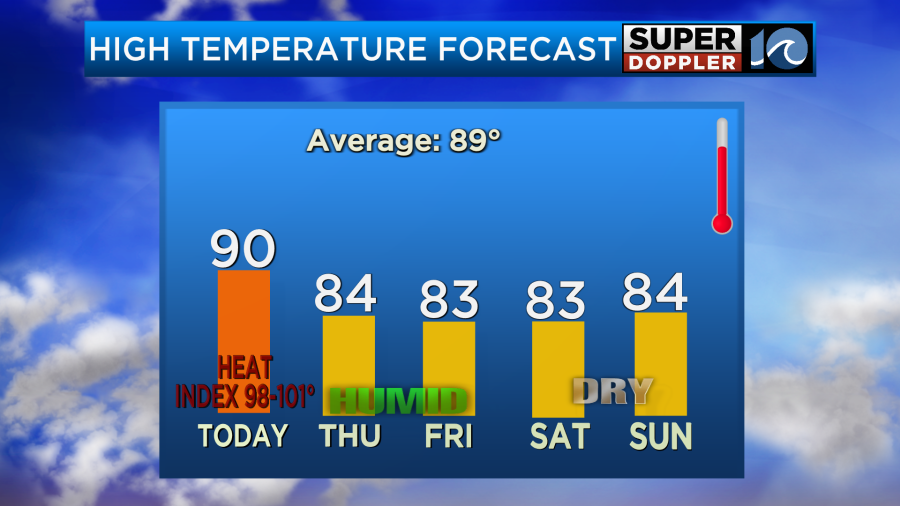
High temps will make it to around 90 degrees before the storms kick in. The heat index will be near 100.
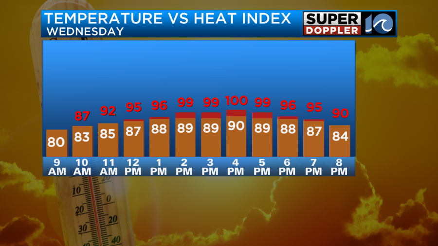
Some of the storms will drop the temps down to the upper 70s by the evening. Tomorrow the stationary front will lie over the region with the cold front moving in from the northwest. This will make for a cloudy or mostly cloudy day. Also, tomorrow the rain and storms will be on and off through the day.
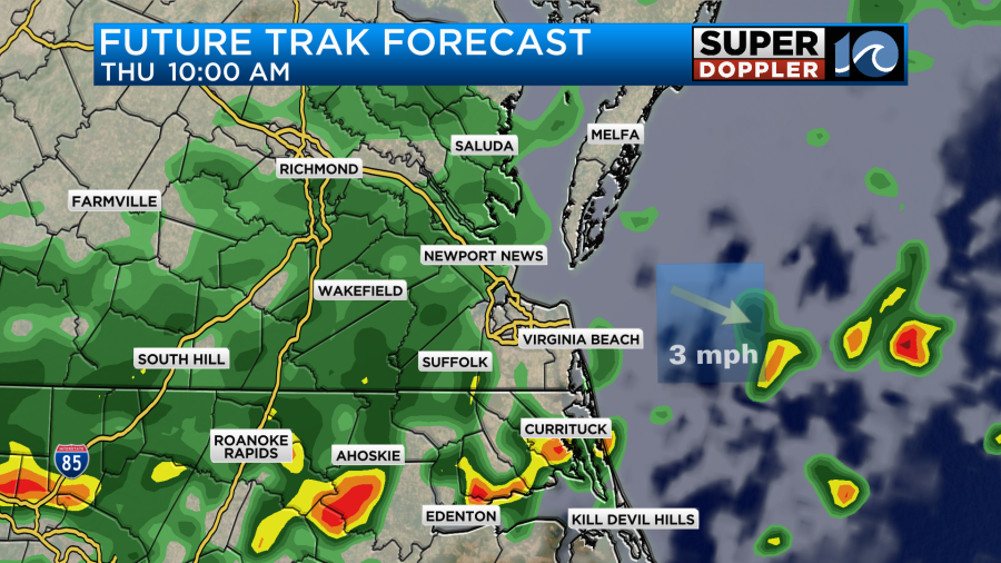
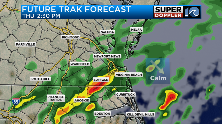
Rain will again be heavy at times. There may be a few strong storms. One benefit is that the temperatures should be held down quite a bit. High temps are aiming for the low-mid 80s, and some models suggest we’ll be closer to 80 degrees for highs.
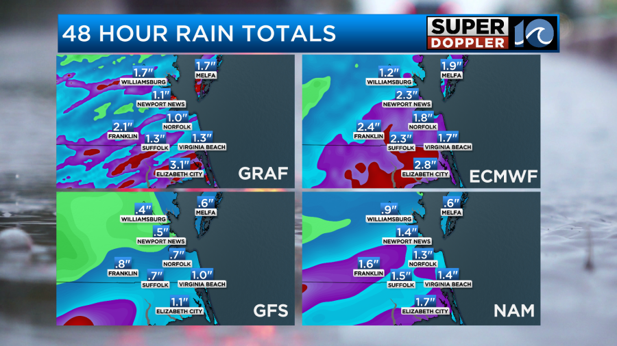
Rainfall will vary greatly over the next 48 hours. We could see amounts between a half in up to 3 inches.
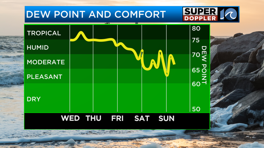
The cold front will enter the area Friday morning. There will be a few showers as the front passes. Then the front will sink into North Carolina during the afternoon. This may create a couple of isolated showers until the much drier air kicks in. We’ll definitely dry out by Friday evening.
High temps will be in the low-mid 80s.
The weekend is still looking really good as the cold front stalls out to our south. However, the GFS Model is hinting at a couple of showers over the Outer Banks. We’ll see. I think overall the temps and lower humidity will make it feel great! I’ll be more definitive on that in tomorrow’s weather blog. At least the quieter pattern looks to continue into early next week.
It’s also still quiet in the tropics for at least a couple of days.
Meteorologist: Jeremy Wheeler


