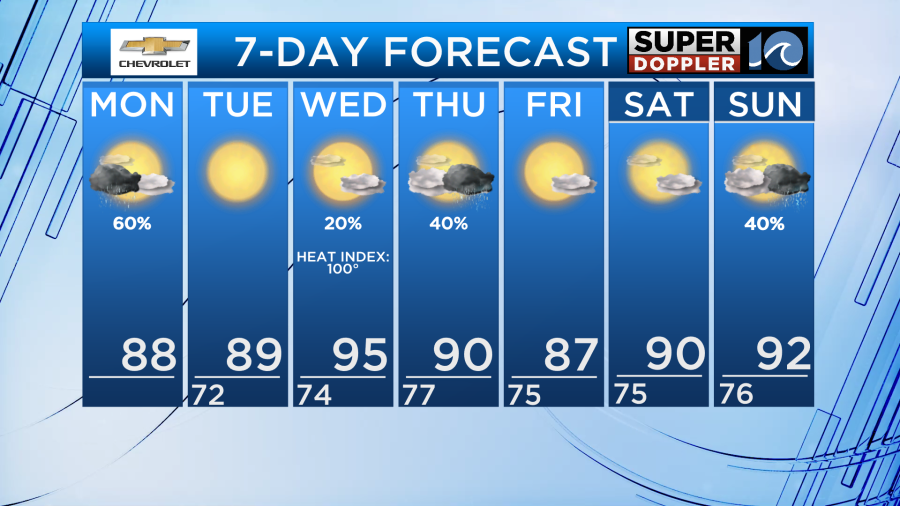
It’s not enough to get us back on track… but we’ll take any rainfall we can get… and we’ll get some today!
After brief thunder and lightning passed through the region overnight and early this morning, we still expect some additional rainfall today. From late morning through the afternoon scattered showers and thunderstorms will develop across the region as a weakening cool front drops into the region.
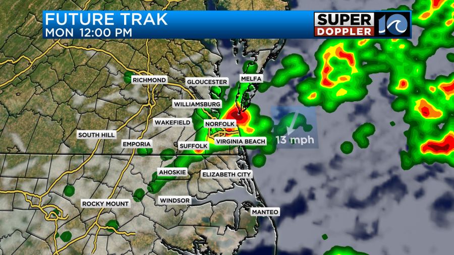
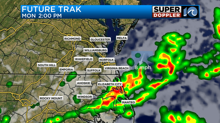
Temperatures today should be in the 80s, but it’ll remain very humid so it’ll likely feel like the low 90s at times in between our shower activity this afternoon.
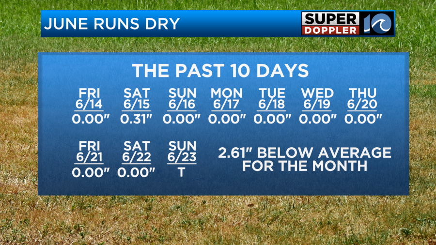
The month of June continues to run dry, the region is about two and a half inches behind schedule so we’ll take any rain drop we can get. After today, another chance of showers is possible later this week, around Thursday, then again over the weekend.
The weakening cool front sweeps through the region later tonight and in doing so, pulls in some brief relief from the summer humidity. Expect plenty of sunshine, highs in the mid and upper 80s, and lower humidity values for our Tuesday coming up.
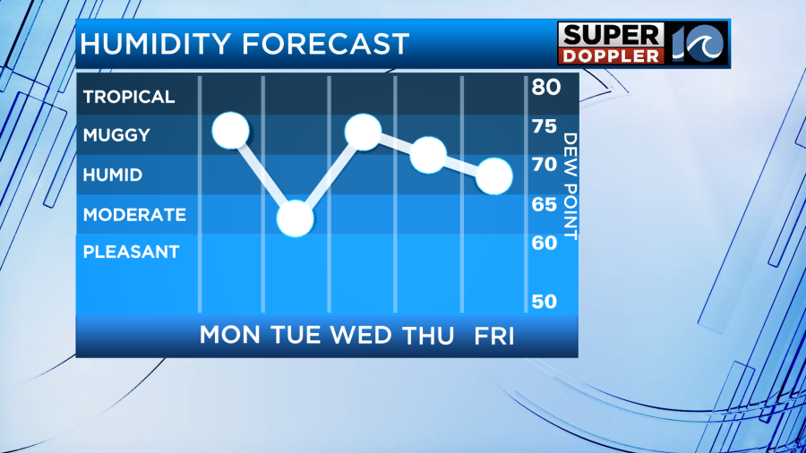
Enjoy that brief window as the heat and humidity builds back in on Wednesday – high temperatures will likely be in the 90s with heat index values close to 100°!

Another dose of scattered showers and a few thunderstorms is possible Thursday before the weekend.
-Steve