(WAVY) — Hurricane Season runs from June 1st to November 30th in the Atlantic basin. Storms can and have formed outside of this time period, but this is the time of the year when most of the activity occurs.
Hurricanes are large storm systems that feed off the warm waters of the ocean. Warm, moist ocean air rises and cools, creating clouds and thunderstorms. This process releases latent heat, helping to fuel these powerful storms.
For a hurricane to form, the right ingredients need to be in place. Hurricanes need warm waters, often above 80°F to maintain their strength. Weak wind shear and moist air also needs to be present.
Too much wind shear can rip a storm apart. Saharan Dust from Africa can also limit storm development across the Atlantic basin.
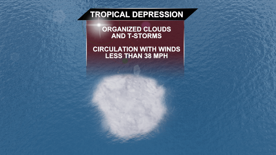
The first stage of a tropical system is known as a TROPICAL WAVE. This is a fairly unorganized area of showers and storms. You may hear us refer to this on air as an “Invest Area.” Over time, these elongated areas of showers and storms can cluster together and a closed low pressure system can develop at the surface. When this happens, a TROPICAL DEPRESSION is born. Showers and storms will spiral counter clockwise around the center in a Tropical Depression. Winds will be less than 39 MPH. Tropical depressions are assigned numbers, in order of their development.
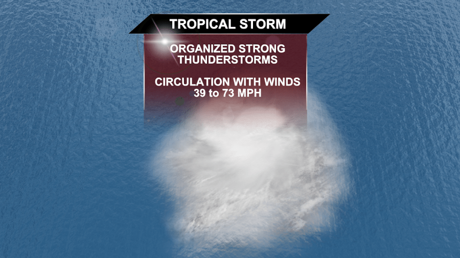
Once winds reach 39 MPH or greater, the system is classified as a TROPICAL STORM. It’s at this point that the system is given a name.
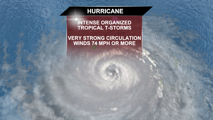
If conditions continue to be favorable for strengthening, a HURRICANE can develop. A hurricane has winds of 74 MPH or greater, intense rain, wind and storm surge.
A Hurricane is considered a “Major Hurricane” once winds reach 111 MPH, or Category 3 strength.
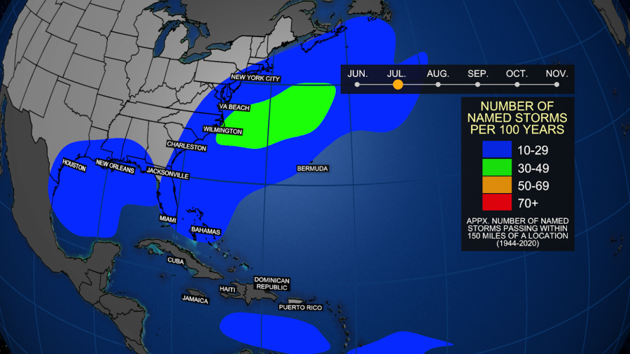
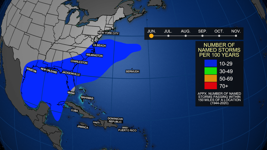
The majority of hurricanes form in the main development region of the Atlantic Ocean, off the coast of Africa into the Caribbean. These storms as they move west can sometimes impact the United States.

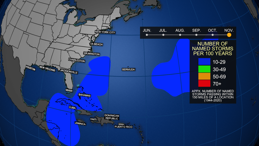
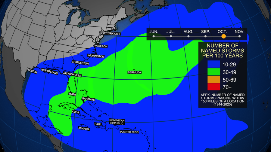
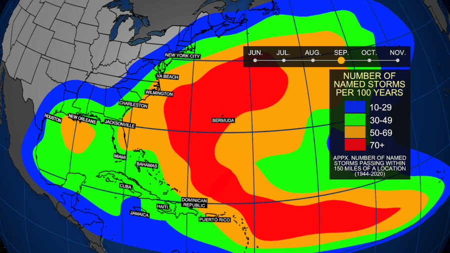
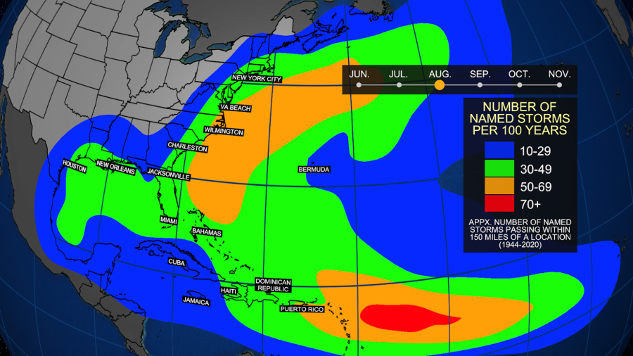
Below are some maps of where tropical systems occur most often during each month of Hurricane Season.