So far in June we have had above average temperatures. It’s only June 10th and we are already almost 4 degrees above average.
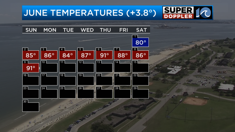
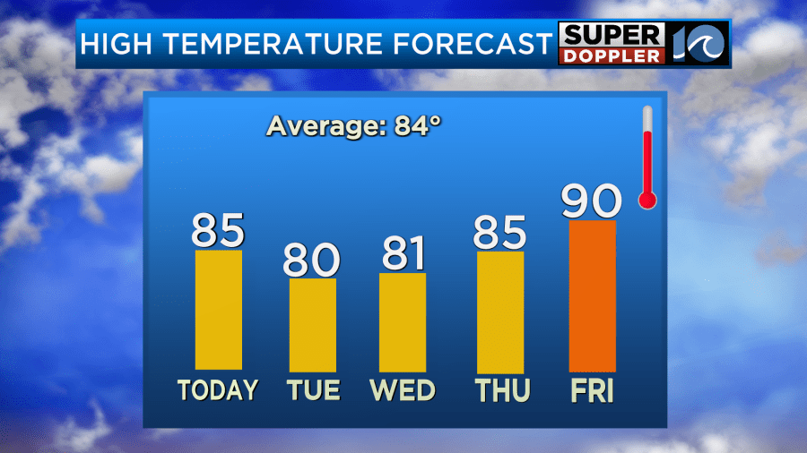
Yesterday, we hit 91 degrees in Norfolk. Today we will cool things down to the mid 80s.
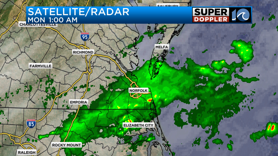
A cold front moved into southeast Virginia last night. It did create a fairly big cluster of showers and isolated thunderstorms between 10pm and 4am.
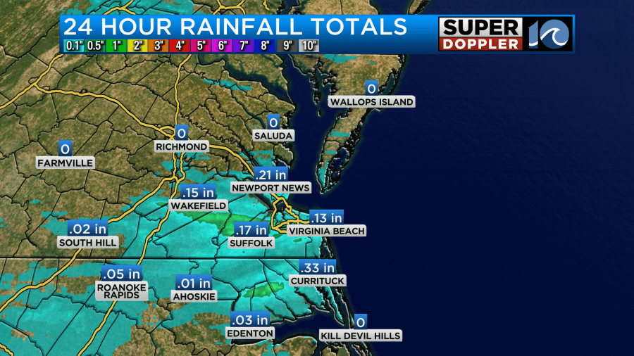
Some locations picked up 1-2 tenths of an inch. This included the Peninsula which has really needed the rain. However, folks on the Middle Peninsula missed out.
I’m showing the local and wider views of the U.S. Drought Monitor.
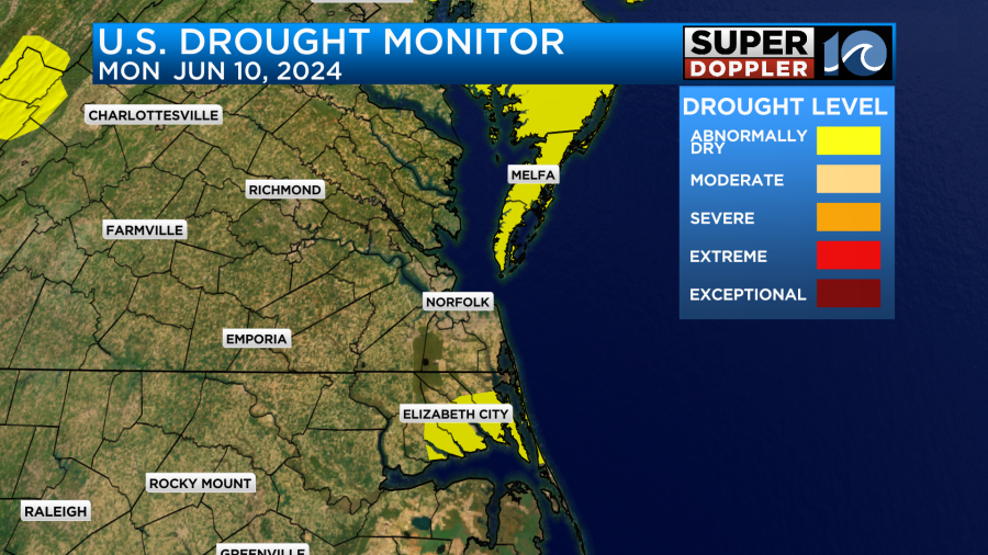
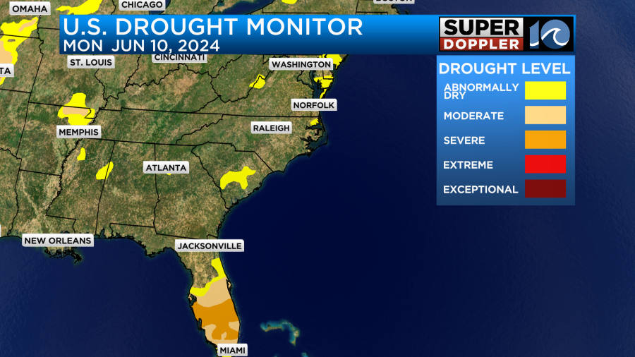
If I were making the map above I would add the Peninsula and Middle Peninsula to the level 1 (abnormally dry) section. Maybe they will be included in the update on Thursday. The interesting thing about the wider map is that Florida is in a “Severe Drought”. The difference between there and here is that they are going to get a good amount of rain over the next 2-3 days.

Meanwhile, we’ll only have some isolated showers here. A cool front is dropping to our south today. It will sink to our south later this morning.
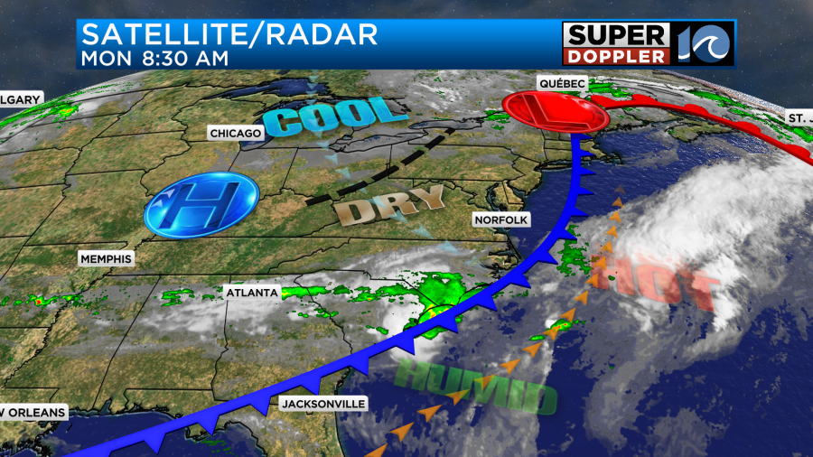
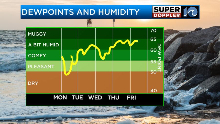
That is why we are going to cool down a bit. We’ll also have some drier air. Dew points are falling from the 60s into the upper 50s.
We’ll be partly cloudy today with a light northwest wind. There may be some isolated showers by the end of the day, but most of the day (and the region) will be rain free.
Tomorrow we’ll have increasing clouds as the cold front stalls out to our south. There will be a weak area of low pressure riding east along the front. This will probably produce a large cluster of showers and storms over North Carolina. Some of those may cross the state line up into the Southside.
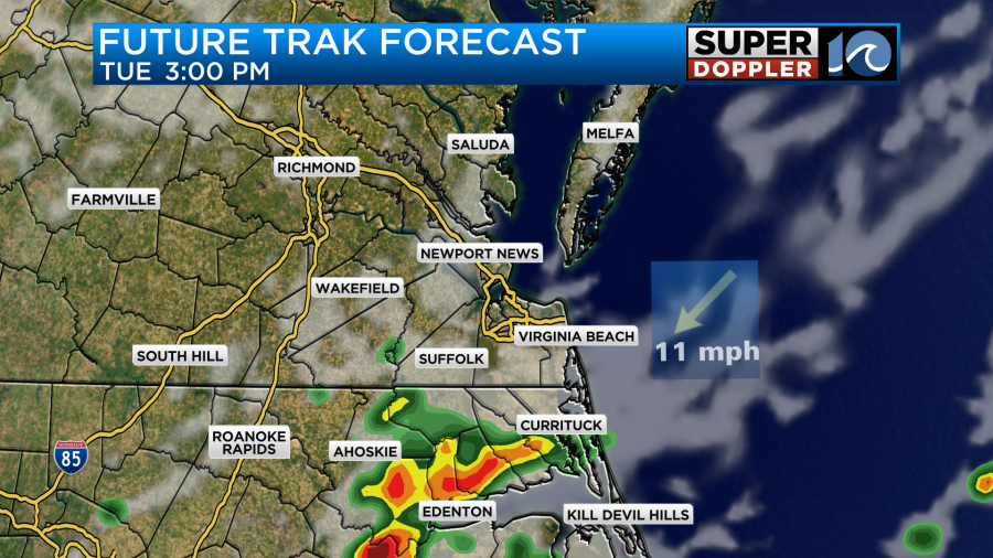
These should decrease by the evening. We’ll see how far north the showers get. Check back for updates on that. High temps will be pretty comfortable. They’ll be near 80 degrees.
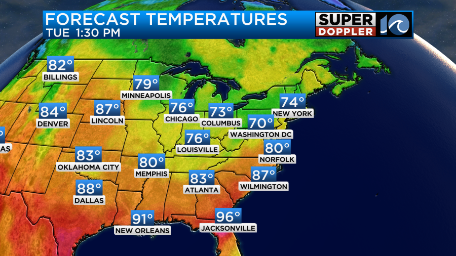
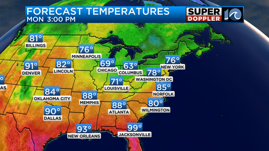
Keep in mind that there will be a lot of heat developing over the Gulf Coast States and over the southwestern U.S. Jacksonville, FL may hit the mid-upper 90s for 2 days.
We’ll be mild and dry Wednesday with high temps in the low 80s and partly cloudy skies. We’ll be in the mid 80s Thursday with partly cloudy skies. However, we’ll heat up to near 90 by Friday.
We’ll likely cool things down next weekend. I’ll talk more about that in tomorrow’s weather blog.
Meteorologist: Jeremy Wheeler