We had another cool day yesterday, but some areas had a little warming. High temps were in the 60s in the metro with 70s inland.
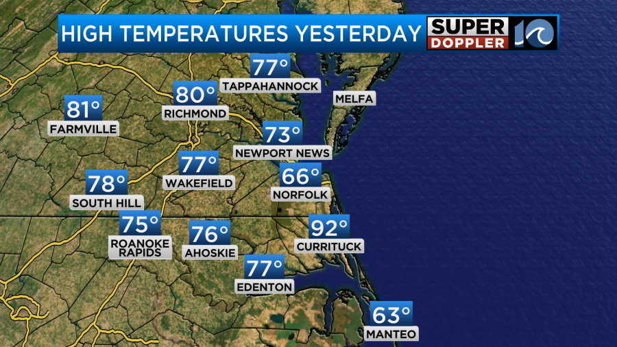
Ignore the Currituck reading. It just didn’t update.
We did have some clearing but there were some clouds that persisted for a while in Norfolk and Virginia Beach.
This morning we started off with lots of clouds, fog, and mist.
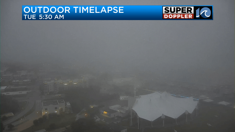
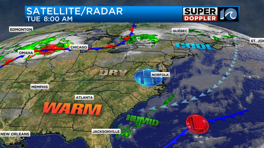
We do have high pressure over the region, but a cool marine layer has been blowing in from the ocean.
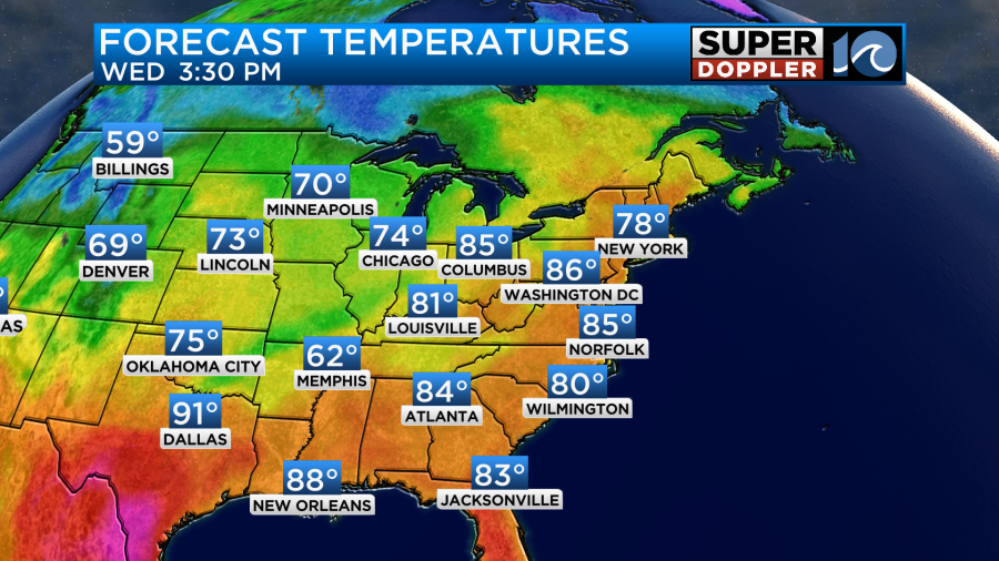
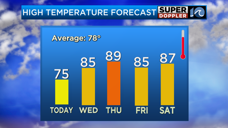
The good news is that the fog should burn off this morning, and the clouds should break up as we go through the day. So expect clearing skies as we go into the afternoon with a few coastal clouds. We’ll only have a light east breeze. High temps will be able to warm up to the mid 70s with a few upper 70s inland.
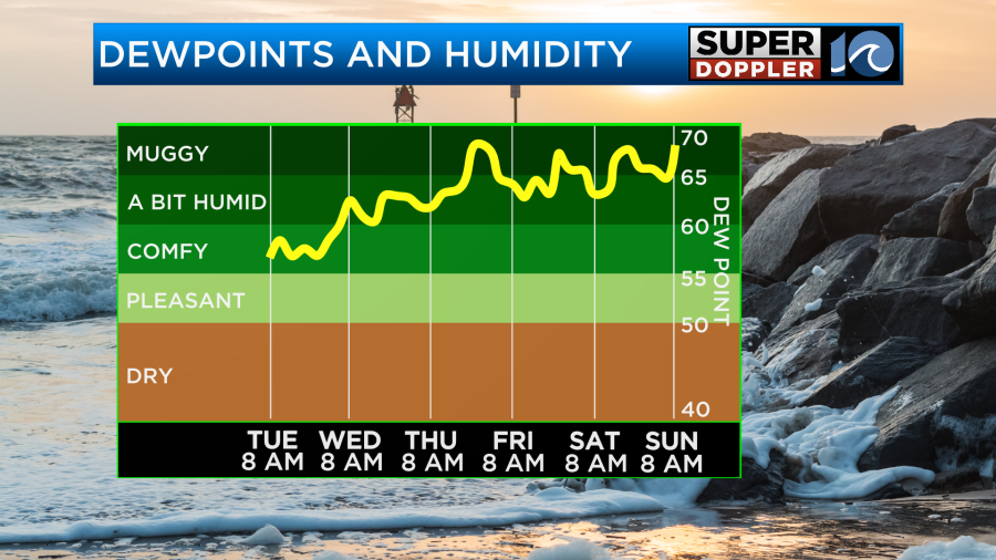
The humidity still isn’t too bad. Luckily dew points are still in the upper 50s. It will be a good day to head outside and get some fresh air. Tomorrow we’ll have more of a southerly wind (though light). High pressure will still be in the region. Other than some patchy fog in the morning we should have a lot of sunshine through the day. This will allow us to heat up quite a bit. High temps are aiming for the mid 80s.
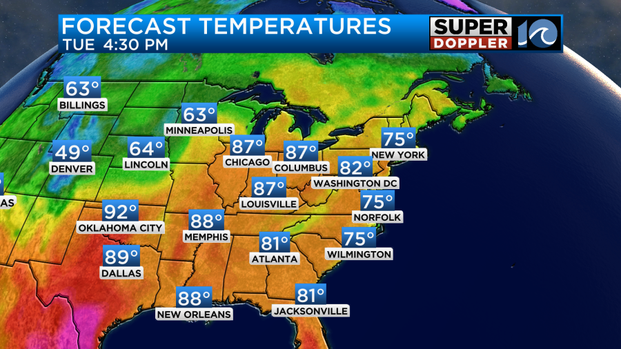
The humidity still shouldn’t be too bad tomorrow. It should be another good day for outdoor activities. However, the increasing heat may be a little too-much too-soon. By Thursday the temperatures will climb to the upper 80s to near 90 degrees.
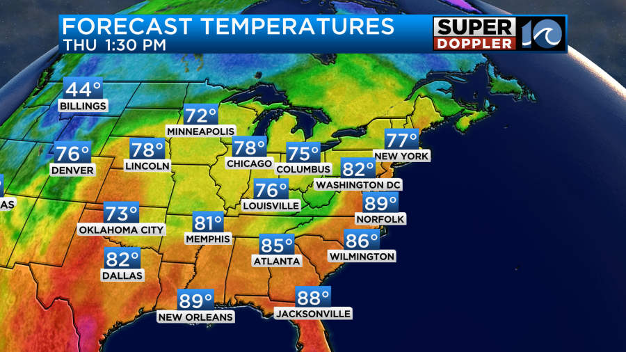
We’ll be mostly to partly sunny all day with only some isolated showers or storms at the end of the day. However, the dew points will be rising into the 60s.
It will probably feel like the low 90s with the heat index. At least there will be more of a breeze out of the southwest.
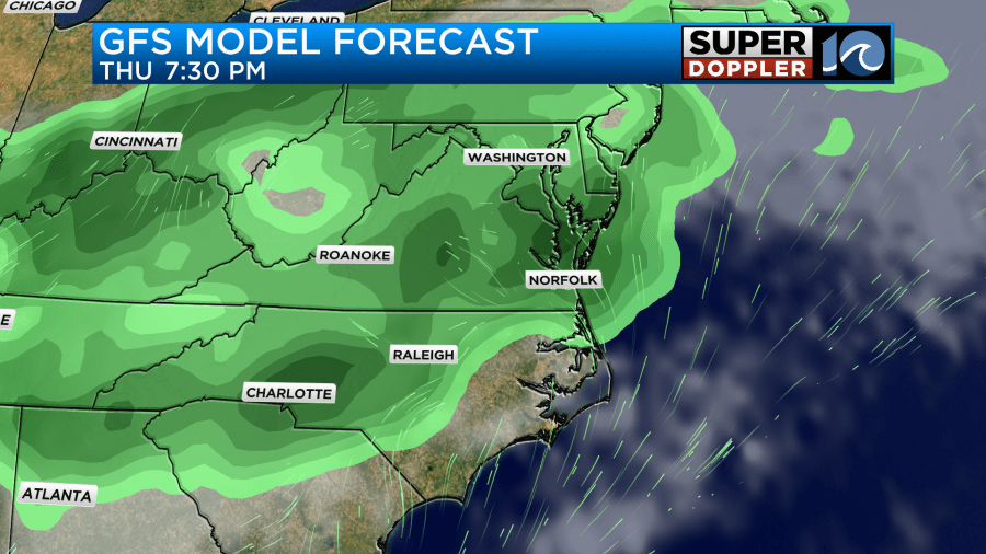
There will be some scattered showers and storms Thursday evening. Some of these could be strong during the later evening hours.
On Friday I think we’re looking at partly cloudy skies with a few PM showers and storms in the region.

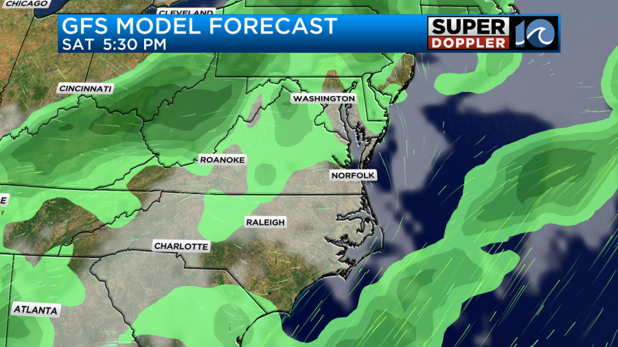
A front will move to our south, but should fall apart. On Saturday we’ll have a mix of sun and clouds with a little higher chance for some rain. The latest update on the GFS has some in the morning and evening with less during the day. We’ll see.
At the moment both the GFS and Euro are drier for Sunday. I’ve only got some isolated showers and storms on that day. There will probably be some more scattered showers and storms on Monday. All-in-all, most of these days will only have (Scattered) showers and storms. I don’t see any large areas of rain as of this time.
The really good news is that we will likely stay warm through the holiday weekend. There will be a couple of weak fronts moving through, but they will either fall apart or stall out. Therefore, I’m keeping our high temps in the 80s through Monday.
The forecast is looking semi-decent for Memorial Day Weekend, but the specific details aren’t really in view yet. Just the trends. So check back on Wednesday and Thursday. By then the weekend will be in-range of the higher resolution models.
Meteorologist: Jeremy Wheeler