We have continued the warm streak/cool streak pattern through the last month. I feel like it’s been going on for several months. Take a look at the high temps for May so far.

We are in the middle of the latest cool run. High temps over the weekend were only in the 60s. On Saturday our high temps were only in the low 60s. Youch! That was likely due to the full cloud cover and rainfall. Today we started off with lots of clouds again.

We are hopefully going to have some clearing today, but I’m not overly optimistic. We have an area of high pressure to our northwest with a cool front dropping to our south.
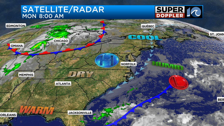
We will have a persistent northeast breeze running at 8-12mph with some gusts over 15mph near the shore. As you can imagine this is going to keep us cool….AGAIN! High temps will be in the upper 60s with some low 70s inland and south.

Tomorrow we’ll start with a lot of clouds, but the models are in pretty good agreement about some clearing in the afternoon. While it’s good that they are all in good agreement. We do have to remember that they all forecast some sunshine last Friday, and that didn’t happen. So I’m cautiously optimistic for now.

High temps should be able to warm up a bit. They are aiming for the low-mid 70s.

By Wednesday the low pressure area offshore should be pretty far away. Also high pressure should build in overhead. So we are looking mostly sunny and warmer. High temps will quickly rise to the mid 80s.
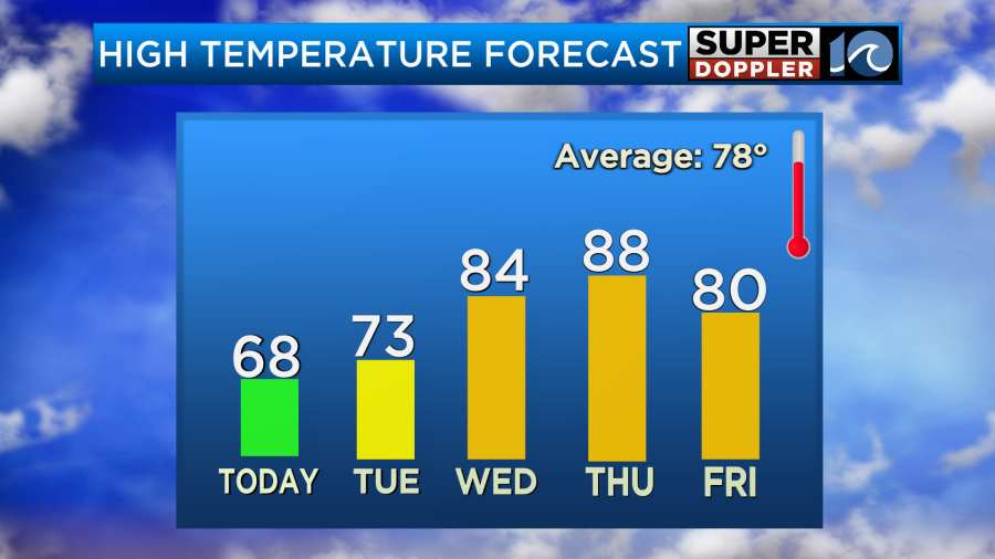
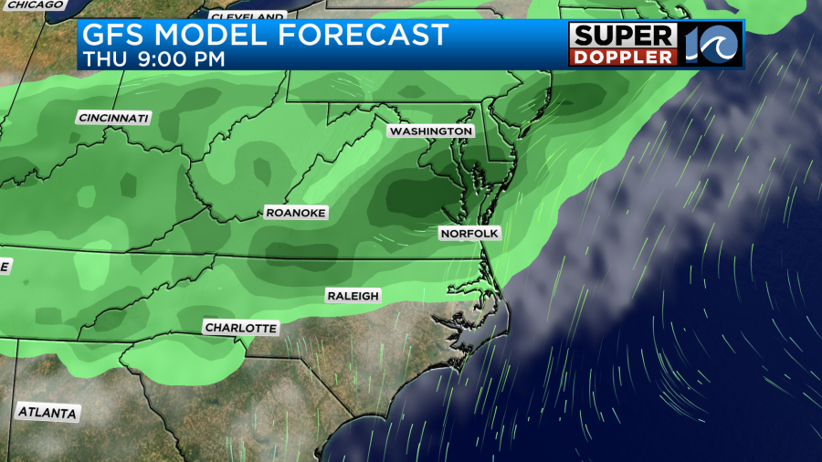
We’ll be partly cloudy for most of the day on Thursday. The wind will pick up out of the south. So high temps will rise to the upper 80s.
The humidity will also increase that day. So we’ll definitely get that Summer feel back for a bit. By Thursday evening it looks like there will be a line of showers and storms entering the area.
This will be a cool front that will (probably) stall out just to our north. So I’ve got high temps near 80 on Friday with a mix of sun and clouds. The front may produce a few PM showers and storms. I would like to talk (in detail) about next weekend since it’s Memorial Day Weekend. However, it’s too soon to have any good detail. The GFS model and the European model are pretty wet on Saturday, but I have very little confidence this far out. At least it doesn’t look too cool. Hopefully, we’ll stay in the 70s and 80s. I’ll go into more detail in tomorrow’s weather blog. I’ve got some old friends coming into town. So I’m heavily vested as many of you are. Stay tuned for the updates.
I know we’ve been very cool lately, but there have been a lot of stories of extreme heat over parts of the world lately. I posted stories about the heat waves in Texas and Florida recently. Now parts of India have had extreme heat. New Delhi just hit a high of 116 degrees (47 degrees C ) the other day. Here is the article with more information: India heat wave.
Meteorologist: Jeremy Wheeler