I’ve been talking recently about how we really needed some rainfall. April finished a little over two inches below average. So I was happy to get some light rain yesterday during the late afternoon and early evening.

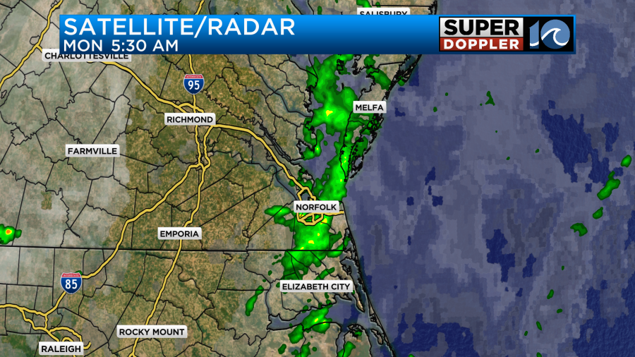
There were a few heavy showers and isolated thunderstorms as well. That precipitation moved out. Then we had another round of light showers move through during the morning commute.
We definitely have a lot of moisture move in the area recently. In fact we are going to be downright muggy for most of the week.

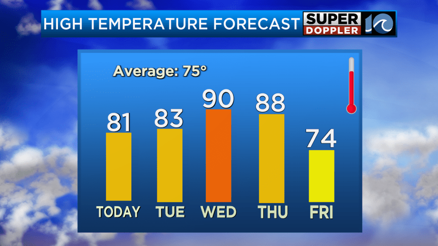
This is going to make it feel very Summery as high temps will be in the 80s and 90s most of the week. This is well above average.
However, this will also mean that we will have a chance for some thunderstorms. A couple of days may even have some severe storms. Today the severe risk is out over the central U.S. It’s a moderate risk which is level 4 out of 5.
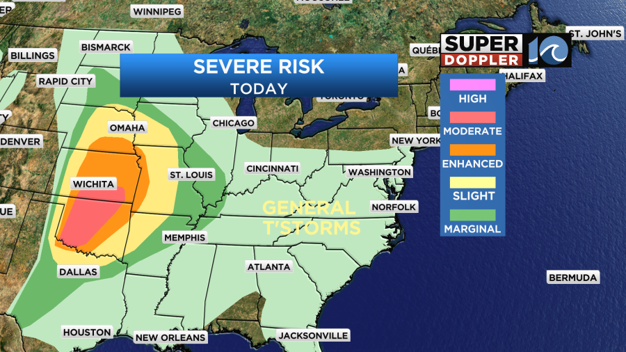
There is a big cold front out that way that is coming off of the Rockies. That will be the focus for their storms. As far as we’re concerned a stationary front is to our north with high pressure to the southeast.
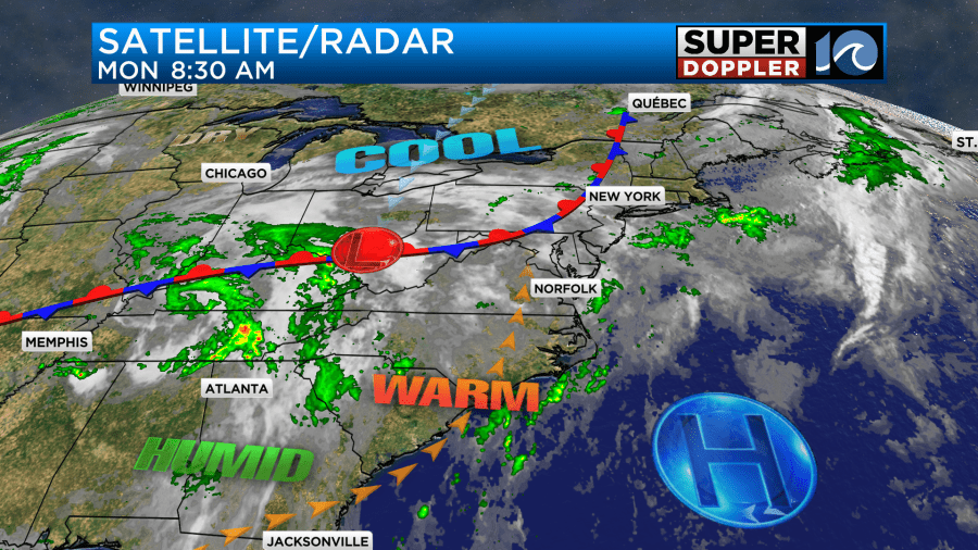
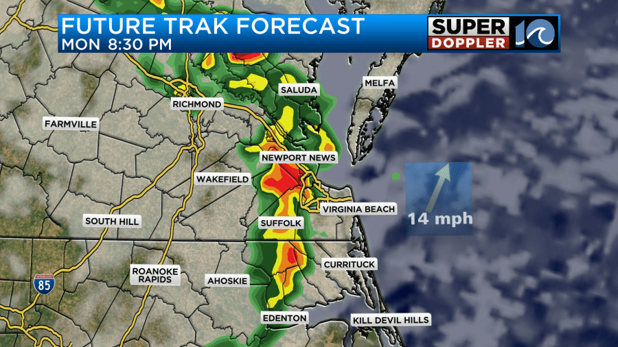
We’ll be mostly cloudy today with some scattered showers and storms reforming this afternoon. There may be some brief clearing in the early afternoon. That could create a little fuel for a few storms. These should just be some general thunderstorms, but a couple of heavy downpours will be possible.
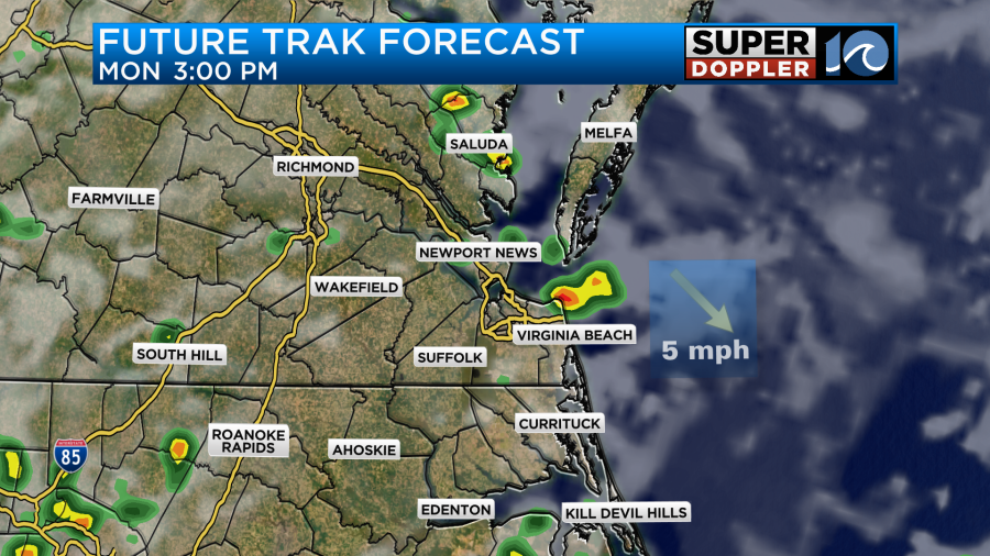
The rain may pick up even more in the later evening. At least that’s what Future Trak shows.
Tomorrow we’ll still be warm and humid with high temps in the low-mid 80s. There will be more sunshine overall. Plus, the front will drift a little closer to the region. We’ll develop some scattered showers and storms later in the afternoon and evening.
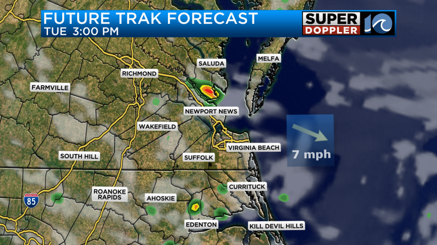
We may have less coverage of the storms tomorrow (though I think more than Future Trak shows). However, the sunshine may add some fuel for a few stronger storms. Hence we have a marginal risk for severe weather during late Tuesday afternoon and the early evening.

Through that time we’ll have varying amounts of rainfall due to the scattered nature of the showers and storms. I’d say on average that we’ll have about a quarter of an inch up to an inch. Some isolated spots may see more.
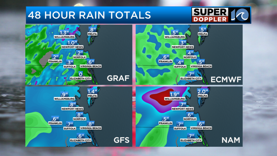
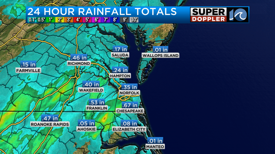
We just picked up about a quarter to a half of an inch in the last 24 hours.
On Wednesday we won’t have much rain in the area. We will have partly cloudy skies with hot temps. We’ll be near 90 in the afternoon. With the high humidity the heat index could be in the mid 90s. Youch! Then we’ll be in the 80s on Thursday with possibly some big thunderstorms moving through. That’s because there will be a strong cold front that will cool us down next weekend. I’ll talk more about the Thursday through Mother’s day forecast in tomorrow’s weather blog.
Meanwhile flooding problems continue for Houston.
Meteorologist: Jeremy Wheeler