Today is going to be an interesting day in terms of temperatures. We started this morning with some very comfortable conditions. We had fair skies, a light southwest breeze, and the humidity wasn’t bad.
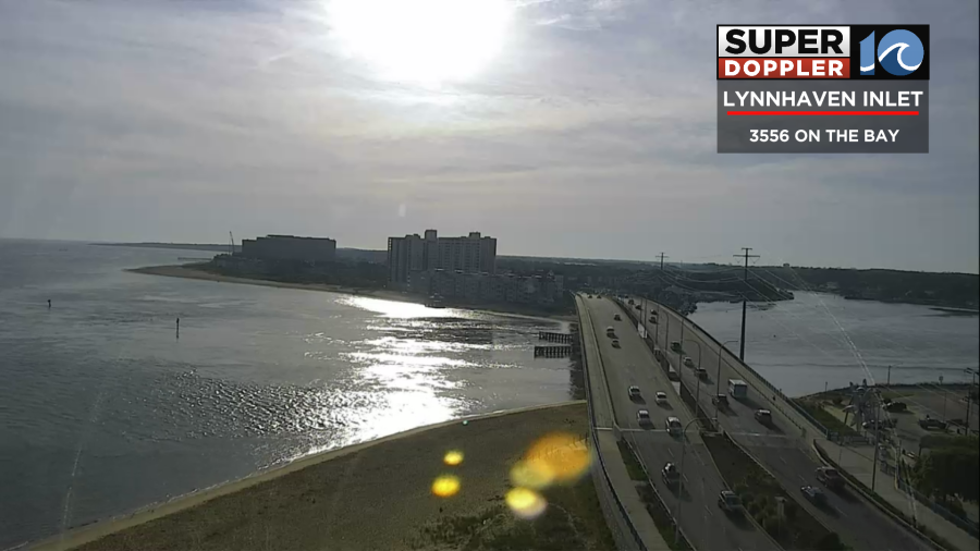
Temperatures were in the 60s area-wide. We even had a couple of 70s by 8am. Today temperatures are going to go up until midday. Then temperatures are going to fall.
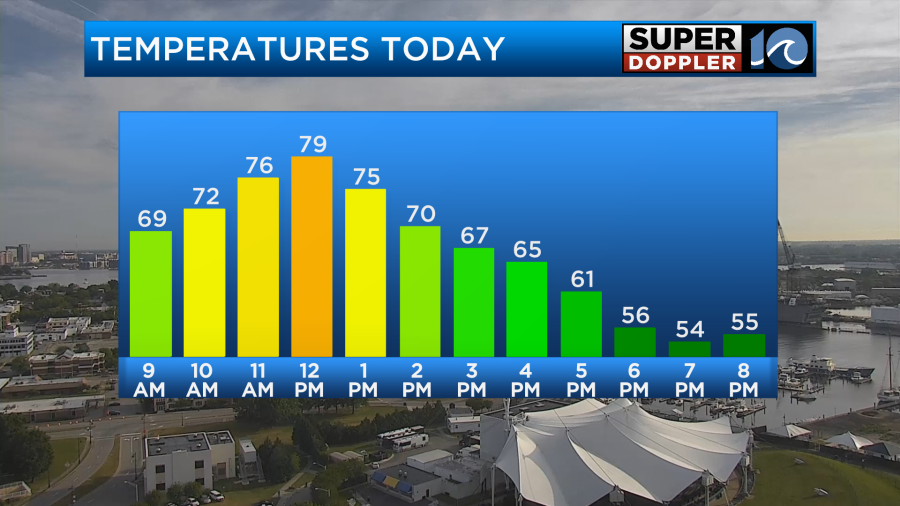
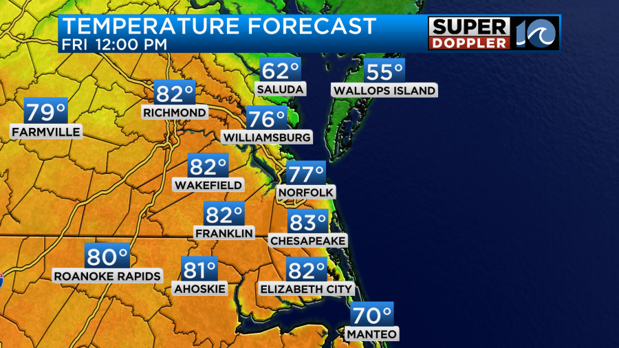
We’ll be in the upper 70s to near 80 degrees by noon with cooler temps on the Eastern Shore.
By the time we get to 3pm many temperatures will drop to the 60s.
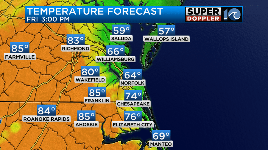
It will take inland locations longer to cool down, but they will get there eventually. The cause for these wacky temperatures is a back-door cold front that is coming in from the northeast.
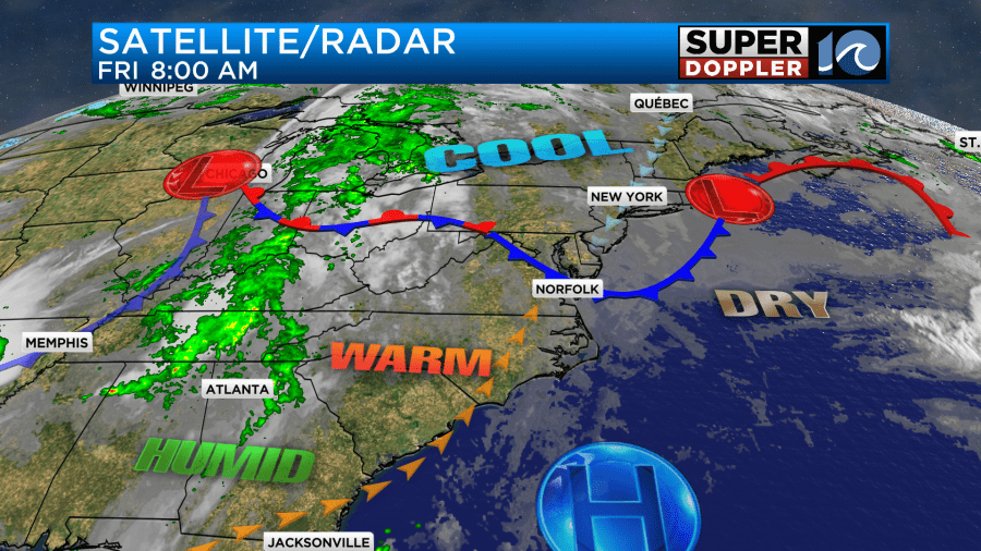
We call it a back-door front because it comes in from a different direction (northeast) compared to a usual cold front (west, northwest, or north). Winds will be out of the southwest for a bit. Then they will turn out of the northeast.
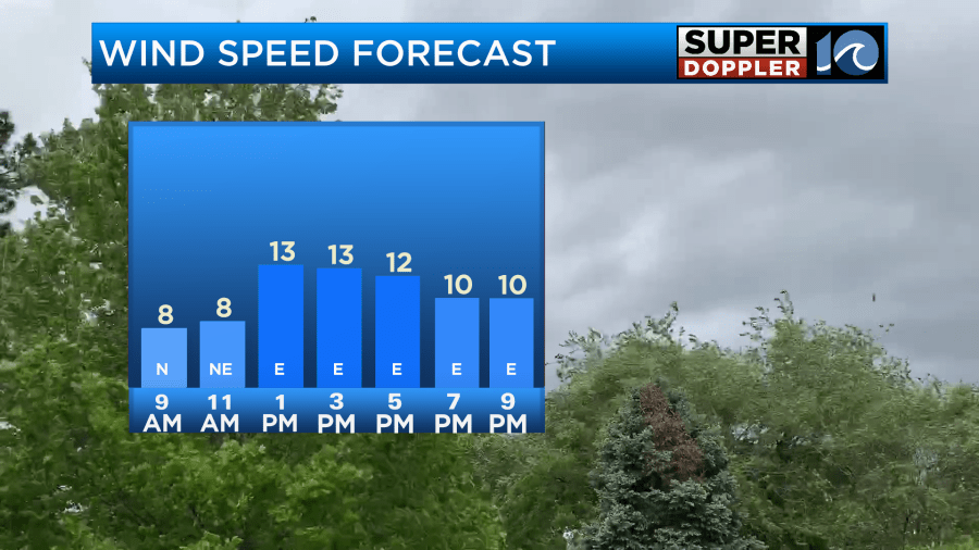
Most of the wind will run at 10-15mph, but there may be some gusts to 20mph near the shore. Skies will be partly cloudy today. The front should not produce any rain per se, but I can’t rule out a few sprinkles as it slides through.
Tomorrow the forecast is simpler. The front will keep sliding to our south. Cool air will continue to sink southward. High temps will be in the low 70s with some mid 70s inland and south.
temps tomorrow
We’ll be partly to mostly cloudy as some overunning moisture produces that. There will be enough moisture for some isolated showers and patches of drizzle.
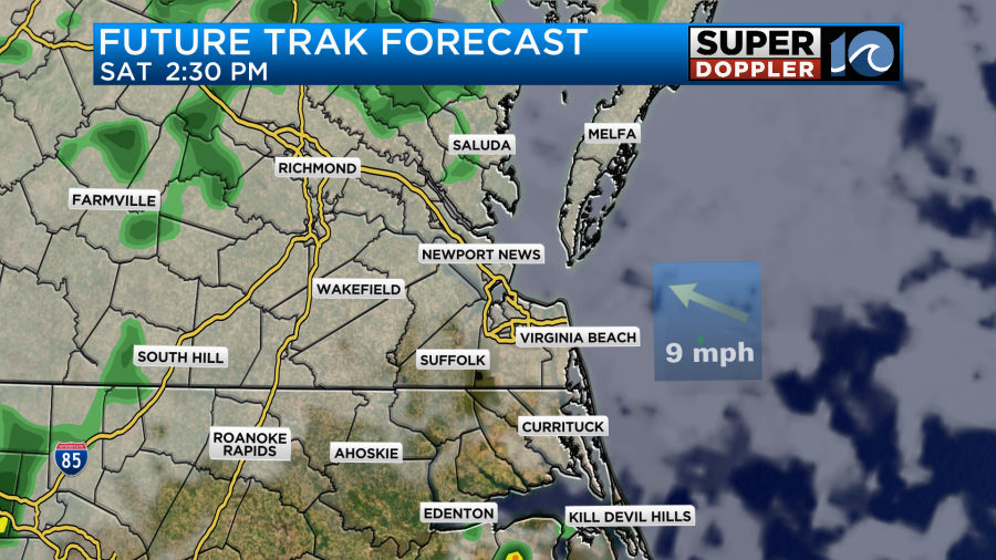
The light/isolated precip could happen at about any time of the day. Even in the evening. Surface winds will be out of the east at 8-12mph .
We’ll have more of a southerly wind on Sunday. Moisture will start to increase again. We’ll be mostly cloudy on Sunday. There will be some scattered showers in the morning. That will be round 1.
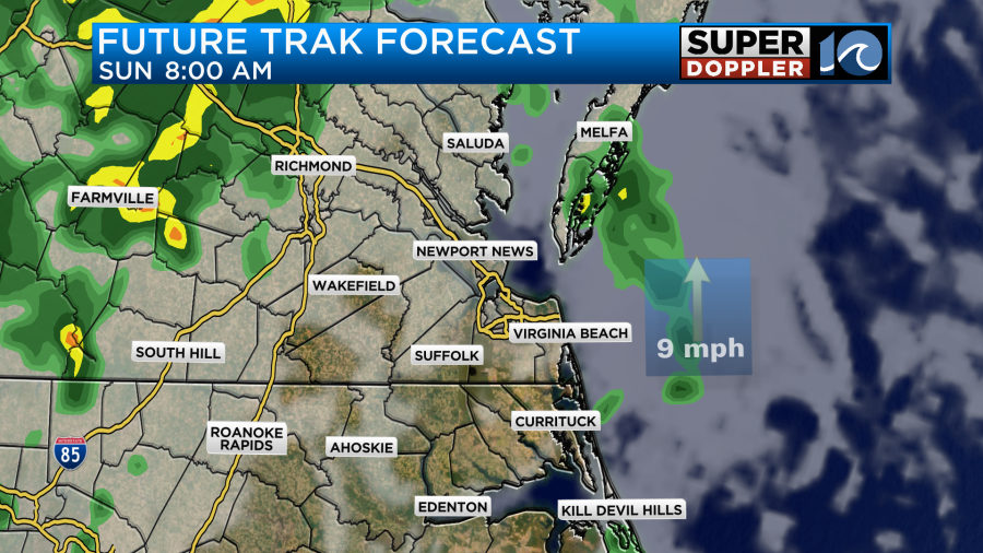
There will probably be a break for a while. Then some more scattered showers will be possible in the afternoon.
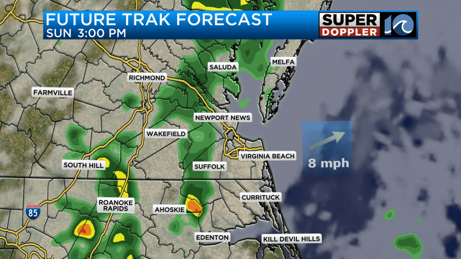
This will be our best chance for rain over the weekend. High temps will be in the upper 70s.
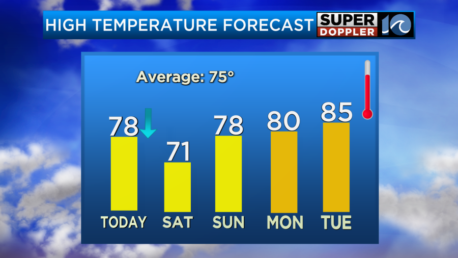
Notice that we’ll be even warmer next week. However, we’ll also have a lot more moisture during that time.
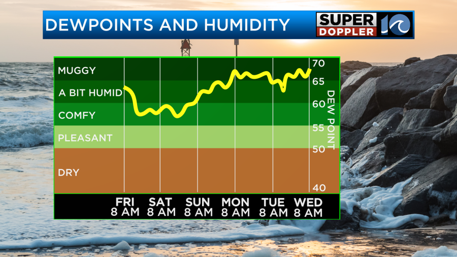
This will make it feel like Summer weather for a few days. We’ll have some more scattered showers Monday and Tuesday with less rain by Wednesday.
Forecast rain totals over the weekend have been decreasing. The latest models have about a quarter to a half of an inch, and many of them are aiming for the lower amount.
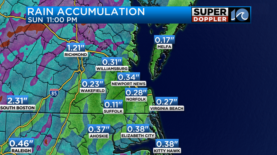
I mentioned that we need some rain. We finished April with over 2 inches of a deficit compared to average. The good news is that we’ll have some more rain early next week. We’ll talk more about that over the weekend.
One place that doesn’t need the rain…. south Texas. There has been some really bad flooding along with large damaging tornadoes over different parts of Texas and the Plains. Here are 2 articles with the details. Texas flooding. Texas tornadoes.
Meteorologist: Jeremy Wheeler


