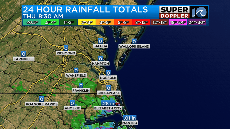
Yesterday we had a weak cool front move into the region. It did create some scattered rain showers and isolated thunderstorms. However, a lot of the area missed out on the rain. That was no surprise.
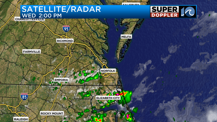
The highest amounts were in some spots over North Carolina where about a quick half an inch fell. Elizabeth City had 0.3″.
Today the front is moving back north as a warm front. High pressure is to our south.
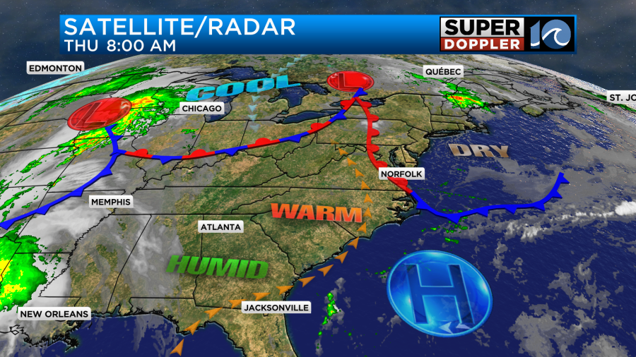
There was some fog this morning as the front started lifting north. Here was one cool shot of the Bonner bridge.

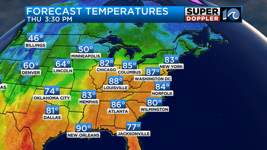
The fog burned off by the mid morning. Otherwise most of our skies were mostly sunny. We’ll have mostly to partly sunny skies today with a light southeast wind. This will push our high temperatures up to the mid 80s.
The humidity won’t be too bad. Dew points are in the 50s. It might feel a bit hot though if you’re in the sun with that lack of a breeze.
Tomorrow the front to the north will reorganize, turn into a cold front, and drop to the south. There won’t be any precip along the front except for an isolated sprinkle or two. Skies will be partly cloudy. The temps will warm up to the mid-upper 70s with some low 80s by the EARLY afternoon.
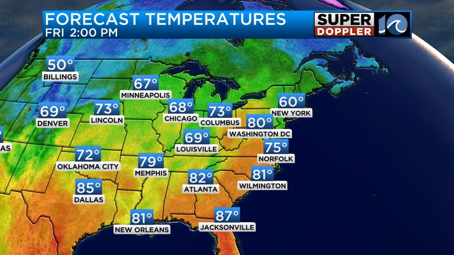
However, temperatures will drop as we go into the LATE afternoon and the front sinks to the south. We’ll likely drop to the upper 60s by 4pm in the metro.
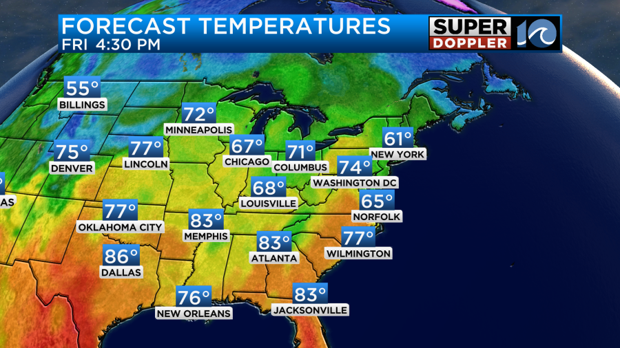
Despite the cool down it may still be warm in some inland areas until the evening.
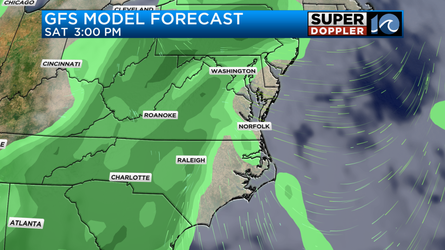
We’ll all be cooler on Saturday. High temps will be in the lower 70s. We’ll have a mix of sun and clouds. There will be a few rain showers, but I only have the chance at 30% as of right now.
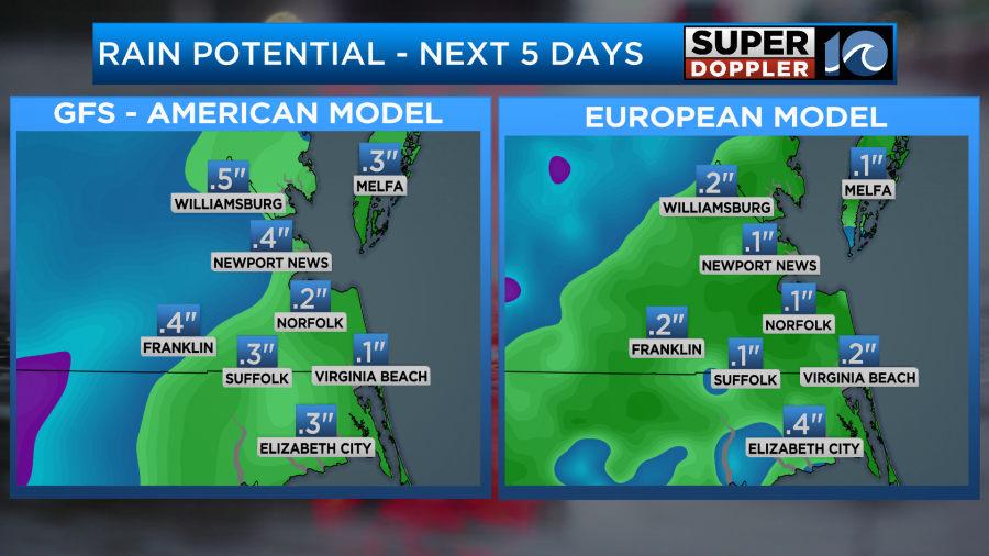
The GFS model has more rain on Sunday. It doesn’t look like a washout, but there may be a good shot at some much-needed rainfall.
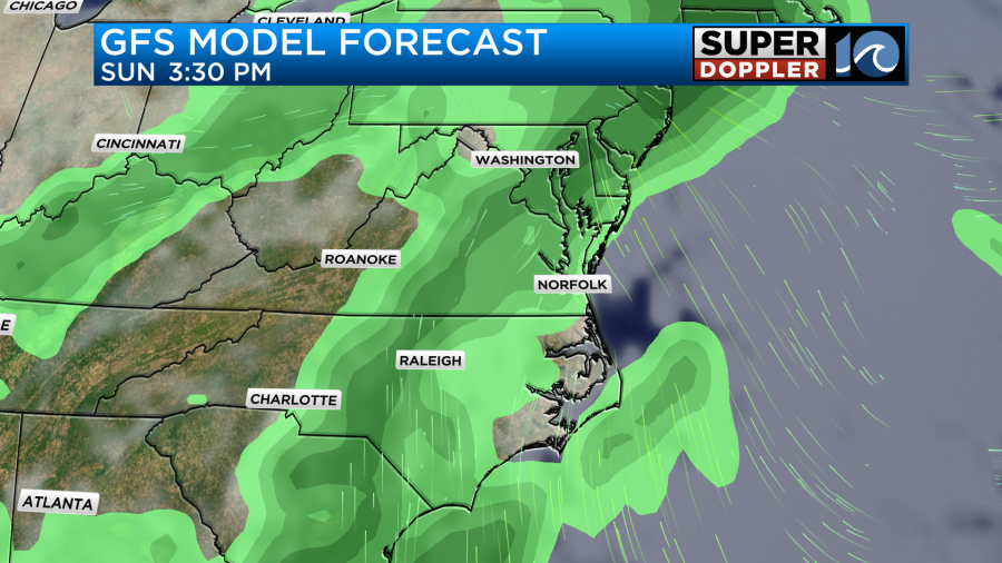
The Euro model is drier as of right now, and the GFS just reduced its rainfall forecast. I’m going to wait until tomorrow to really focus on amounts. Here is a preliminary rainfall forecast.
High temps will be in the low 70s Saturday with mid-upper 70s Sunday.
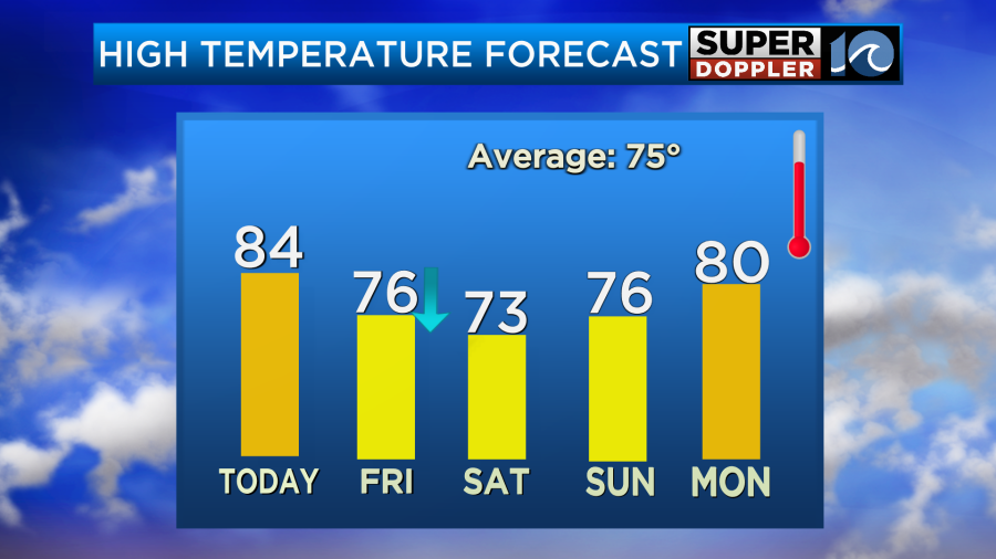
We may really warm up by the middle of next week. High temps may get close to 90 degrees.
Meteorologist: Jeremy Wheeler