Yesterday, we ended up hitting 73 degrees in Norfolk. Now that is a distant memory. Today will be a different world. (Kind of like the Upside Down).
A powerful cold front dropped into the region yesterday evening, and sharply dropped the temps. Rain showers also moved in.
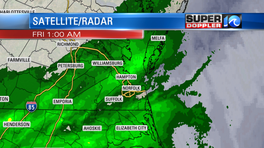
The rain was light but widespread. We only picked up a tenth of an inch or 2 since last night. Today the showers will stay to our south except for a possible bay-effect shower near the shore or bay. We’ll have partly cloudy skies. However, the strong winds will stay up through the early afternoon. Gusts will be up to 30mph.
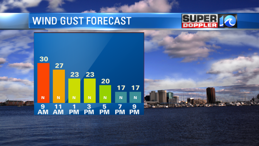
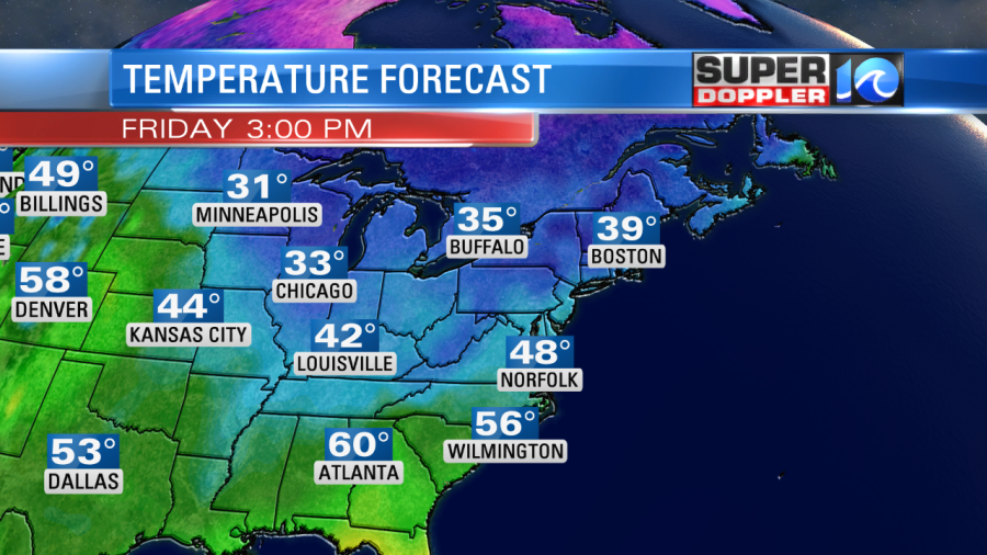
The winds will taper off this afternoon into the evening. But they will still be out of the north. So despite some sunshine our high temperatures will only be in the upper 40s to near 50 this afternoon.
The wind will decrease this evening. So it won’t be as windy for the Friday night football games. However, it will be cold. Temps will be in the 40s, and there will still be a little breeze. Bundle up today, and bundle up even more tonight. Overnight we’ll be partly cloudy. Temps will drop down to the 30s with 20s inland. There will be freezing conditions over a large part of the area. There are freeze warnings up for parts of the region.
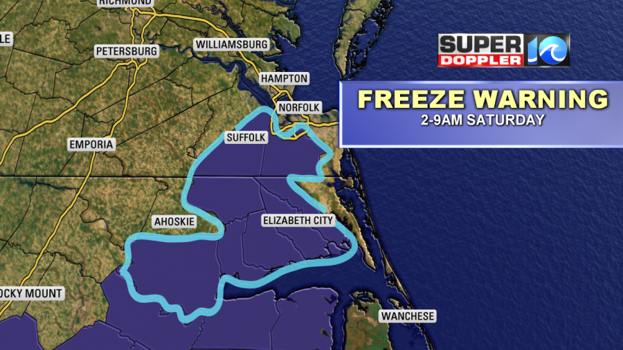
There may be some more locations added later today. Keep in mind some locations have already had a freeze. So they won’t have them again as their growing season (technically) is over.
Tomorrow we’ll have high pressure over the region. We’ll be mostly sunny with a light northeast wind. High temps will be near 50. We’ll have fair skies on Sunday. We’ll warm up to the low 60s. Then we’ll warm up even more on Monday for Veteran’s Day. Highs will be in the upper 60s. The forecast looks dry through the day.
Another strong cold front will move in on Tuesday. We’ll have dropping temperatures with lots of rain moving in. A wintry mix is possible in the evening, but there will likely be melting as it falls on a wet/mild ground. This will probably be a case where the dry air races against the colder temps. So we’ll see. We’ll have updates on it over the weekend. Either way we will be much colder on Wednesday. Highs will be in the mid 40s!
Have a good weekend!
Meteorologist: Jeremy Wheeler