Spring warmth today… a spring shuffle tomorrow… and spring swings by the end of the week. The next few days poses a classic spring roller coaster ride in weather… sit back and enjoy!

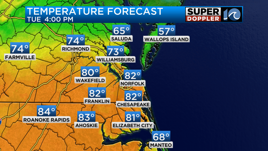
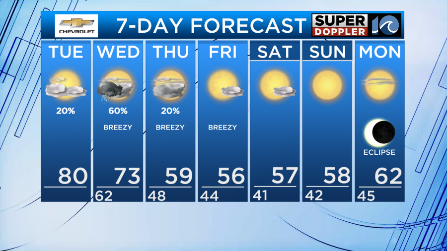
Some fog through the morning is causing some lowered visibility on the roads, so careful through mid morning. Cloudier skies for most of the day, but we’ll slowly tap into the spring warmth. Look for high temperatures near 80° to go along with mostly cloudy skies through the afternoon.
Rain chances are pretty slim during the daylight hours, we’ve only got a passing shower or downpour in the forecast for tonight.
Tomorrow is when our rain chances arrive as the dynamic system to our west throws us it’s cold front. The warm breeze gusting to 35+mph ahead of the front puts afternoon temperatures in the 70s before scattered showers and thunderstorms develop.
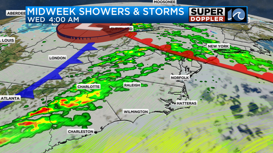
Look for scattered showers and thunderstorms to develop around late morning and take us through the afternoon. These won’t be for everyone, but those that do develop have the potential to be strong and severe. Be sure to stay weather aware Wednesday with the possibility of damaging wind and hail.
Behind this front comes the cooler air and temperatures drop big time. Stubborn clouds stick around Thursday with highs down to the 50s! The cool breeze continues through Thursday and Friday, but will pull out the sunshine by Friday. It’s brighter and cool through the upcoming weekend.
Enjoy the warmth today and stay weather aware tomorrow!
-Steve