Update Monday Afternoon:
March most certainly is coming in like a lion… well, at least for this week! We’re looking at rain across the region every two to three days through the weekend!
Round 1 takes us through tonight, so expect rain through the evening commute and into the late night hours. A few lingering showers will be around early tomorrow morning, but the morning clouds give way to some sunshine and tomorrow turns into a lovely day. Highs should be in the 60s!
Round 2 arrives Wednesday… the morning looks dry (as of now) but widespread on/off rain is set to move in and soak us through the majority of the day. Rain will be heavy at times, with a rumble of thunder thrown in there too. High temperatures should sit near 60° with the rain going all the way into the late night hours.
We’ll get a break from the soaking rains on Thursday and Friday with just a mix of sun and clouds before Round 3 moves in for the weekend. As of now, we’ve got it around later Saturday and into Sunday.
Keep those umbrellas with ya this week… we’re getting soaked!
-Steve
______________________________________________________________________________________________________
We just wrapped up a pretty wet meteorological Winter (December, January, February). However, it looks like things are going to get even wetter for our region in the short-term forecast. Luckily, we did have a very nice Sunday as predicted. Temps were solidly in the 60s with fair skies all day. Today, however, we are going to have a lot of rain in the region. Let’s talk about it:
Currently, high pressure is slowly retreating to the north. Meanwhile, a weak and slow-moving area of low pressure is coming up from the south along the coast.

There has already been a lot of rain over the Outer Banks. A few showers had moved into Hampton Roads by 8am.
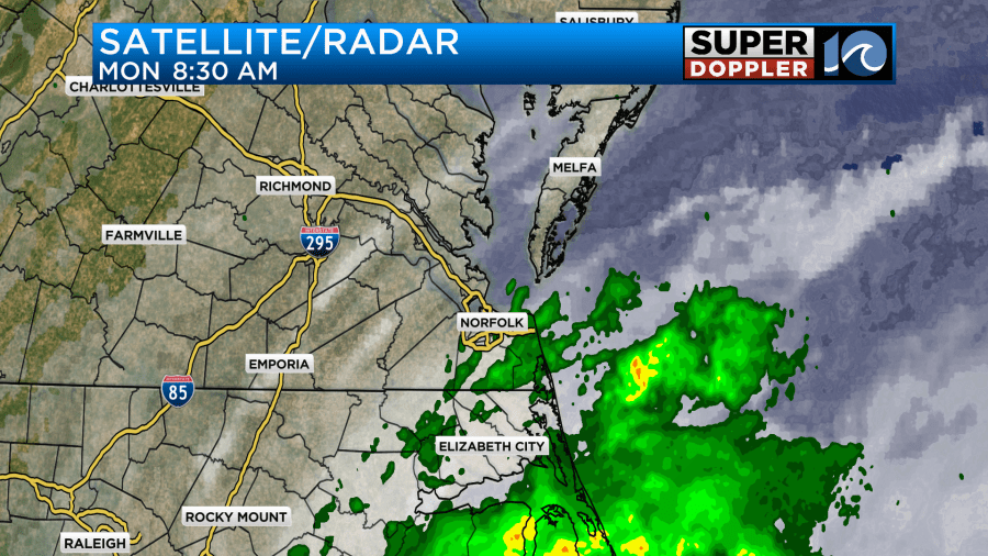
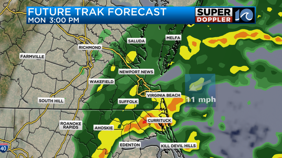
Rain will keep going over northeast North Carolina until the evening. Then it should taper off slowly. Meanwhile, rain will increase into the afternoon and evening across southeast Virginia.
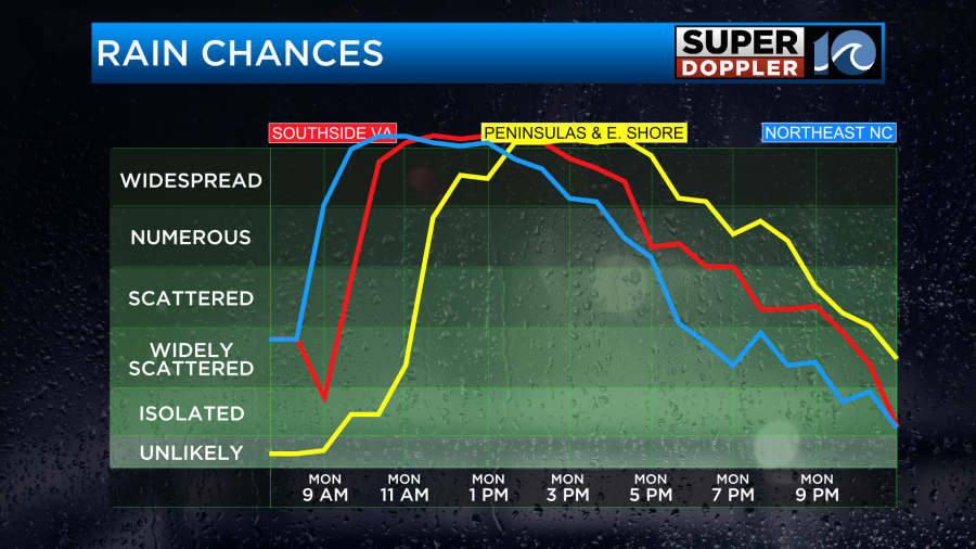
Rain will become heavy over parts of the region between the late afternoon and early evening.
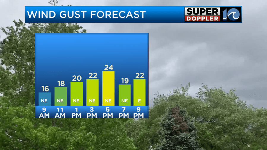
The wind will also increase out of the northeast. It will gust up to 25mph.
The problem with this combo is that it could create a pretty messy evening commute.
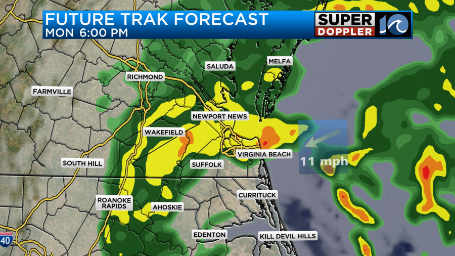
High temps will make it into the mid 50s.
Overnight rain showers will become more scattered and will taper off as the area of low pressure moves to our north. Rainfall will be about 1.5 to 2″ over the region.

There may be some isolated showers early tomorrow morning, but we should be dry for the majority of Super Tuesday.
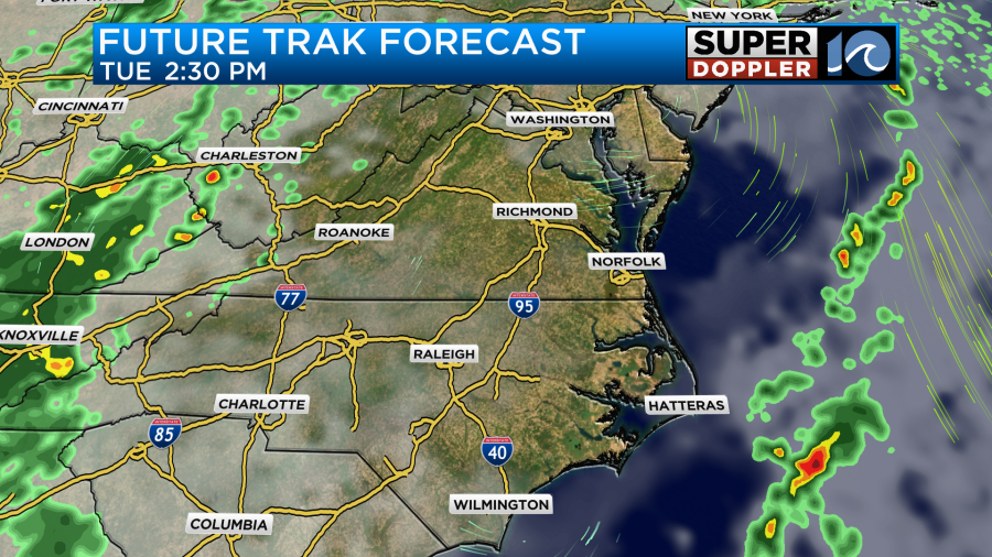
High temps will be in the 60s. It will be a pretty nice day overall.

Meanwhile the fires will keep burning over Texas, and the heavy (and crazy) snow will keep adding up over the mountains of California.
We won’t have anything that dramatic here, but we will have a lot more rain moving in on Wednesday. Basically, another area of low pressure will slide through the region. This time it will move in from the west, and it will be bigger.
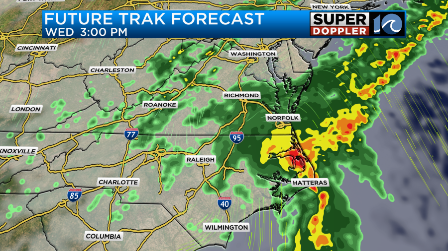
The rain may not only be heavy, but some thunderstorms may mix-in as well. High temps will be in the 60s. We should be pretty good Thursday and Friday. Then more rain is expected over the weekend. I’ll talk more about that in tomorrow’s weather blog.
Meteorologist: Jeremy Wheeler