Update: Wednesday Afternoon
The winds of change are crankin’ as we await the arrival of our approaching cold front. Expect the warm winds to continue through the evening commute, with a few areas of light rain developing through sunset. After sunset, however, the front and heavier rain will come crashing into the region.
The line of moderate to heavy rain associated with the cold front will punch through the area after five or six o’clock, with rain taking us through midnight or so. After midnight the front will push offshore taking the rain with it. Strong winds will be a contender before and during the passage of the cold front, as a few strong thunderstorms could be thrown into the mix as well.
As the rain moves out tonight, skies should clear pretty quickly as the dry and chilly air drops in. Temperatures will plummet from the 70s this evening into the 30s tomorrow morning – yikes! Thursday (Leap Day!) will be our lone chilly day with highs pinned near 50 degrees, however, it’ll feature plenty of sunshine!
Next dose of rainfall will come late Friday night and Saturday, temperatures will quickly recover back into the upper 50s by then. As of now, the better day this weekend looks to be Sunday.
—Steve
______________________________________________________________________________________________________
We are going to have one more day of warm weather before the temperatures crash. We started off this morning with scattered rain showers, temps in the 60s, and a strong southwest breeze.
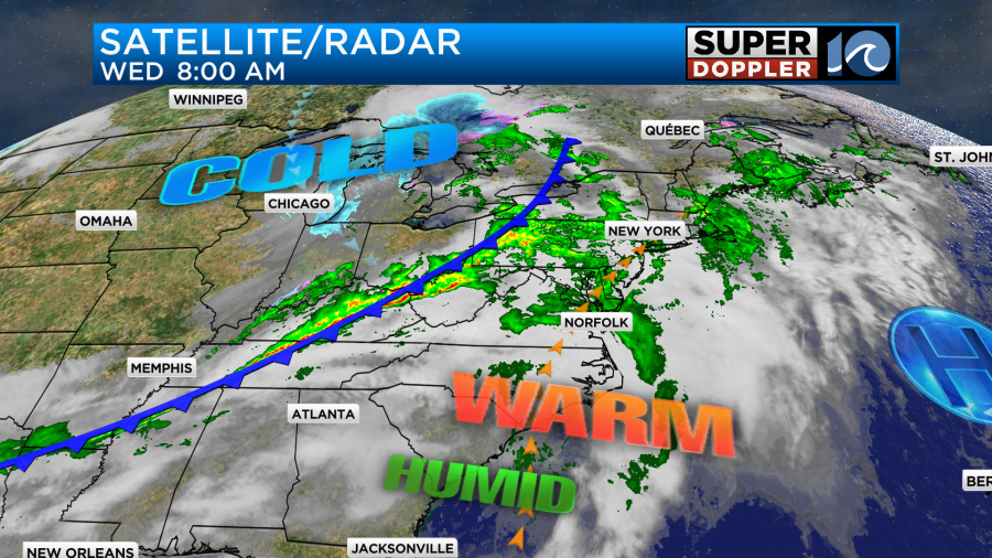
High pressure is far offshore. A strong cold front was rolling through the Ohio River Valley.
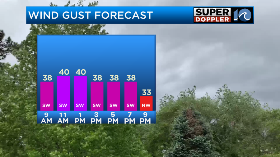
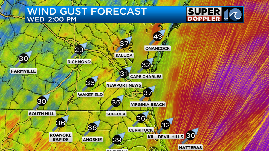
The wind is going to be strong all day ahead of the front, but the showers will be more isolated for a long stretch. Wind gusts will reach to near 40mph through most of the day with some isolated gusts to 50mph possible.
After the mid-morning we’ll have partly to mostly cloudy skies. Again, the showers will be pretty isolated through the late afternoon. Temps will warm up despite quite a bit of clouds. They will run in the mid 70s this afternoon.
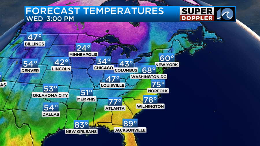
There may be some upper 70s over parts of North Carolina up to the state line. By this evening the cold front will be on our doorstep. There will be line of heavy rain and gusty winds along the boundary.
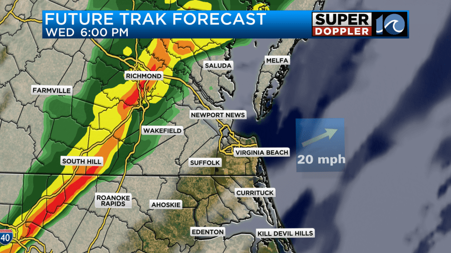
The front will quickly swipe through the metro between 6pm and 9pm.

So far we’ve had about a quarter to a half an inch of rainfall over the region. The rain along the front could put down another quarter to a half an inch. It would be in a short period of time. So I doubt we’ll see regional flooding, but there may briefly be some standing water in a few locations. The Outer Banks may also see some minor sound-side flooding this evening.
High temps are going to reach up to the 70s this afternoon, but tomorrow temps will crash! Low temps will drop to the upper 30s to low 40s Thursday morning. We’ll only top off in the upper 40s during the afternoon.
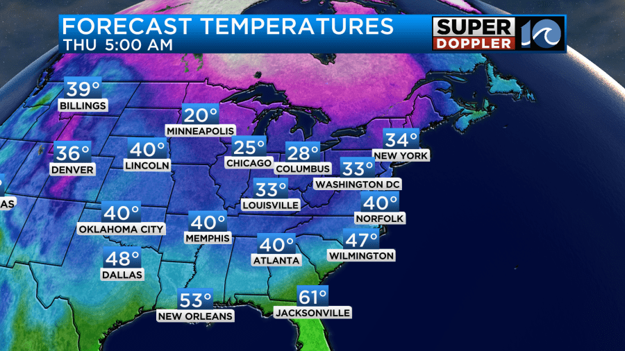
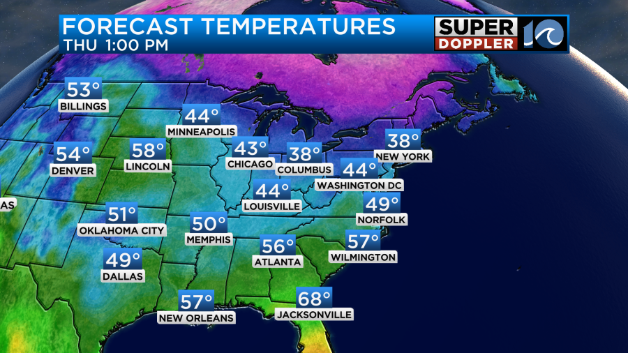
We’ll be dry through the day Thursday. Winds will decrease, but they will be out of the north. Wind chills will be in the 30s through the early afternoon.
We’ll be mostly dry on Friday. Clouds will slowly increase. We’ll have some isolated showers late in the day. High temps will return to the 50s with lighter winds. Rain will return though Friday evening into Saturday morning.
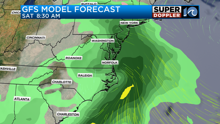
This will be a fast-moving (but weak) area of low pressure that will move through. I’m hoping it kicks out by the afternoon. If it does, then we should be dry from Saturday afternoon through Sunday. High temps will be in the upper 50s to near 60 both days.
Meteorologist: Jeremy Wheeler