This morning we had a lot of rain over the area (as predicted).
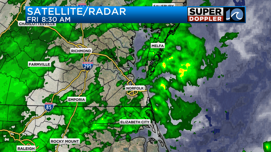
We started with temps in the mid 50s this morning, but temps dropped a little as the rain picked up. We have southwest winds at all levels, and that is pumping the moisture into the region.
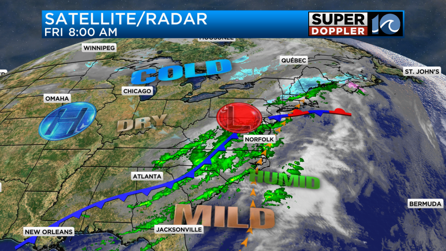
This is all ahead of a cold front that is slowly moving towards us from the west. The front will move in later today. Our winds will be out of the southwest then west at 8-12mph. We’ll have rain showers on and off through the day.
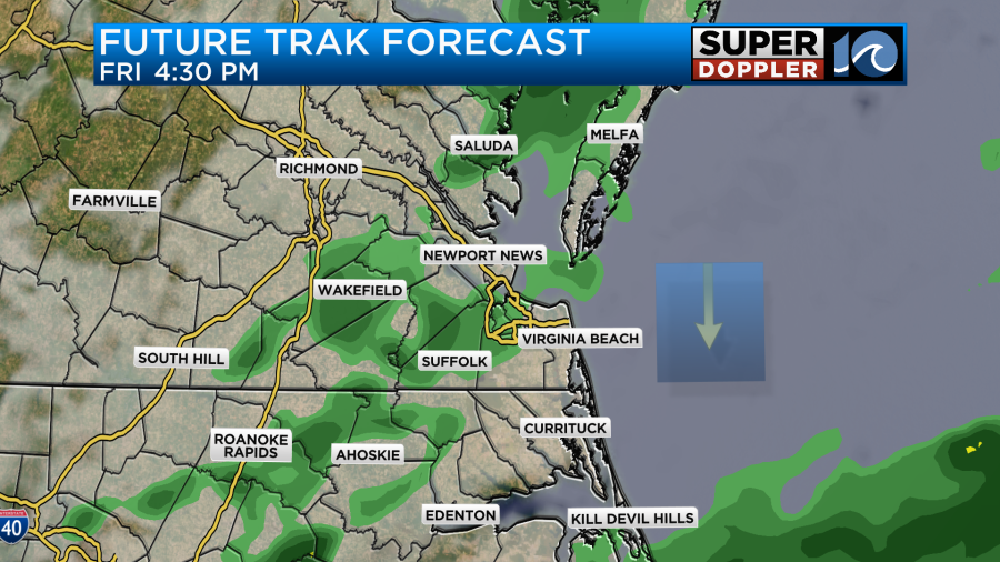
Most of the rain should be light. The rain will then taper off this evening. Overall, we’ll only pick up about a quarter to a half an inch of rainfall.

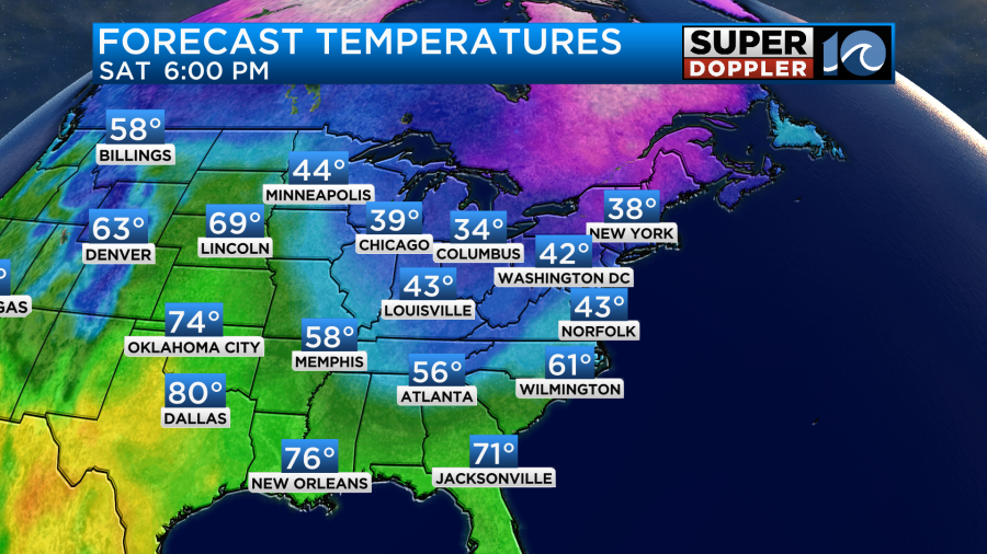
High temps will be in the mid-upper 50s later today. Tomorrow the cold front will sink to our south. High temps will drop to the upper 40s to low 50s.
Temps may actually fall a bit in the afternoon.
We will be dry for the first half of Saturday. Then an upper level low will swing through the region. This will produce a few rain showers in the afternoon.
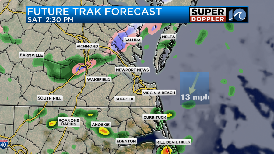
Between the late afternoon and early evening some colder air aloft will be rolling in. This will produce some isolated areas of a wintry mix.
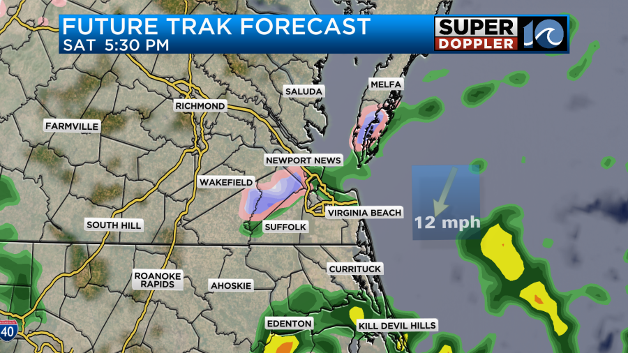
The air aloft will be cold enough for a few wet snowflakes or sleet pellets. However…it will ALL melt on contact. Surface temps will fall, but they will still be in the upper 30s to low 40s in the evening.
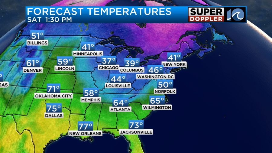
So unfortunately, we will be cooler this weekend. High temps will only be in the upper 40s on Sunday. At least we’ll be dry. The extra tough part about that is that we are going to have a heck of a warmup next week. High temps are aiming for the low 60s on Monday, and now it looks like we’ll get to near 70 degrees next Tuesday and Wednesday.
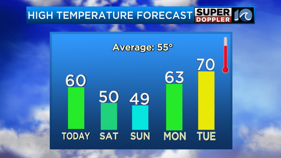
We’ll be dry through at least Tuesday.
Meteorologist: Jeremy Wheeler