Temps have been pretty nice lately. They have been seasonable with highs mainly in the upper 60s to near 70. Though it has been above average for some time. The average high temperature for this time of year is 66 degrees. Today we’ll be above average again with highs near 70. Then we’ll heat up even more tomorrow.
Today we have an area of high pressure to the northeast with a strong (but slow moving) cold front over the central U.S.
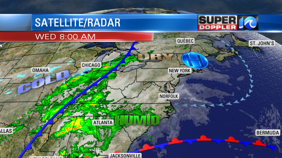
The front is slowly going to meander towards our region, but it won’t get here until tomorrow night. Today we’ll have a light east/northeast wind. Humidity is increasing at all levels. Dew points are climbing into the 60s. We’ll be mostly cloudy with some isolated rain showers possible. Winds will be light and out of the east/northeast.
Tomorrow the cold front will get closer to the region, but it will still be to our west during the day. We’ll have mostly cloudy skies. There will be a few showers in the region, but they will be isolated-scattered. By the evening the models push most of those showers west.

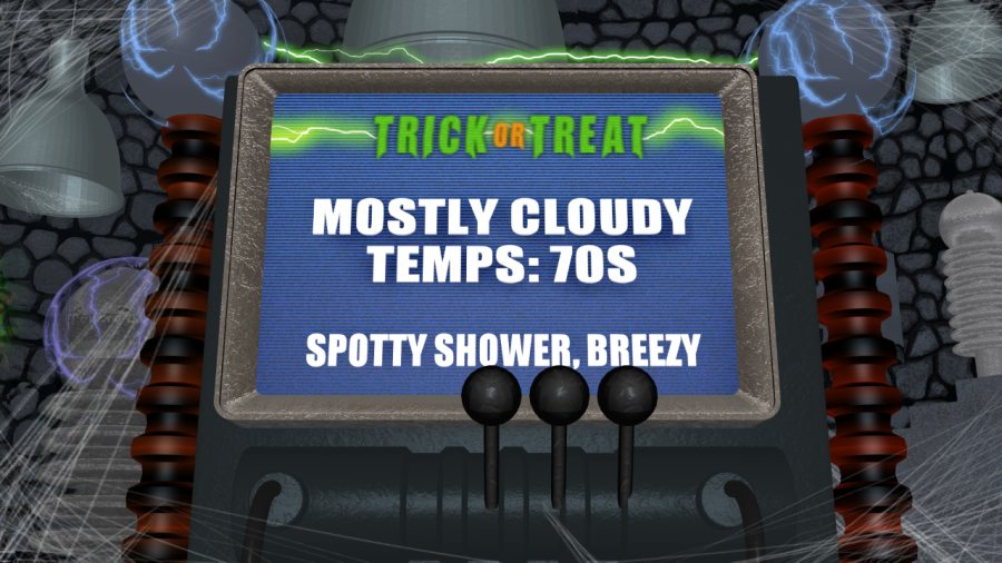
The forecast still looks pretty good for the trick-or-treaters. Skies will be mostly cloudy. There will only be a spotty sprinkle or shower in the region. Most likely inland/west.
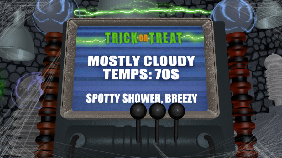
Temps will be very warm. During the afternoon our high temps will be near 80. It will be warm, humid, and breezy. Winds will be out of the south at 5-15mph with gusts to at least 20mph. Temps will be in the 70s during the evening. The breeze will still be strong. So you may want to strengthen your holiday decorations. Also keep it in mind when it comes to the costumes. Remember (warm, humid, breezy)…
So the current forecast calls for quiet weather between 6 and 9pm. However, around 10pm – 2am there will be a line of showers and thunderstorms pushing in from the west. This will be just ahead of the cold front. Some of these storms could have strong gusty winds and heavy rain.
Some of the rain will linger into Friday morning as the front pushes through, but then we’ll dry out by midday. It will be much cooler with high temps in the 60s on Friday. Then we’ll be much colder this weekend with highs in the upper 50s to low 60s. (That’s not a complaint!). The models show a mainly dry weekend, but some of the models are showing an area of low pressure offshore. Some of them have it close enough to bring a few showers to coastal North Carolina on Saturday. That could still change. So stay tuned for updates. Either way it will be cooler and drier.
Meanwhile there is some wild weather out west. They have had more big snow over parts of the Rockies recently. Then there are the wildfires out in California which have been historic.
Meteorologist: Jeremy Wheeler