Overnight, we had some odd weather for February. There was fog, scattered rain showers, mild temps, and isolated thunderstorms.
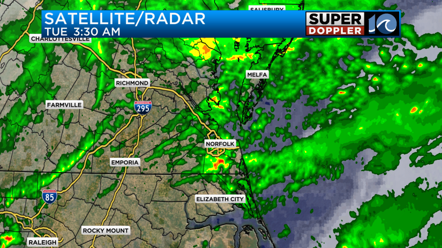
As the morning went on we had some more scattered showers move through, but the fog dissipated. Going forward we are going to transition from rain and fog to strong winds. An area of low pressure rolled through the area last night, but now it is moving away from our region to the northeast.
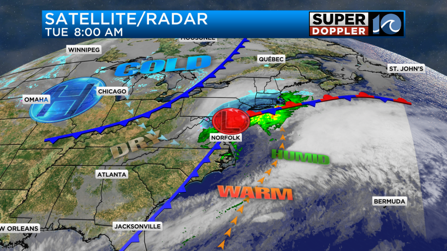
It is causing big problems with snow and wintry weather up there today. There is a cold front dragging behind the low through our region. This feature and the strong northwest winds will drop our temperatures today.

It will also dry us out later today. Winds will gust to 35mph out of the northwest. There may be a few gusts between 40-45mph near the shore.


This is kind of a narrow window for strong winds (which is good). However, the window will last long enough to create some minor to moderate tidal flooding over the sound-side of the Outer Banks. This could happen for a while between about 10am and 2-3pm.
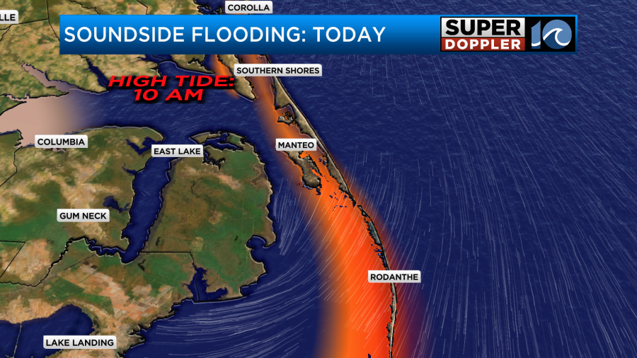
Most of the region will NOT have any tidal flooding. However, the water may rise slightly on the bay-side of the Eastern Shore.
We picked up about a quarter to a half an inch of rain in the last 24 hours.
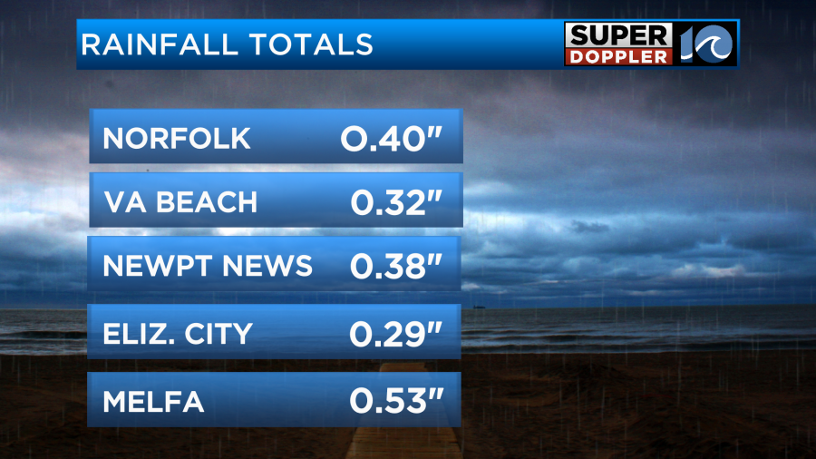
There was no flooding reported. There should only be a trace of rain added from the rainfall today.
We’ll be dry and cool for Valentine’s Day. High temps will be in the upper 40s to low 50s. Then we’ll be dry and cool Thursday and Friday. There may be a few rain showers returning on Saturday. I’ll talk more about that in tomorrow’s weather blog.
Meteorologist: Jeremy Wheeler