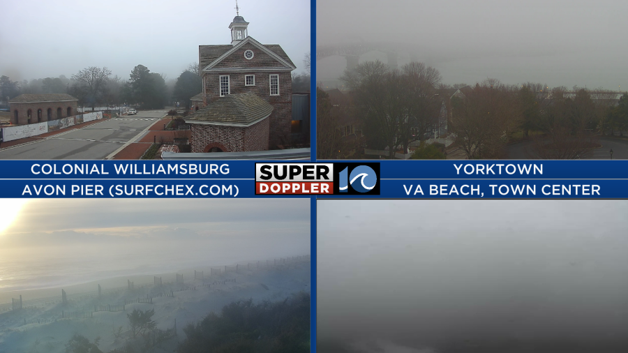
We started off this Tuesday with some areas of fog.
There was a stationary front draped across our region. A weak area of low pressure was moving east along the front.
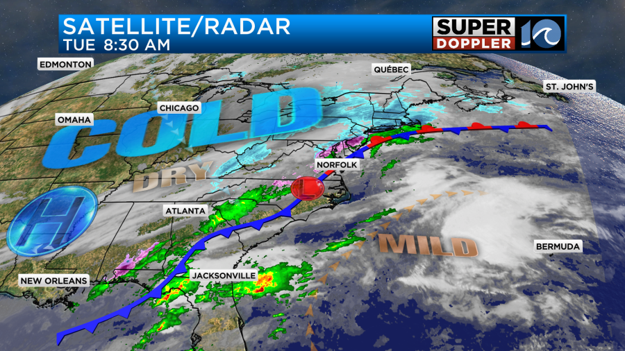
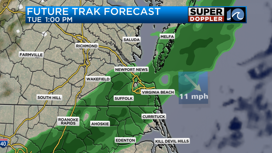
The front and the low will create some scattered rain showers today. It will be a chilly rain. The highest chance looks like it will be between the mid morning and the mid afternoon hours.
By the evening it may end as a brief/melting wintry mix, but there won’t be much precip out there. Surface temps will be above freezing. So there shouldn’t be any big problems. One small issue could be a few slick spots during the evening commute.
As the low pressure system moves offshore it will drag the cold front to the south. This will increase the wind out of the northwest this afternoon. Gusts will be up to 25mph.
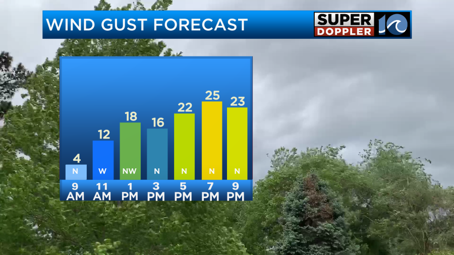
This will not be a destructive wind like a few days ago, but it will become a biting wind. Temperatures will probably top off in the upper 40s around midday with a few 50s even to the south.
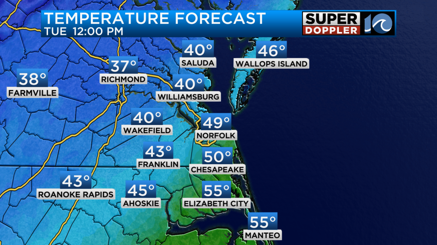
However, during the afternoon temps will fall. They’ll be in the upper 30s to low 40s during the afternoon. Then they will drop to the mid-upper 30s during the early evening.
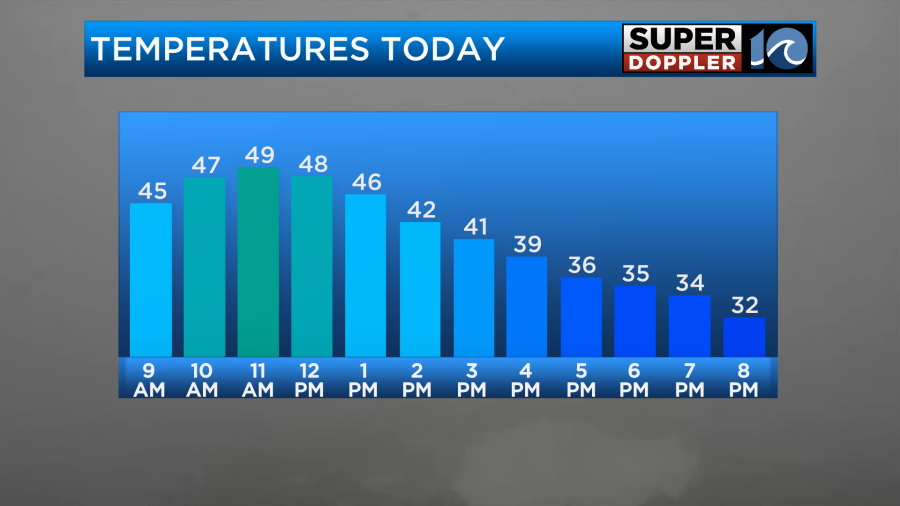
Tonight we’ll have gradual clearing with the gusty winds remaining out of the northwest. We’ll dry out big time. This will allow temps to drop down to the 20s tomorrow morning.
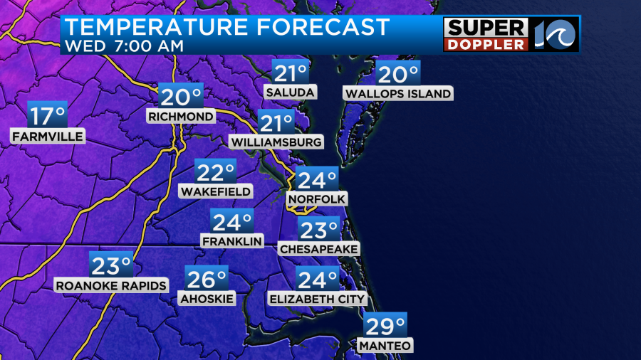
The wind will still be a little gusty in the morning. So wind chills will be in the teens and single digits for a while. Through the day tomorrow the wind will die down, and we’ll have a lot of sunshine. However, we’ll only be able to warm up to the mid-upper 30s.
At least we’ll be dry. With the colder temperatures coming in, today is the day to prepare. Here are some tips and reminders for your home.

We’ll be dry and chilly on Thursday. Lows will be in the 20s again, but high temps will rise to the 40s. On Friday an area of low pressure will slide east through our region. It will create some scattered rain showers. High temps will be in the 40s. However, we’ll be in the 30s early and late in the day. So there may be some light snow and/or a wintry mix combining with the rain showers. At least in some locations. The GFS is a little more wintry in Hampton Roads compared to the Euro model. Both have some snow north of Hampton Roads. Both have an element of a mix line (pink).
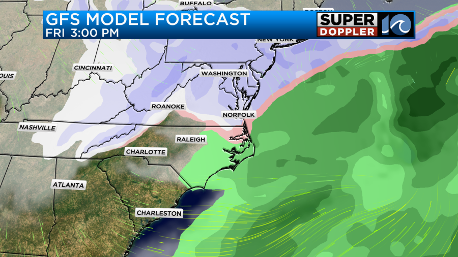
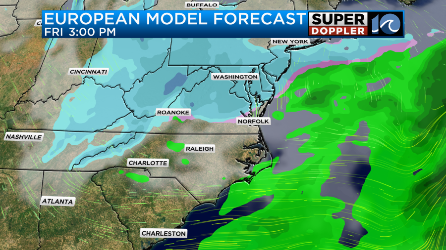
None of the models have any big snow. Especially with temps above freezing. However, some light accumulations could be possible north of the metro. Especially, if the GFS verifies. We’ll have plenty of time for updates before we get there. Regardless, it will be much colder again on Saturday. Highs will be in the 30s.
Meteorologist: Jeremy Wheeler