The last 2 afternoons were pretty nice out. We’ve had lots of sunshine with high temps in the 50s. It’s been seasonable. Today, however, it is going to be breezy and seasonably chilly. We have a cold front that is dropping to our southeast. High pressure is edging in from the west.

We’ll have lots of sunshine today, but temps will struggle to get above the mid 40s.
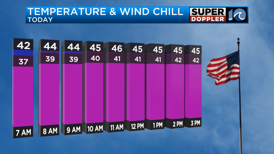
The breeze will be up out of the north at 5-15mph with gusts to 20mph. This will make it feel chilly at times. Wind will decrease this afternoon into the evening.
Tomorrow we’ll start off with temps in the 20s and 30s. However, we’ll be able to warm up a bit in the afternoon. Winds will be light and out of the west. Plus, we’ll have a lot of sunshine again. So high temps will aim for the mid 50s.
We’ll have another nice day on Saturday. Clouds will increase, yes. But, we’ll have enough sunshine to call it a nice day. High temps will rise to the upper 50s. The Sunday forecast hasn’t changed too much. We are expecting a lot of moisture to rise up into the area. This will be some deep moisture too. Low pressure will be forming to our south. Rain will increase through the day as well as the wind.
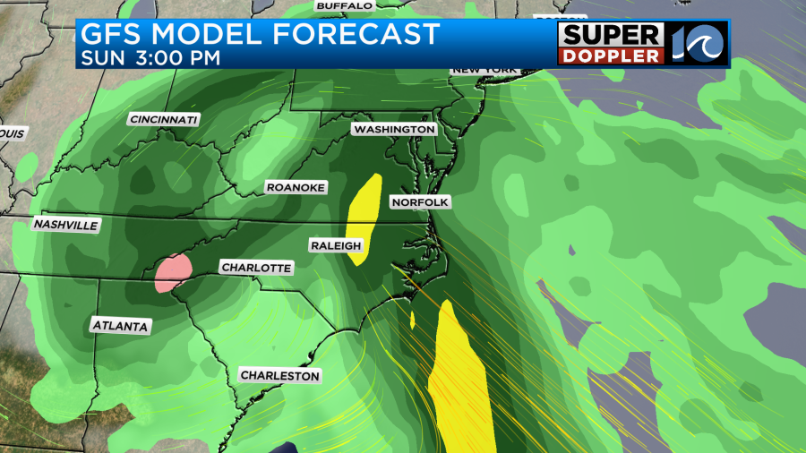
The GFS and European models are in pretty good agreement about this. They both have increasing winds from the south/southeast through the day. High temps will probably be able to reach up to near 60 degrees. During the evening the models have widespread rain and even stronger winds.
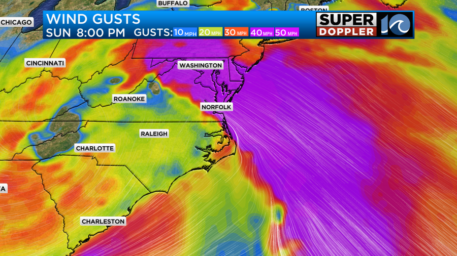
The winds could briefly gust up to 40mph Sunday evening into late Sunday night. The big difference today is that the models are agreeing now that the low will quickly move to the north. If you read yesterday’s weather blog then you know that the GFS was lingering the low. Not anymore.
So now it follows the European Model.

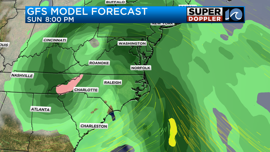
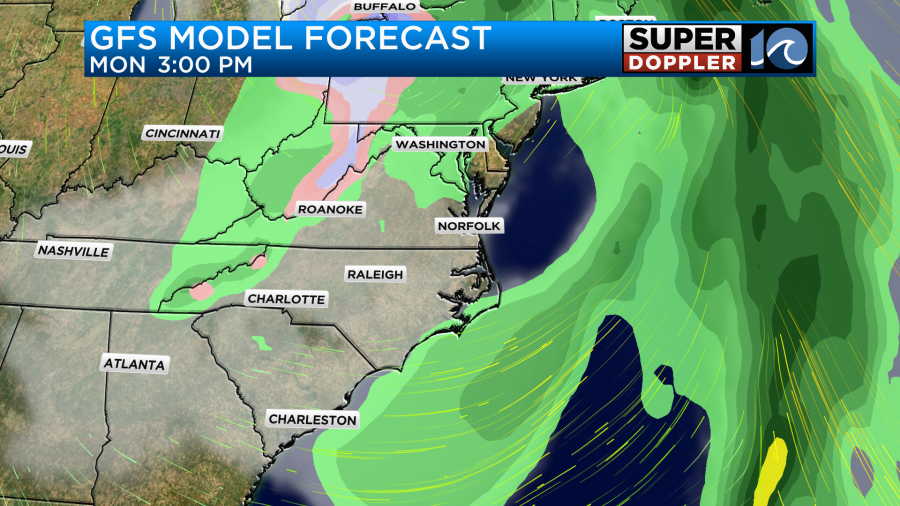
As the low strides north we’ll have some drier weather wrap in behind it. Winds will be breezy out of the west/northwest. We’ll have a decreasing chance for rain. These new winds may limit the any tidal flooding that we could see. It’s still too early to make that call.
As the low moves farther north, we’ll be pretty dry on Tuesday with only an isolated shower in the region. We’ll be near 60 on Monday, but we’ll only top off in the 40s on Tuesday.
Due to the models kicking out the low sooner. They have also now trended with less rainfall.
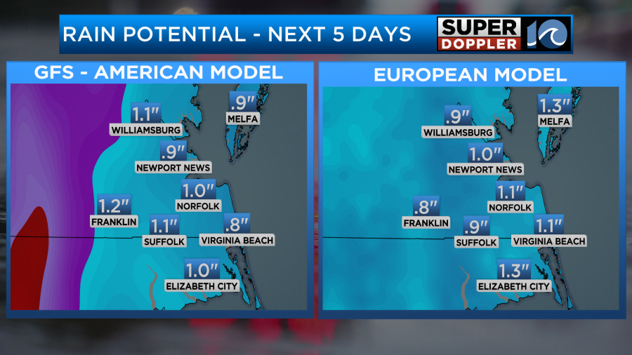
This rainfall forecast now includes Monday.
The overall forecast could still change, but at least the trends are coming together. So there’s a little more confidence in the Monday forecast. We’ll have more updates over the next couple of days. So be sure to check back for them.
Meteorologist: Jeremy Wheeler