Yesterday was wet and windy. Meteorologist Jeff Edmondson wrote a weather blog last night with some of the recap. I’ll add some of the rain totals here:
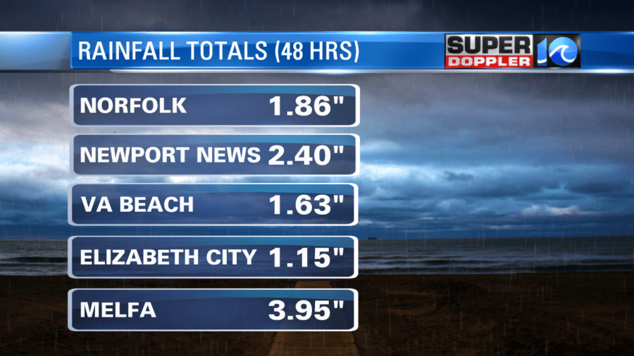
However, I did get some reports in from the Eastern Shore that some folks had about 4-6″ of rain up there. There were also some reports of flooding up there as well. The rest of the region had some beneficial rain. There was a large area of 1.5 to 2.5″. I would say that the drought has ended, but the official U.S. Drought monitor will update on Thursday. This will be after another round of rain that is coming in tomorrow. More on that in a moment.
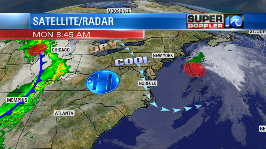
Today we are in-between systems. The low pressure area (which was the remnants of Nestor) actually moved offshore late yesterday. However, the moisture is still funneling in behind it out of the north/northeast. So we have had areas of drizzle since yesterday afternoon. It’s been wind-driven at times. So it has felt moderate to heavy at times. High pressure is just off to our west, but the moisture is still coming in off of the ocean.
Through the day we’ll have lots of clouds. The drizzle should taper off by the afternoon. I’m hopeful that we’ll have some peeks of sun later today, but overall we’ll have ample cloud cover. The wind will be out of the north at 5-15mph. High temps will be in the mid-upper 60s.
Tomorrow we’ll be in-between system. The low will be long gone-and our region will be ahead of a cold front. We’ll have lots of clouds, but we’ll also have a south wind. So high temps will rise to near 70. There will be scattered showers with a few thunderstorms during the afternoon.
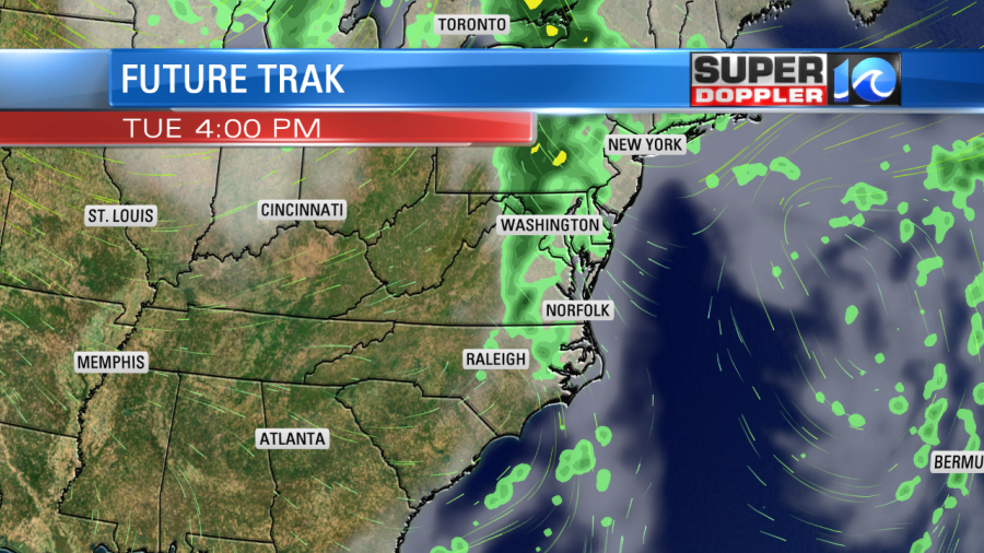
If the south wind increases a little more than forecast, then we could get some strong thunderstorms in the region. For now though I think most of the instability will be over North Carolina. There will also be some decent upper level winds. So there may be a low chance for some severe. Again, that will be determined by how far north the instability gets.
We’ll be cool and dry on Wednesday and Thursday with lots of sunshine and highs in the 60s. We’ll be partly cloudy on Friday with some isolated pm showers. Highs will be in the 60s. Then we’ll have some more rain on Saturday. I’ll go into more detail on that tomorrow.
I’m happy to report that all is quiet in the tropics! Yesssss!
Meteorologist: Jeremy Wheeler