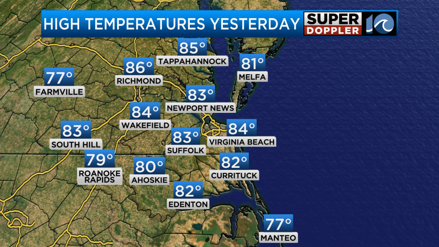
Yesterday wasn’t just warm. It was actually hot at times. I was walking my dog in the early afternoon, and I think we both just felt like it was too hot in the sun to stay out long. It didn’t feel like mid-August, but it did feel like late Summer. We ended up breaking a record. We hit 85 degrees in Norfolk. The old record was 84 set back in 2020.
We are going to have one more warm day before the temperatures crash. A large area of cold air has been affecting the central U.S. over the last few days. There was even snow over parts of the Midwest recently. Today we are still going to have warm temps here, but it will be much colder over the central U.S.
The cold front is still to our west. It is very slow moving. Highs pressure is just to our southeast.
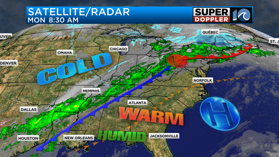
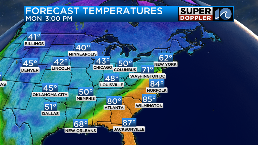
Notice that most of the rain is behind the front to our west. More on that in a moment. We’ll have fair skies today with a west/southwest breeze. It will run at 10-15mph with a few gusts up to 20mph. High temps will aim for the mid 80s again.
Dew points are near 60. This is moderate humidity, but at least the breeze will offset how it feels. It will be another decent beach day. However, there is a moderate threat for rip currents at the local beaches. We won’t have any rain during the day, but some isolated showers will arrive this evening as the cold front slowly sinks into the area. The front will sink to our south between 6 and 10pm. Scattered showers will fill in behind the front as the winds pick up out of the north.
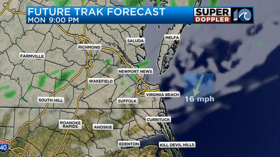
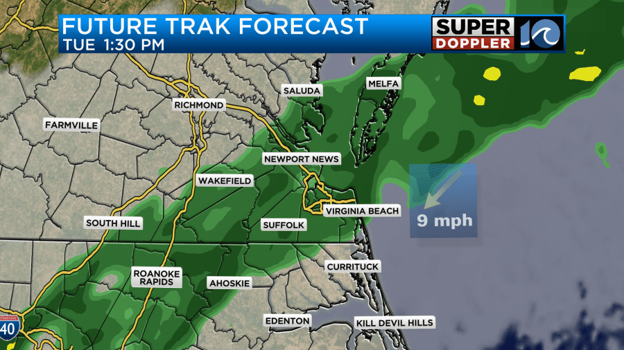
Winds will gust up to 30mph later tonight. Probably after midnight. Tomorrow the front will slow down. It may briefly stall out over North Carolina. Meanwhile a weak area of low pressure will form to our southeast (offshore). It will run up into the front, and it will push moisture north of the front. Also, an upper level low will sweep in from the west. This means that we are going to hold on to a cloudy forecast through the day Tuesday as overunning moisture takes over. We’ll also have a broken line of showers that will increase between midday and the mid-afternoon.
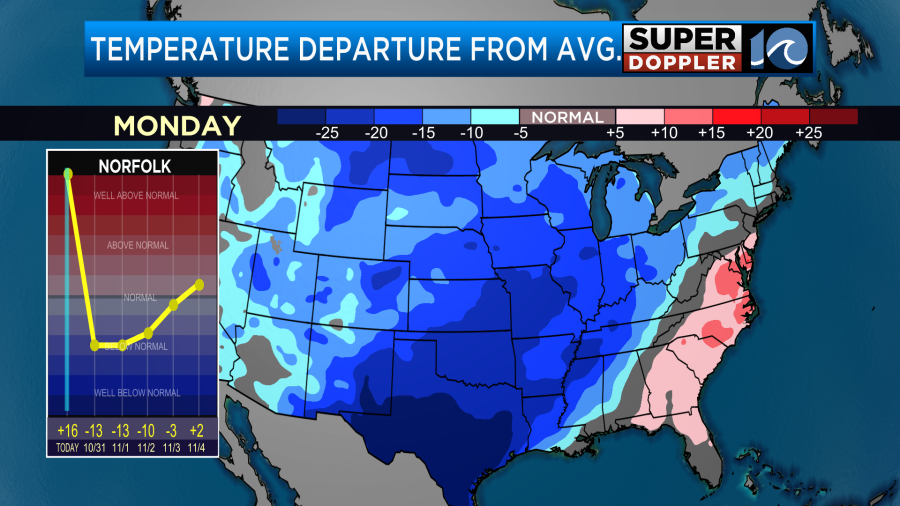
High temps will only be in the mid 50s. It’s a huge crash in temperatures in a 24 hour period. This after starting in the low 50s in the morning.
temps tomorrow
Unfortunately, the scattered showers will continue into the evening. This will impact the trick-or-treaters.
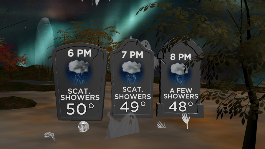
Temps will be falling from the low 50s in the early evening to the upper 40s by the end of candy hours. At least the breeze will be easing a bit by the evening, but even a light breeze will feel cool with those temps and the rain.
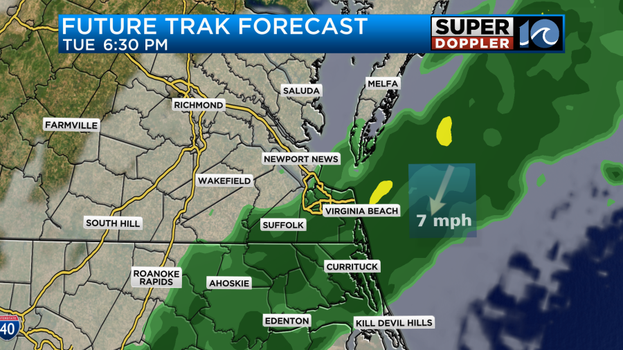
It’s possible that the rain will drop to our south a little earlier than forecast, but we can’t bank on that. Especially with all of the models showing rain between 5 and 9pm. Check back tomorrow for updates.
A few scattered rain showers will continue Tuesday night into Wednesday morning. Then we should dry out. However, it will stay chilly. Low temps will be in the low 40s Wednesday morning. High temps will only be in the low-mid 50s. Thursday will be dry and chilly too. There’s even a chance that some frost will happen on Thursday and Friday mornings. We’ll have updates on that over the next couple of days.
One bit of advice. If you haven’t run your heat yet or if it’s been a while, then make sure to briefly run the heat for a bit during the day. That way you can make sure it’s running ok before you need it. A lot of folks will kick on the system before they go to bed only to discover a problem in their sleep.
The Atlantic is taking a breather for now. There are 2 tropical disturbances that could form over the next couple of days.
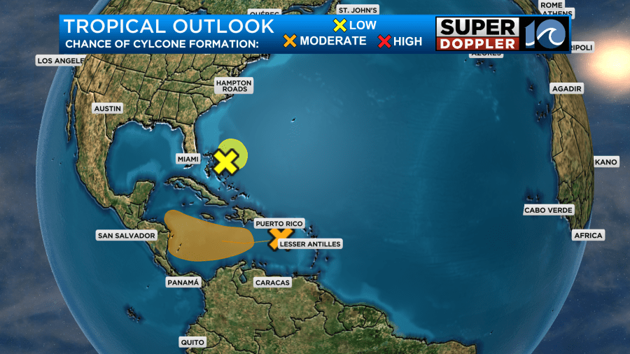
However, the one that is closer to the U.S. only has a low chance of briefly becoming tropical. It is the same low that will interact with the strong cold front. So it will stay offshore, but it will be pushing that moisture north into the front. The other disturbance is moving west over the Caribbean.
Meteorologist: Jeremy Wheeler