We asked for rain … we asked for cooler temperatures. Well, we got it. ( I don’t mind the coolness). We had a large amount of rain during the last tropical system (Ophelia). Much of the region had 2-4″ with 1-2″ north of the metro.
Since then we’ve had some more rain from the REMNANTS of Ophelia. We have also had a lot of clouds. So it’s time for a change. Luckily, I think we will get some changes by the weekend. Let’s talk about it:
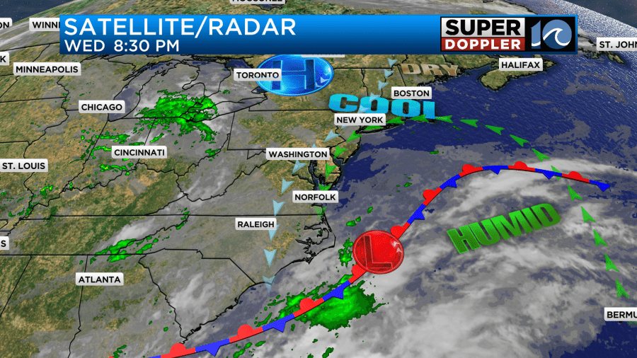
Today the weak area of low pressure (remnant low) is still offshore. You know yesterday it lined up that we had a lighter wind than expected. It was also more out of the north than northeast. So we had a little dryness in the air that at least gave us a break from the rain and drizzle.
Today the low has drifted north a bit since then.
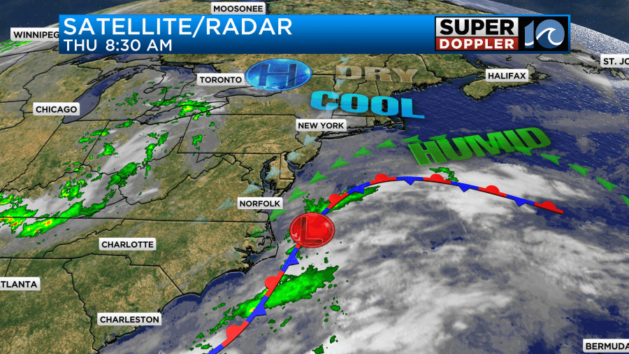
With its current position winds have started to run out of the northeast again. This should allow the deep moisture to return. Actually, I think that’s already happened. It looked like a lot of mist and drizzle on the tower cams this morning.

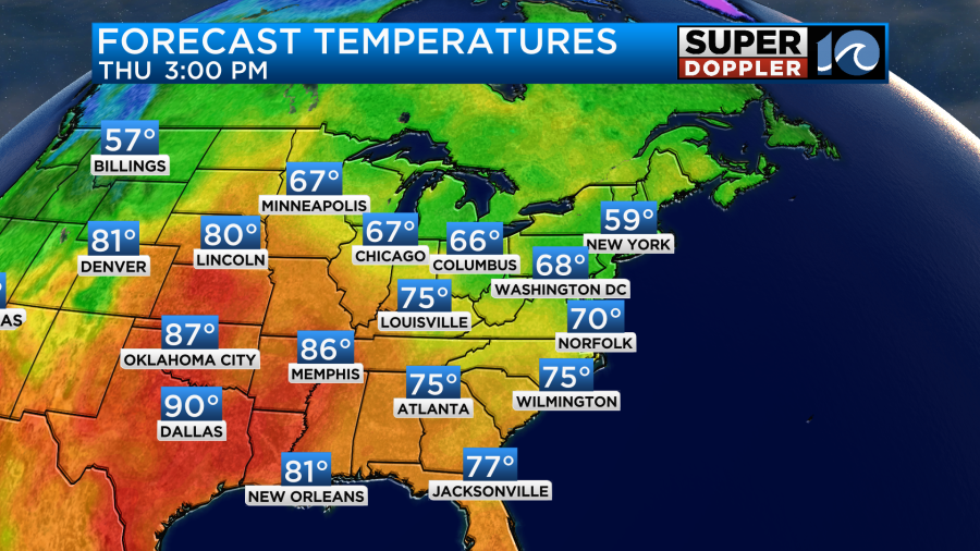
We’ll be cloudy again today over most of the region with a little bit of sun over towards I-95. There will be pockets of drizzle with a few showers coming in off of the ocean occasionally. High temps are aiming for around 70 degrees on the models, but I think we’ll be in the upper 60s to low 70s.
The breeze will stay up out of the northeast at 10-15mph with gusts to 20mph. This is creating some more minor tidal flooding in the region. Luckily the tide has been coming in a little under-forecast for the last couple of tides. As I write this the tide is reaching up to about 4.9 ft. The forecast was for 5.2ft.

It should be minor going forward, and it should mainly affect the areas that are prone to tidal flooding.
On Friday, the low will push a little more to the north, and it should weaken some more. So we’ll still have lots of clouds, but I’m hoping we’ll have some sun popping out during the afternoon and early evening. High temps will be in the 70s. We’ll have a lighter northeast breeze.
Some models still have a bit of that moisture lingering on Saturday as the low pushes slowly farther away to the northeast. So for now I’m thinking that we’ll have a mix of sun and clouds with some isolated showers. High temps will be in the 70s. By Sunday the models are showing a more rosy scenario. We’ll have lots of sun with highs in the mid 70s. We’ll be drier Sunday into early next week. High temps will upper 70s by Monday.
Tropical storm Philippe is having a dramatic life, but not a powerful one. It is currently weak and moving to the west.
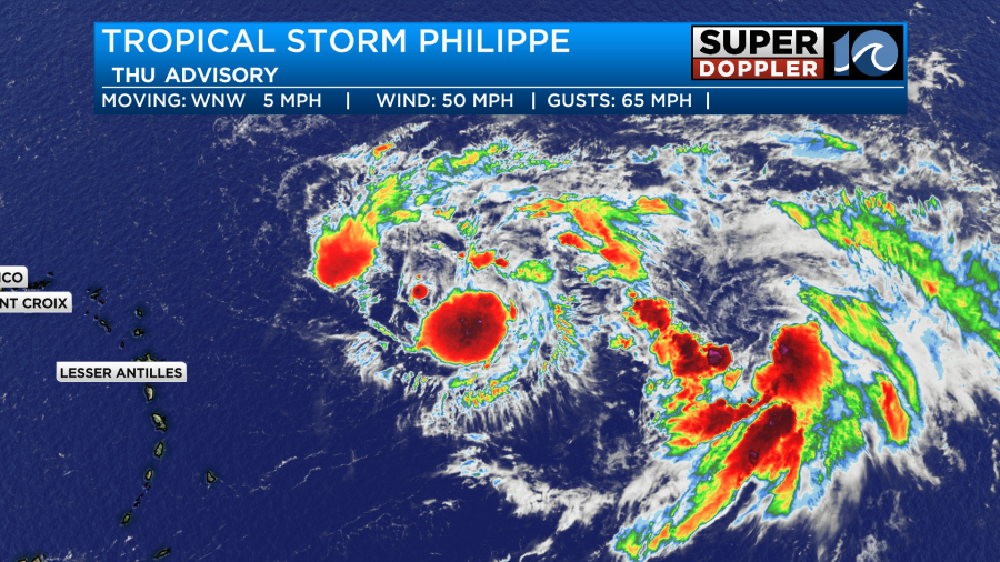
It will continue to meander to the west for the next few days. It is now expected to become post-tropical, remain weak, and stay east of Puerto Rico.
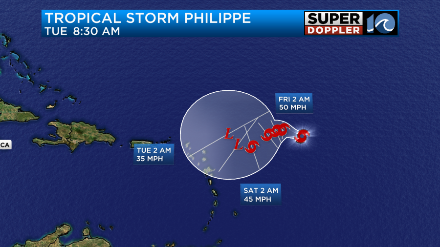
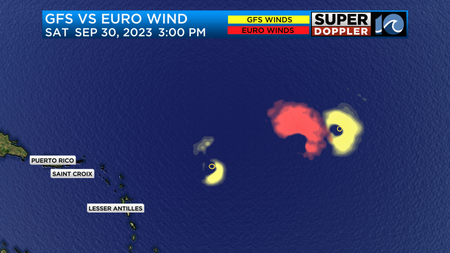
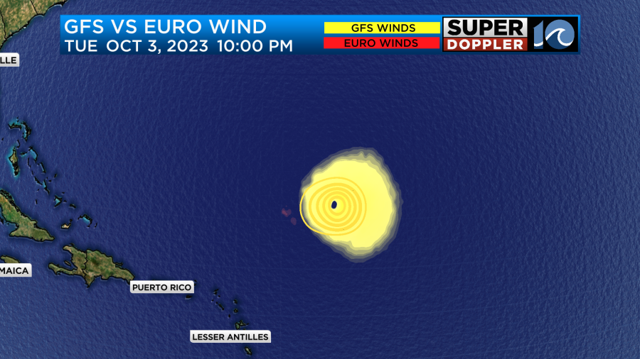
However, it could get a second life in several days. Some models are now sending it south, then doing a hook back to the north.
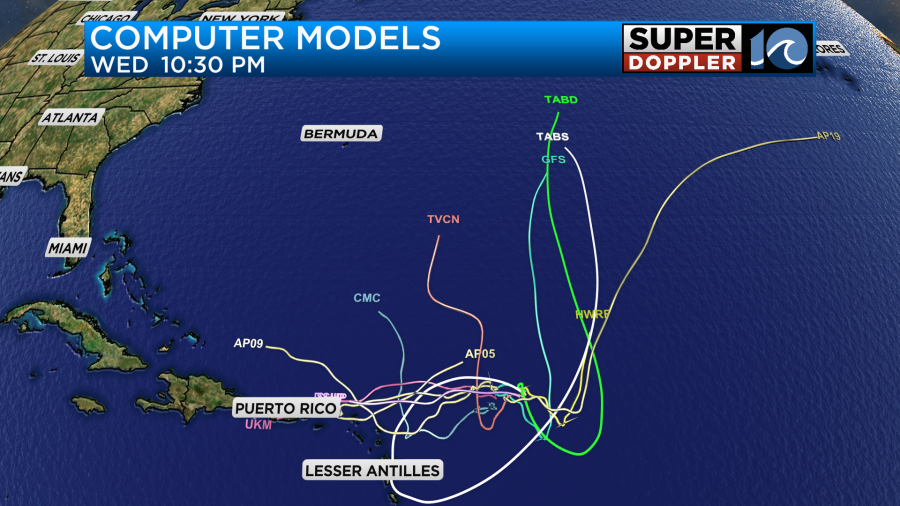
What a zany looking forecast. The GFS model is one of those that has it going north and strengthening down the road. It also has it interacting with the tropical disturbance (Rina?)
We’ll follow it and bring you the latest, but I think either way it will stay out to sea as far as the U.S. is concerned.
Meteorologist: Jeremy Wheeler