Full disclosure…This weather blog is going to be shorter than all of the weather blogs from last week. The local weather is simple, and the tropics have really gotten pared down. With that said …
This morning a cold front was slowly sliding through the region. There was also a weak area of low pressure along the front.
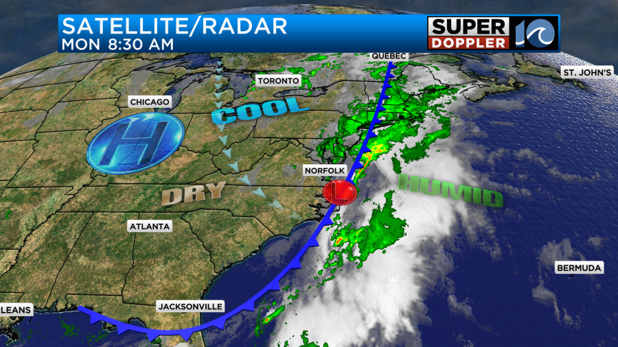
The front brought us some scattered showers this morning. It created some traffic problems and slowdowns during the morning commute.
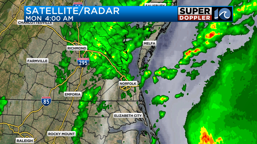
Rain amounts were light for most locations. It was a trace to about one to two tenths of an inch over most of the region. We still need rain as we are going into the fall planting season. At least for the lawns.
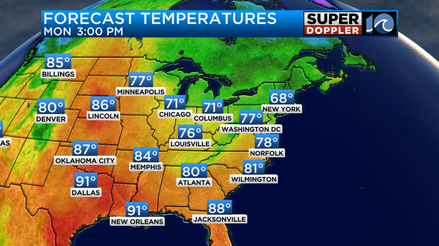
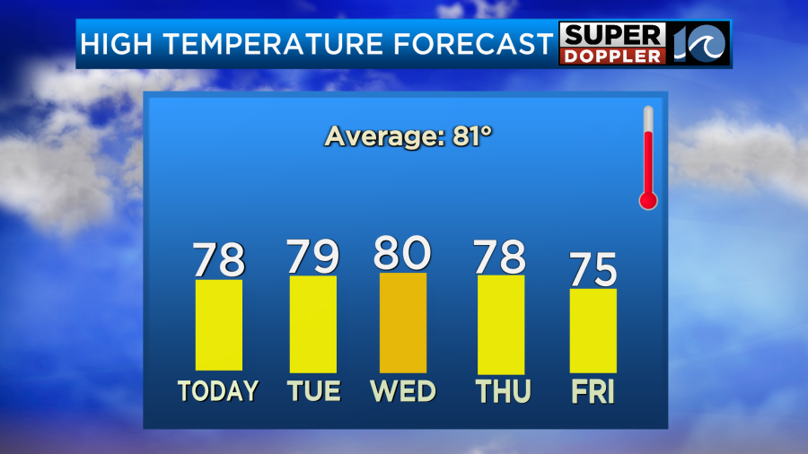
The front will slide offshore soon. Then high pressure will build in to the region. After the clouds and showers this morning, we’ll dry out through the day. High temps will rise to the upper 70s.
At the same time the breeze will be picking up out of the northwest. It will run at 10-15mph with a few gusts to 20mph. This will drop the dew points to the 50s.
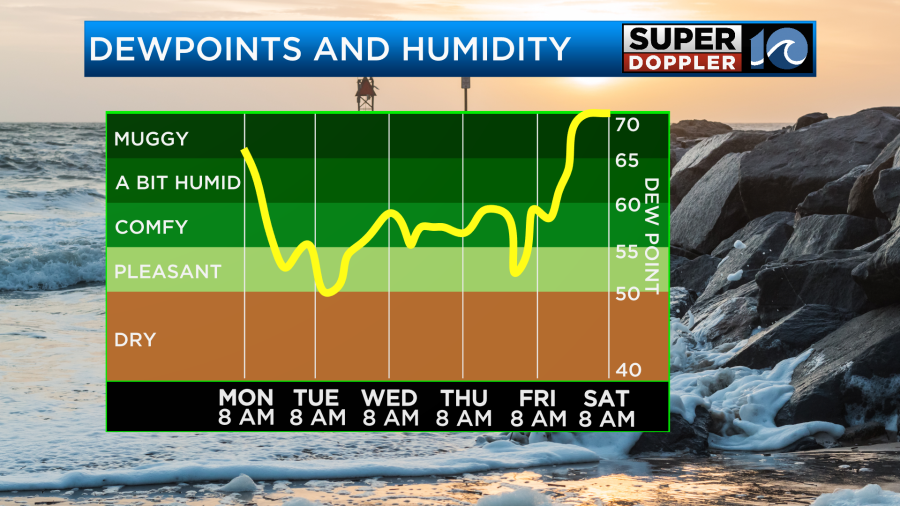
Luckily the humidity will stay down for a few days. If it’s not raining, then it might as well be comfortable at least. It will be.
Tomorrow we’ll have lots of sunshine with high temps in the upper 70s to near 80.
Dew points will be in the 50s. We’ll have a steady north breeze. It will be awesome! Mild temps and dry air will continue for most of the week.
Towards next weekend we’ll be watching for a potential area of low pressure to creep up along the coast. If it does form, then it could become tropical. This is pretty far out in time. So I’ll have an update on that in tomorrow’s weather blog with a little more detail.
Meanwhile, things have calmed down a little in the tropics. Lee and Margot are no longer systems. Now the only thing we are tracking is hurricane Nigel.

Nigel become a hurricane during the 5AM update this morning. The good news is that it will track to the northwest in the short term. Then it should hook to the northeast and stay out to sea.
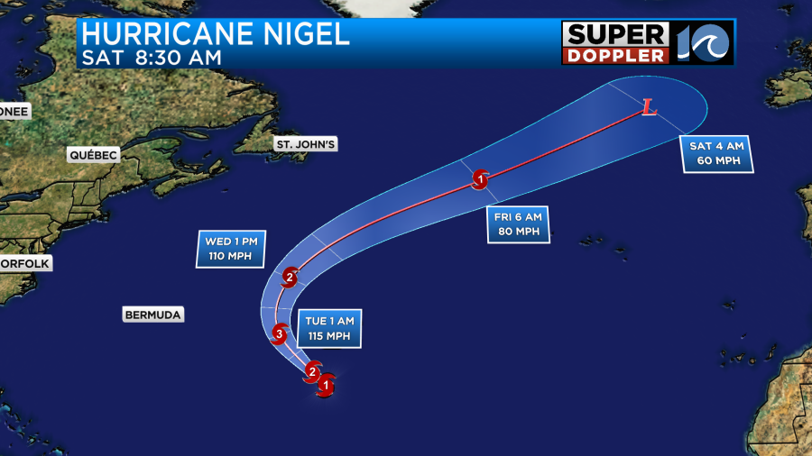
The models are in pretty good agreement into taking that turn.
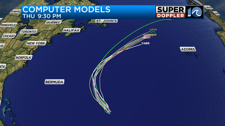
The waves and rip current threats will likely increase again this week, but really we are getting out of the beach season. There are a couple of other tropical disturbances in that Atlantic that could form in the next few days. We’ll keep an eye on them.
Meteorologist: Jeremy Wheeler


