Temperatures over the next few days will hang in the 80s with humid conditions. This will keep some isolated showers in the forecast tomorrow after a good chunk of sunshine fills the day. By Tuesday night into Wednesday a cold front will be approaching the region. With it comes another round of scattered showers and aid in more ways than one.
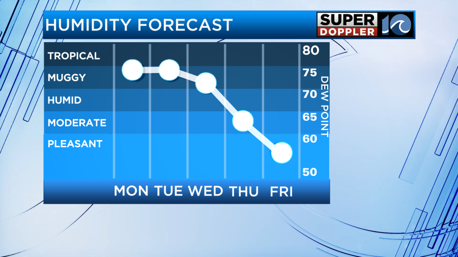
First, the front provides comfortable conditions by the end of the week as it sweeps the region. We expect temperatures in the 70s and lower humidity values later this week into next weekend.
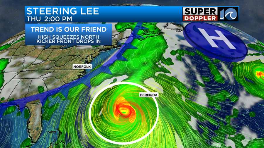
Second, the front will help steer Lee in the extended forecast, keeping the system off our coastline.
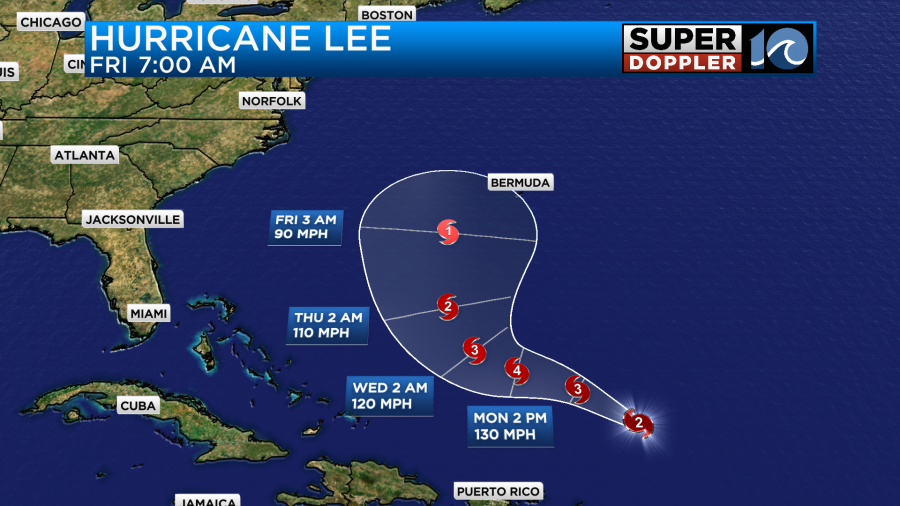
Hurricane Lee is expected to make the northerly turn between Tuesday and Wednesday this week, then from there the system should race to the north. It’ll be a close call for Bermuda by Friday, but there’s still big uncertainty about how sharp the northerly turn is.
As an area of high pressure squeezes to the north, a window opens for Lee to race northward. Then our midweek cold front helps nudge (or guide) Lee through that window. As of now, the trend has Lee passing our coastline by the end of the upcoming workweek, but we still don’t know by how much. So check back in throughout the week to monitor the changes in the forecast. Fortunately, things so have been pretty consistent.
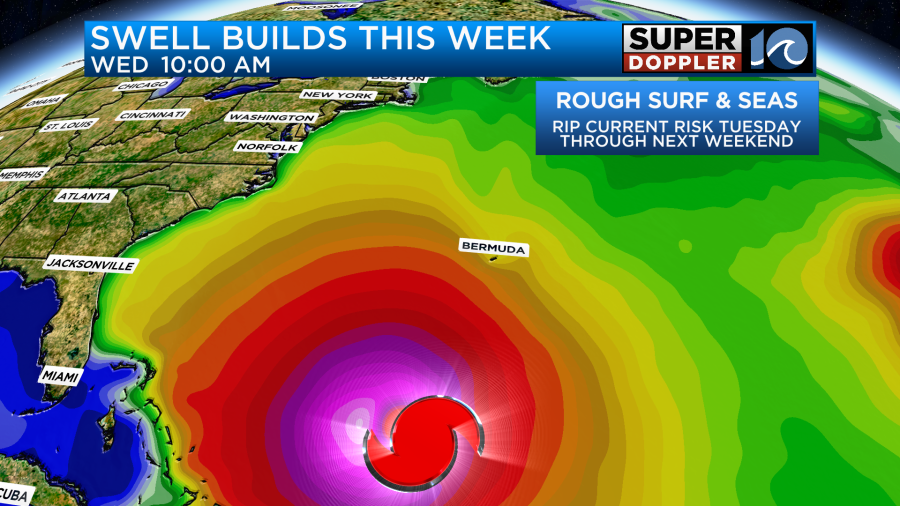
One thing is for certain, the surf will be up. Rough surf and seas are expected all week long as the strong hurricane kicks up the waves. Area beaches will likely see the swell from Lee arrive sometime Monday, then filling in throughout the week. The rip risk will be elevated from Tuesday all the way through next weekend. Use some caution out along the coastline this week.
After a muggy next few days, we’ll be able to enjoy some pleasant and comfortable conditions by the end of the week.
Meteorologist Steve Fundaro