This morning was a lot different from the last couple of mornings. The drenching rains were nowhere to be found. So we actually started with a lot of sunshine with a few clouds. However, it was warm and humid. Both the temps and the dew points were in the 70s. We’ll heat up today before a cold front sweeps into the region. That front is over the eastern Tennessee River Valley, but it is quickly moving to the east.
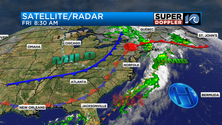
There is a stationary front to our west, but it is falling apart. The cool front will enter our region during the mid-late afternoon. It may create a stray shower or two, but drier air streaming in from the west should really limit the rain. High temps will be able to reach the low 90s before the cooler/drier air sinks in.
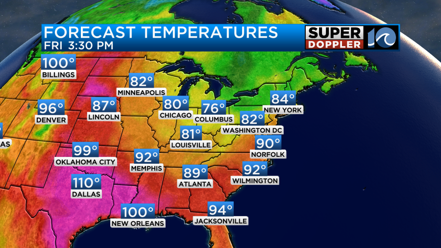
The heat index could briefly rise to the mid 90s before the drier air arrives. Dew points will gradually drop from the low-mid 70s to the low 60s by the end of the day. They will drop to the 50s tonight, and they will stay down for the weekend.
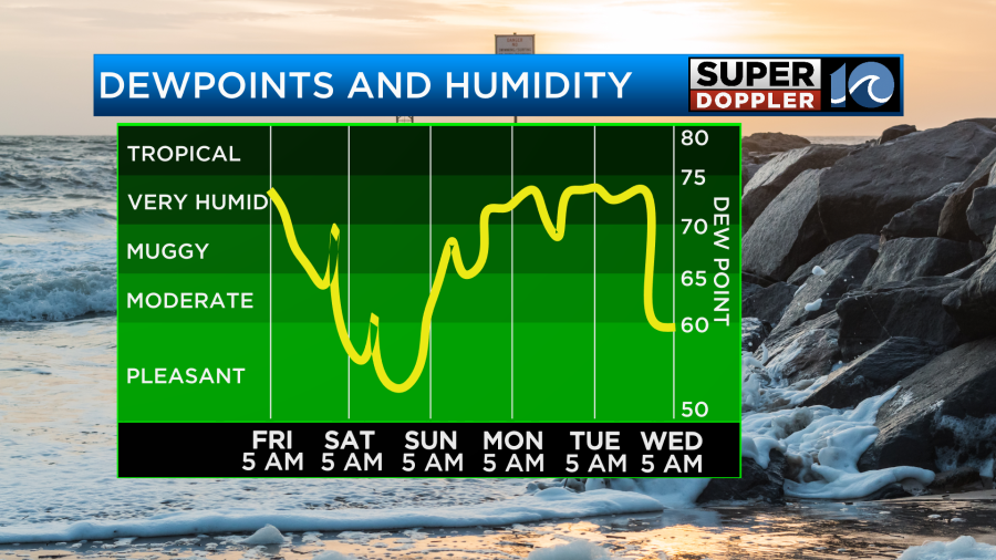
The weekend looks awesome! We’ll have highs in the 80s both days with dry conditions and lots of sun. Low temps will be in the 60s, but a few upper 50s could even occur in a few inland spots.
However, the temps and the humidity will spike on Monday. High temps will reach the mid 90s. The heat index will be over 100.

It’s far off, but the long-range forecast shows a huge cool down for next Wednesday. Highs in the upper 70s??? We’ll see.
The tropics are heating up. Currently, there are 3 areas of possible development in the Atlantic, and there is that could develop in the Gulf Of Mexico.

Out of the cluster of 3 disturbances the one farthest east has a high chance of formation over the weekend, but it would probably stay out to sea. The one that is farthest west has a low chance of formation, but it could affect the Lesser Antilles.
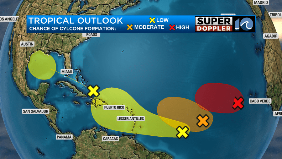
The one that will travel to the Gulf of Mexico has a low chance of formation for now. However, the Gulf waters are super warm. So we’ll see what happens in a couple of days.
I don’t normally talk about Pacific systems. However, hurricane Hillary is unique. It is currently a category 4 hurricane in the eastern Pacific Ocean.
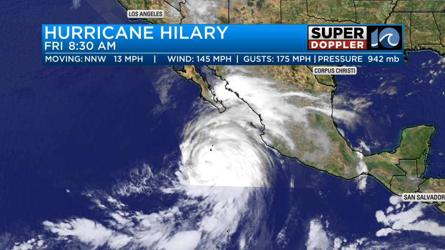
It is moving generally to the north. However, it may move through southern California as a tropical storm. It could even make a landfall south of or near San Diego.

Either way it is forecast to bring several inches of rain to that region. That’s not good due to the geography and the mountains. So some pretty bad flooding is forecast. Stay tuned for updates.
Meteorologist: Jeremy Wheeler


