Yesterday morning all of the models were in agreement that there would be a lot of severe storms to our west and our north. Most of them were in agreement that we would see a (broken) line of storms in our region. However, there was one model that kept showing a split or even some quiet weather for last night: the NAM model. Interestingly though the higher resolution version of that model did have the line of storms.
In the end the storms did the 7-10 split (a bowling term) right around our region. So we did some storms just to our north, and we did have a few storms to the southwest. However, it became just a little rain between 10 and 11pm.
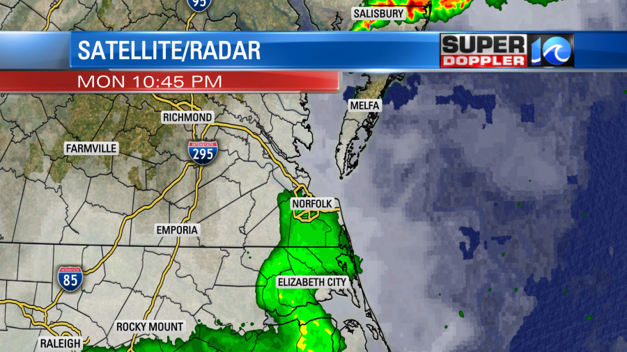
However, we did not get the big/severe storms as the Storm Prediction Center had forecast. (as well as many of the models).
This does happen quite a bit in our region. Though we haven’t had that split in a while. We’ve actually gotten hit quite a bit over the past 2 months We are 0.59″ above average for the month for rainfall. We are 3.23″ above average for the year with 32.62″ of rainfall so far. So it was actually a good thing that we got missed. Let alone that we didn’t have to deal with the severe weather.
Those storms formed well east of a cool front. Today that front is sliding through the region.
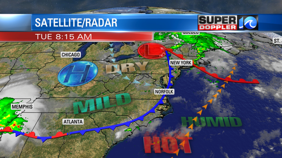
Today is going to be pretty nice out. We’ll have a nice breeze out of the west with decreasing humidity. The wind will run out of the west/northwest at 10-15mph with gusts up 20mph. The breeze itself will help with how it feels outside. However, the dew points will also drop to the low 60s this afternoon. So that will be a double whammy.

We’ll have fair skies through the day. Keep in mind that a stray shower or two could fall along the front. However, the chance for rain is only 5-10%.
Tomorrow the front will stall out to our south. We’ll stay fairly dry with dew points in the low-mid 60s.
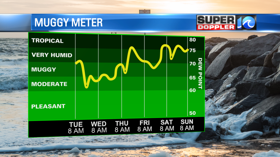
We will be drier, but we will also have less wind and lots of sun. That will allow our high temps to reach about 90 degrees. However, the front will move north on Thursday, and it will pass north of our region by the afternoon. This will up the heat and the humidity. High temps will rise to the low-mid 90s, but the dew points will get back up to the low-mid 70s. That will put the heat index up to 100-106 degrees. There may be more Heat Advisories issued. We’ll also have some scattered thunderstorms forming in the afternoon.
We’ll be pretty seasonable this next weekend. High temps will be near 90 or in the low 90s. There may be some isolated showers or storms, but the chances for any rain showers look low.
It’s still quiet in the tropics, but I bet things will heat up over the next couple of weeks.
Meteorologist: Jeremy Wheeler