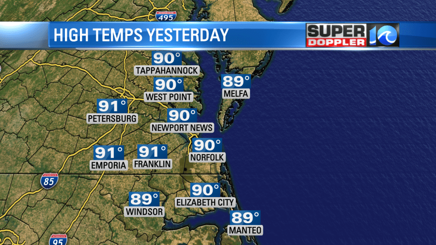
Yesterday was still pretty nice out, but temperatures did tick up a bit from the day before. High temps were near 90 degrees as expected.
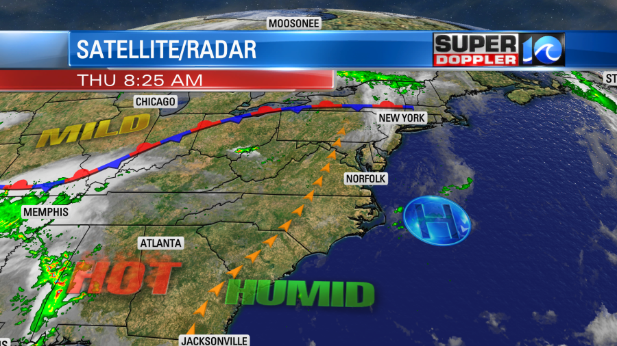
However, it did feel like the mid-upper 90s with the heat index. Today will still look pretty good, but the temps and humidity will rise some more. High pressure is just offshore.
This is allowing for more of a persistent southwest wind (8-12mph) to blow today. In-turn that will help to push our high temperatures up into the mid 90s this afternoon.
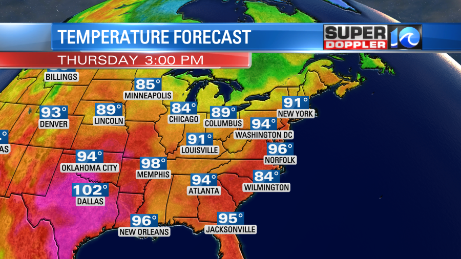
The temps will really only be a few degrees above average. However, the heat index will be tough. It will be up to around 100 degrees this afternoon.
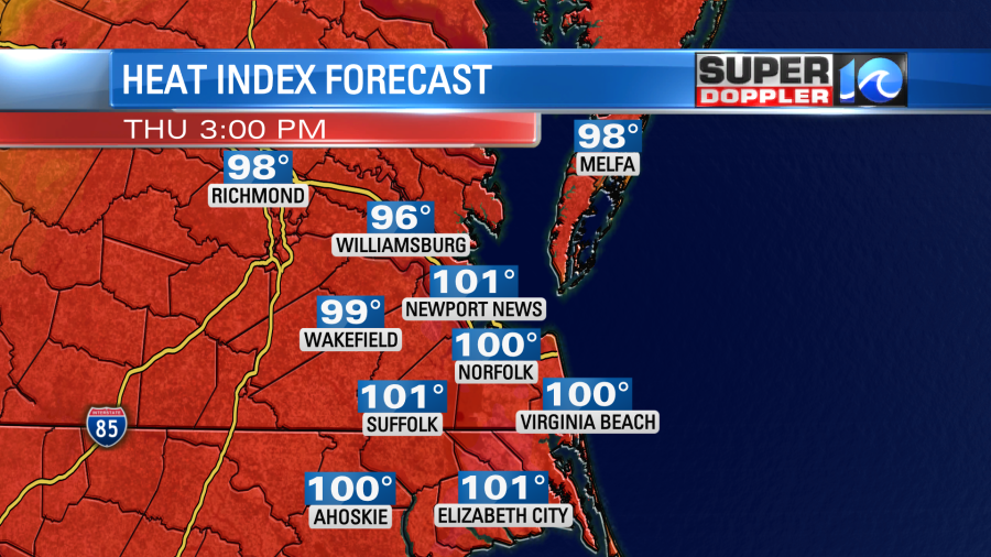
This is below Heat Advisory criteria. We’ll be mostly sunny through midday. Then we’ll be partly cloudy. With the high heat and humidity we may pop up some isolated showers or storms this afternoon, but the chance is low.
However, tomorrow the chance for rain will go up. A batch of showers and storms will move in late tonight into tomorrow morning, but it will weaken as it does. This could bring us a few showers during the morning commute.
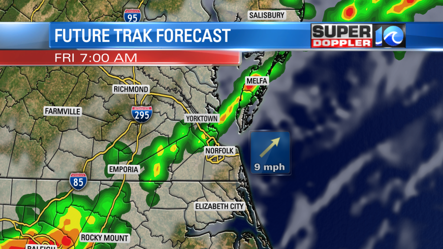
Those showers will probably die out during the mid-late morning. However, the leftover boundary from those showers will likely be out there during the afternoon. So as we heat up through the day some scattered storms will form along that boundary.
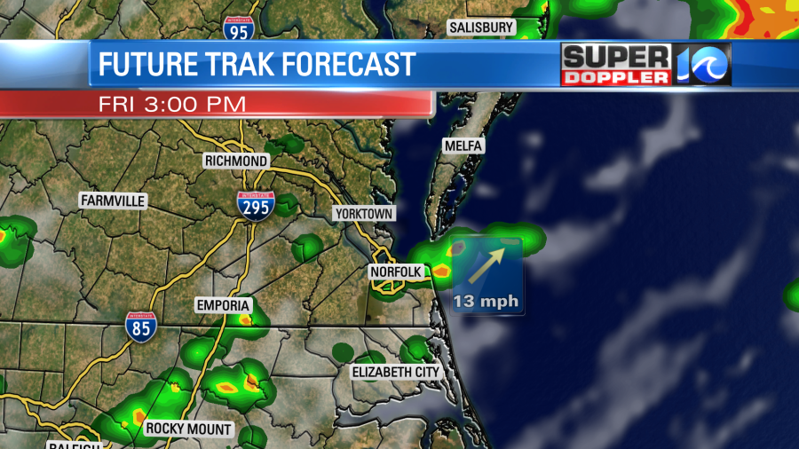
The exact details are not set for tomorrow’s storms, but the theme is there. A few showers in the morning. Then scattered showers and storms will develop in the afternoon. The timing could be as early as the early afternoon. Some models have them as late as the early evening. There could be some heavy downpours and brief gusty winds. Skies will be partly to mostly cloudy through the day.
With the extra clouds and the higher rain chances it looks like the temperatures will come down a bit. So high temps will aim more for around 90 degrees.
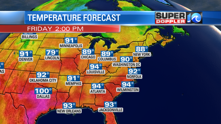
Keep in mind that the heat index will still be in the mid-upper 90s.
We’ll be partly cloudy with some scattered PM showers and storms over the weekend. High temps will be in the low 90s. The typical mid-Summer mugginess will continue. The heat may continue into next week, but the chance for rain looks like it will drop.
There hasn’t been much of an update to the weak feature in the middle of the Atlantic. It still has a medium chance of formation as it rolls east.
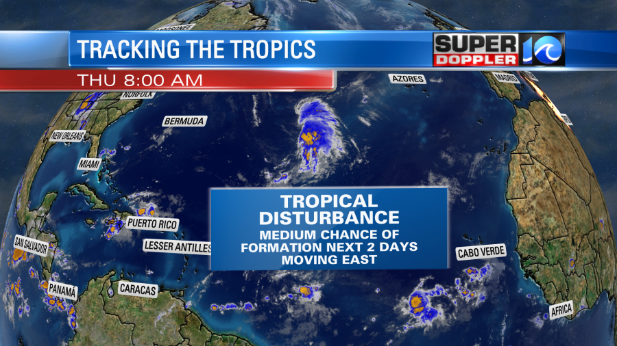
Whether it forms or not, it is expected to stay out to sea.
Yesterday there was a tornado near O’hare airport in Chicago. This caused quite a stir, and tornadoes are pretty rare up that way. Several tornadoes caused damage to some homes and buildings in that area.
On a final note…I talked about the water temperatures near southern Florida in the low 90s the other day. This was rare if not unprecedented. Well…Yesterday a water temp was recorded in the upper 90s down there. Wow! This is off the charts. Here is the article with more information: Extreme water temps near south Florida.
This could be a huge problem form the marine life down there including the coral reefs.
Meteorologist: Jeremy Wheeler