The storms took their time, but they did finally arrive last night.
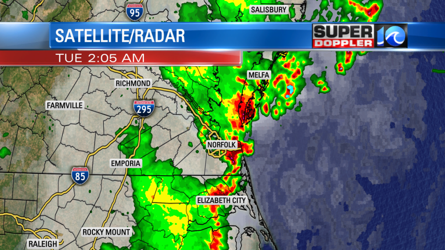
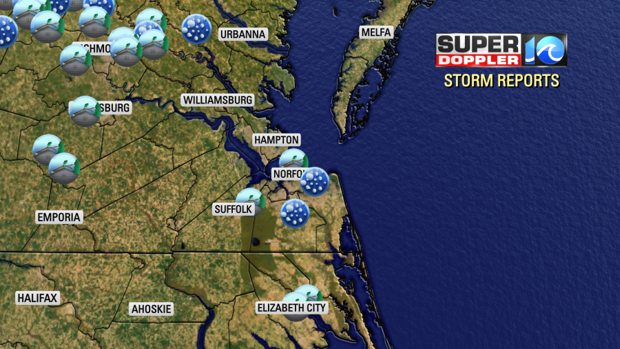
Storms were slow-moving to our west in the early evening, but they picked up some speed between midnight and 2 a.m. The sudden rush of wind created a lot of strong wind reports (blue dots) where winds gusted between 40 and 60mph.
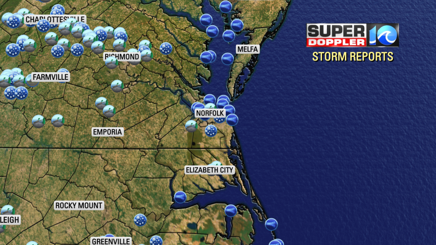
There were a few damage reports. There was a report of a tree on a home in Norfolk and in Elizabeth City.
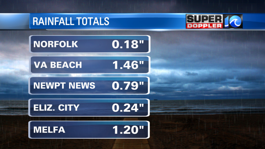
Rain was heavy in many areas, but it lasted much longer in a few spots. So amounts varied greatly.
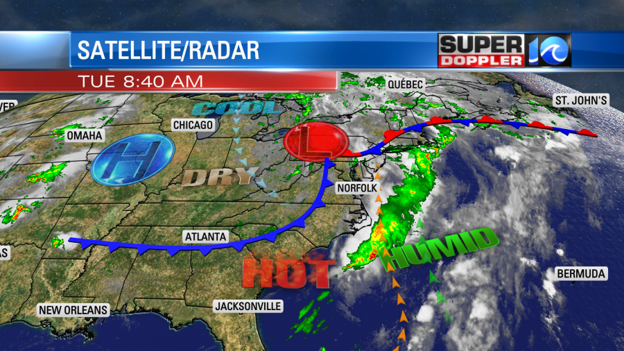
This was not from a cold front moving through the region. That boundary is still to our west. The strong storms were mainly from an upper level shot of energy along with a good amount of instability. We will still be in the warm zone today with the front very slowly approaching from the west.
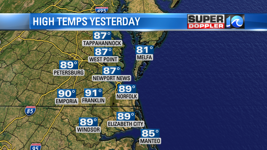
We never did make it to the low 90s in Norfolk yesterday. A bank of clouds moved over us around midday, and that kept high temps there in the upper 80s. It was sooo close!
We are approaching the latest 1st 90 degree reading on record. It was in early July in the year 1972.
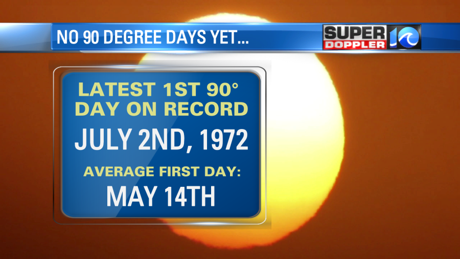
I don’t think we’ll get to that today, but we will heat up to the upper 80s.
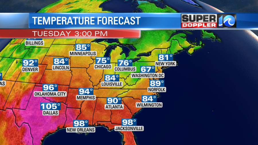
Either way it will feel like the low 90s with the heat index. Stay hydrated if you are working outdoors. Kids at camp should as well. We’ll be partly cloudy for a long stretch. Then some scattered showers and storms will fire up later today.
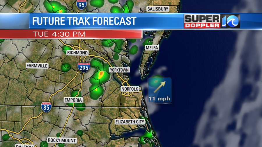
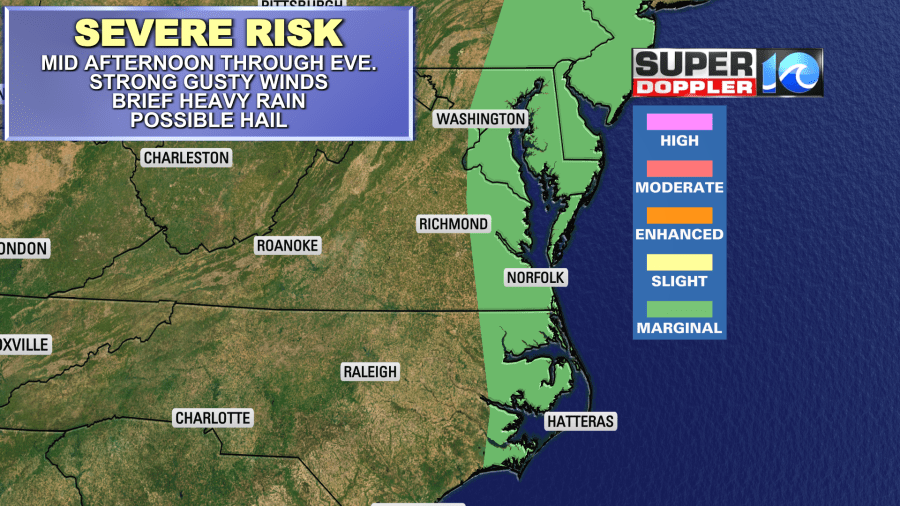
We’ll have a steady south/southwest wind at 10-15mph. There may be a few storms this evening, but they will not be late like last night. This is because the front should move through in the later evening. Some storms could be strong to severe.
Tomorrow we’ll a little cooler and drier. High temps will drop to the low-mid 80s with partly cloudy skies. Dew points will drop from near 70 today to the low 60s. Maybe even upper 50s. It should be pretty nice out. We’ll have similar weather on Thursday with highs in the mid 80s. then we’ll heat up to near 90 on Friday.
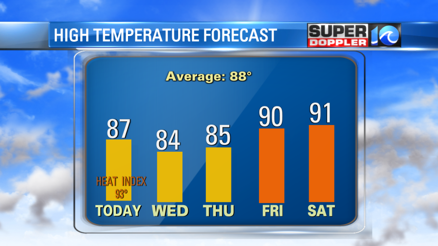
I doubt we’ll see much rain between Wednesday and Friday. There may be an isolated shower. Isolated showers or storms are possible on Saturday. Highs temps will probably hit the low 90s. So between Friday and Saturday we have a decent shot at reaching 90 for the first time this year. We’ll see.
In the tropics the National Hurricane Center is still talking about the possibility of Cindy reforming in the Atlantic. Now they have it on the Tropical Weather Outlook.
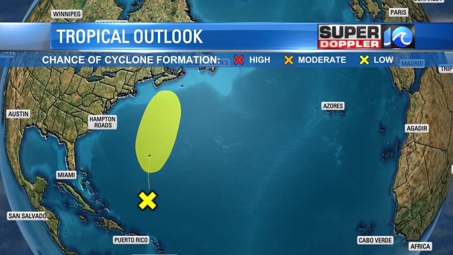
Even if it does form it should stay weak. It could possibly impact parts of Nova Scotia. It shouldn’t have any impact on us.
Meteorologist: Jeremy Wheeler