Yesterday, was definitely warm and humid. The breeziness helped out, but that same wind pushed the temps up into the upper 80s in the afternoon. There was some fuel for thunderstorms, but they only formed in certain areas between the afternoon and evening. We had a big group in Virginia Beach, eastern Chesapeake, and North Carolina during the afternoon.
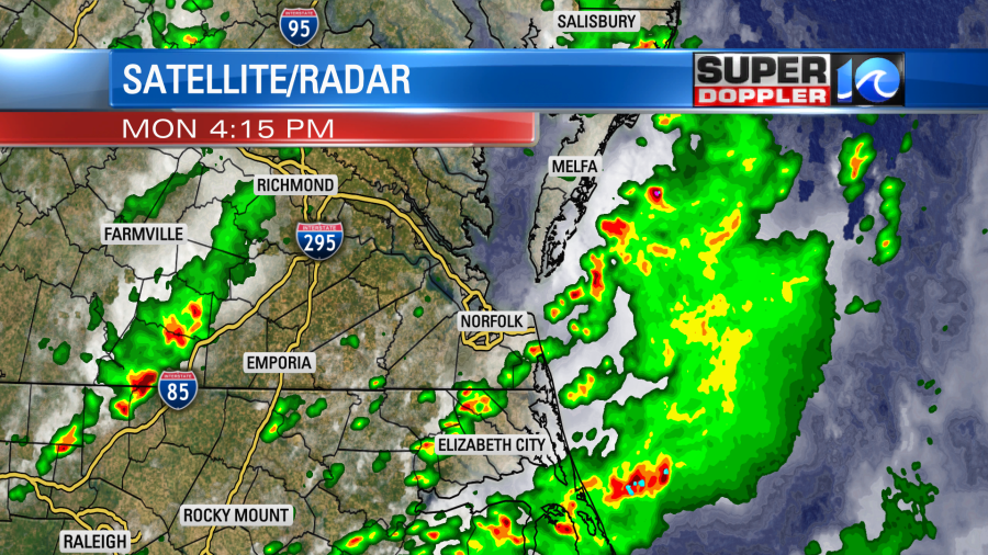
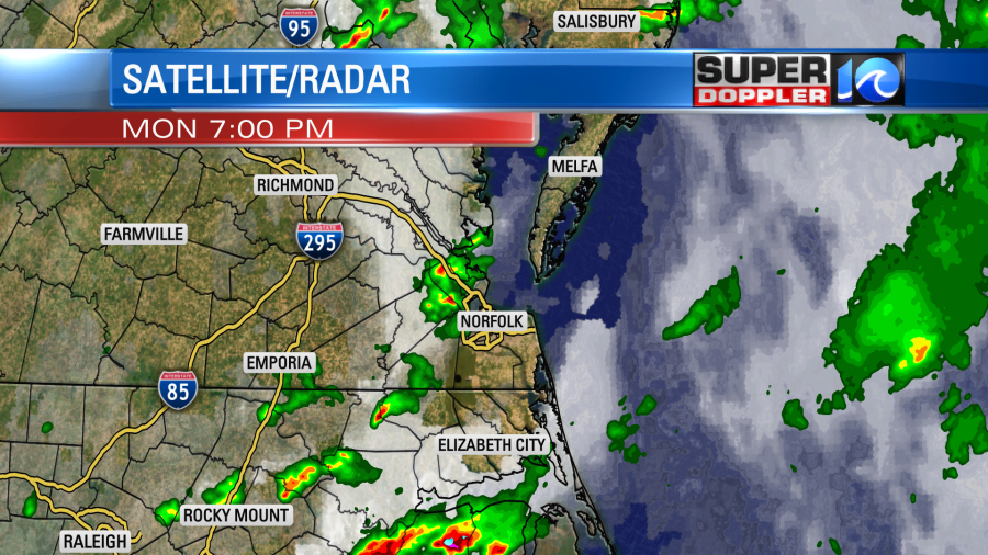
Then last night a big line of showers and storms moved towards us, but it weakened and decreased instead of firing up.
There was plenty of instability, but there wasn’t much wind shear (increase in wind speed with height). So I think that’s why the storms were limited to certain areas. This was all ahead of a cool front. A warm front had traveled far to our north, and that put us in the warm zone. Today that cool front has sunk to our south.
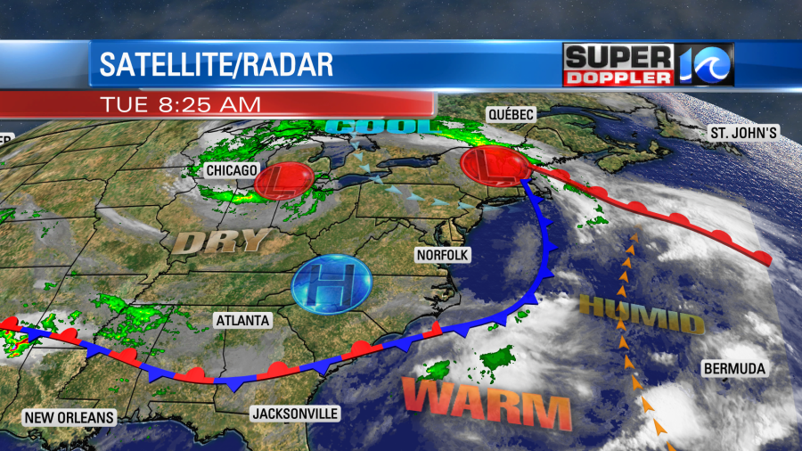
The front will stall out for a brief time today. Most of the region will stay dry with partly sunny skies. However, as the front stalls there may be some isolated showers over northeast North Carolina or near the state line. The chance is low. A stray shower may make it to the metro by th evening, but it’s a low chance.
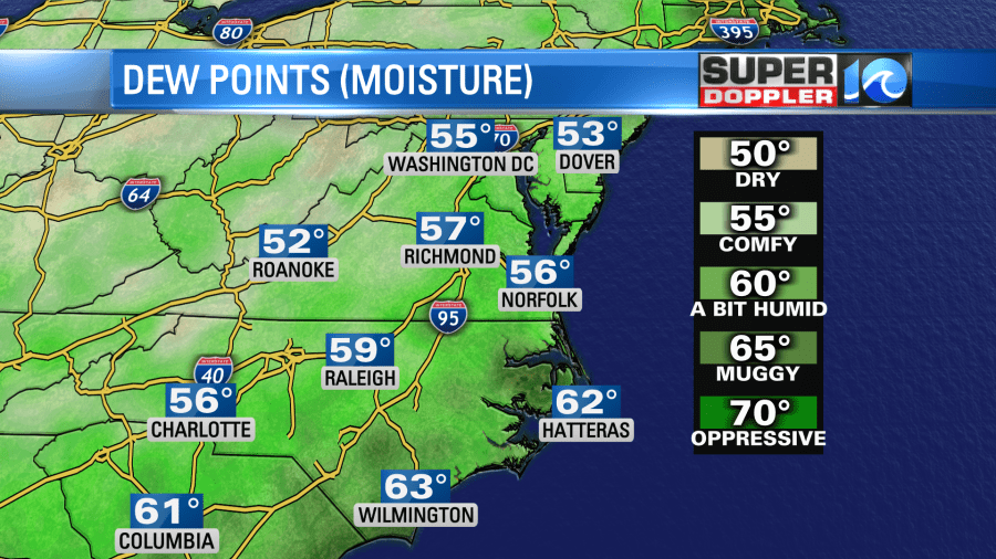
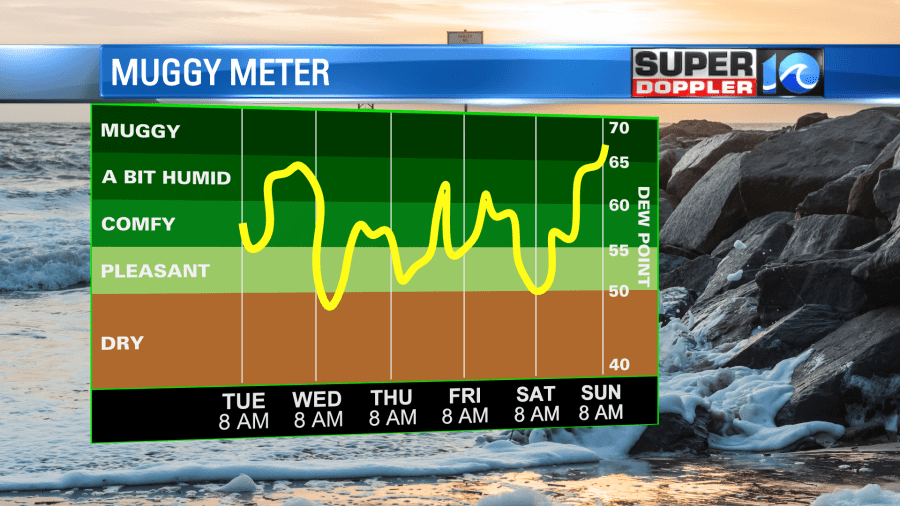
The good news is that our humidity has dropped quite a bit. Dew points were in the low 70s yesterday. Today they are in the upper 50s.
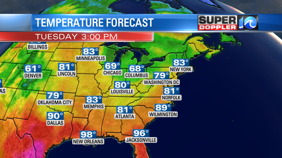
We’ll stay pretty dry through the day with highs in the low 80s.
It should be very nice out! Tomorrow the front will lift back north as a warm front before another cool front moves into the area. So we’ll heat up to the upper 80s as the winds pick up out of the southwest. Humidity will increase as well.
There may be some isolated showers as the cool front approaches tomorrow afternoon. However, most of the day should be partly cloudy. We’ll cool down and dry out again Thursday. Highs will be in the low 80s.
Basically we’ll stay in the 80s into and through the weekend.

There may only be an isolated shower on a day or two through Saturday. The bit of bad news is that there may be some scattered showers moving in late on Sunday. That’s Father’s day. It’s possible that they may hold off until the evening. The timing still could change. So check back for updates. For now Monday looks pretty wet for ceremonies on Juneteenth. I’ll have more on that in tomorrow’s weather blog.
Meteorologist: Jeremy Wheeler