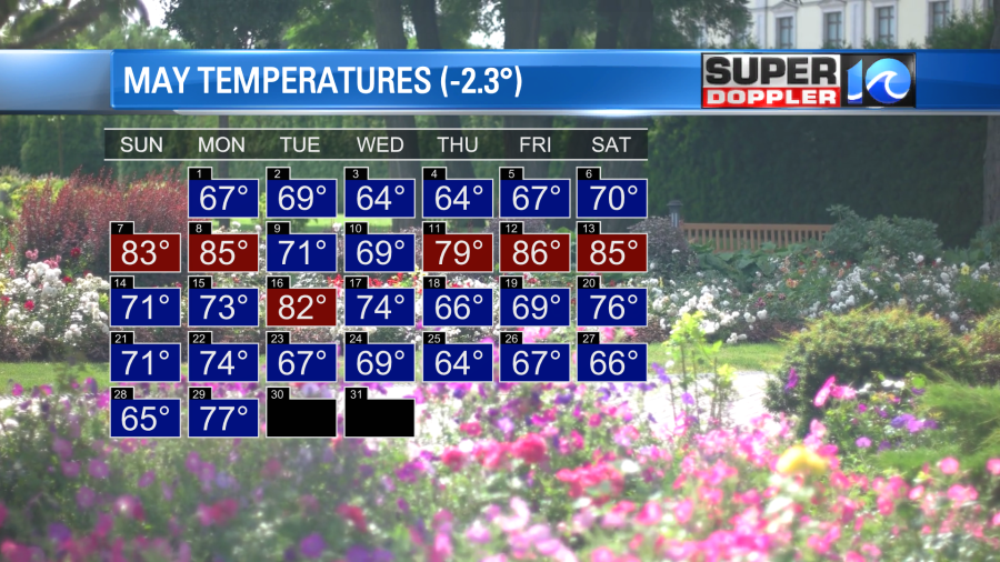
At this point I feel like the Mid-Atlantic area has been getting picked on. We keep talking about cool weather, wet weather, and windy weather. Sooner or later this pattern has to break! Looking back on it we have had a chilly month. We are finishing out the month over a degree and a half below average.
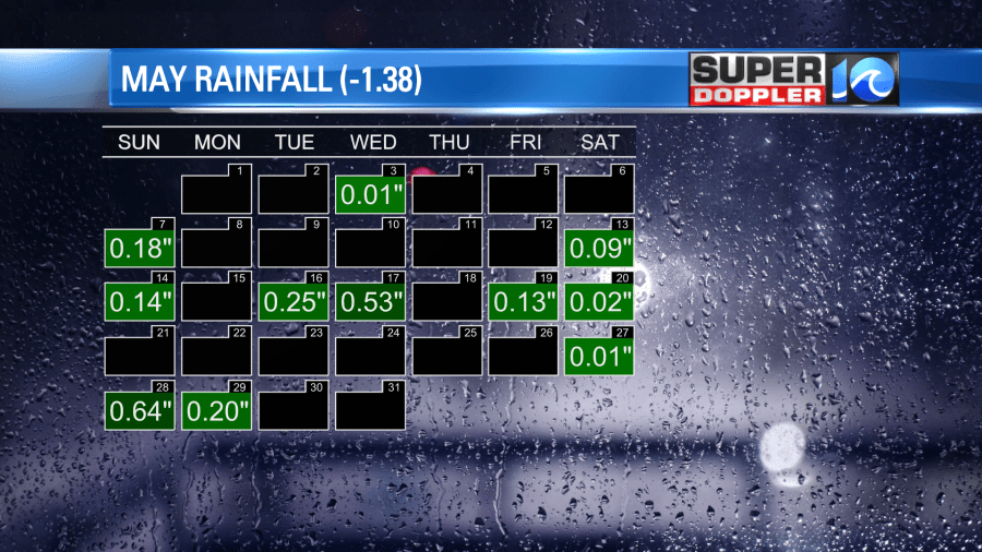
It has been wet for a while as well. However, we haven’t picked up any big amounts of rain on any of the days.
There is a weak area of low pressure that has plagued us for days. It continues to spin over the region today, but it has moved east a bit.
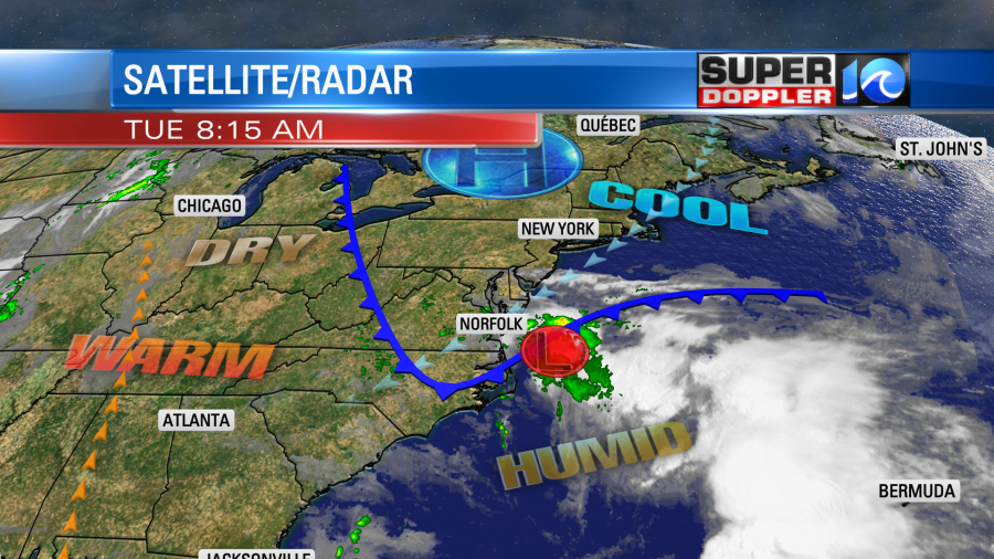
Now a cold front has wrapped around the low, and it is sinking south. So after a break from the strong breeze yesterday, today we will have a northeast wind running at 10-15mph with gusts to 25mph. This is going to put us back in the unseasonably chilly air. High temps are only going to be near 70 this afternoon.
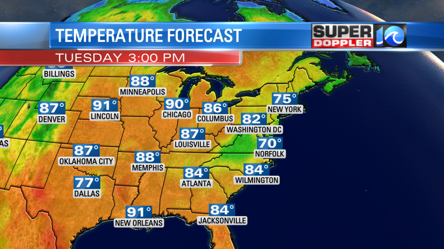
You can see all of the heat over other parts of the country. In fact…when I say that the Mid-Atlantic is getting picked on… I mean it. Take a look at the map for the temperature departure from average for the country:
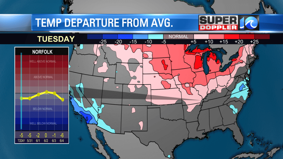
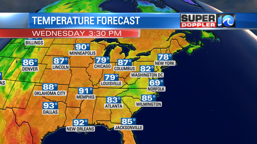
It will be close to 90 today in Minneapolis and Chicago while we are near 70. Wow! California is also cool, but that is a more recent trend.
On top of the cool temps, we are going to have lots of clouds today with scattered rain showers at times. We had a big slug of rain come in this morning from the oceanfront.
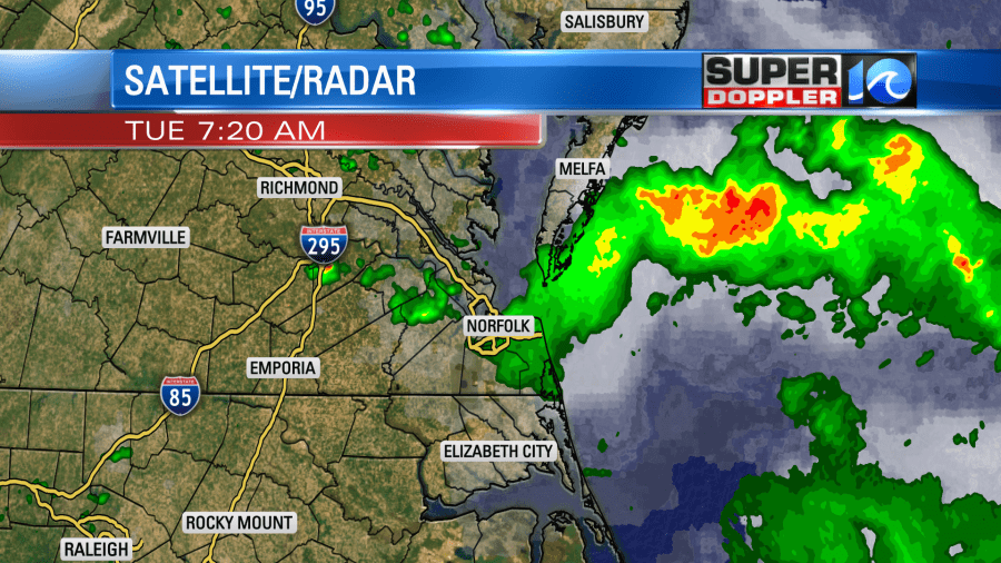
There was widespread fog and drizzle. It wasn’t a great way to head back to work after the holiday weekend. Through the day we’ll have some on and off scattered rain showers.
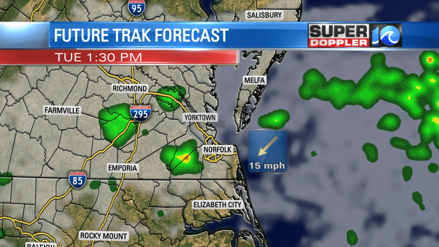
A few showers will continue tonight with some more fog and drizzle. Then tomorrow the low will drift a bit more out to sea, but it will basically linger offshore. An upper level low will also be sitting overhead.
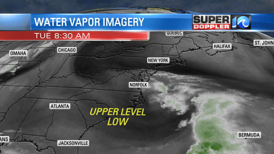
So we’ll have very similar weather to today. There will still be a cool northeast breeze. High temps will again be near 70 degrees.
There will be more scattered rain showers.
By Thursday the low will move farther offshore. We’ll have more sun and less rain. That low may meander around the Atlantic for a bit, but at least now the models have it farther offshore Thursday into Saturday. So I have partly cloudy skies with only a low chance for a shower Friday and Saturday. Highs will be in the mid-upper 70s. However, a cold front will drop south Saturday night, and that will cool us back down to near 70 on Sunday.
The details may change a bit for the weekend before we get there. So check back for updates on that.
I will say that the GFS model is finally showing some heat moving in in a couple of weeks. We are talking the second week of June. That is way too far out for any good forecast, but it is a promising sign.
Meteorologist: Jeremy Wheeler


