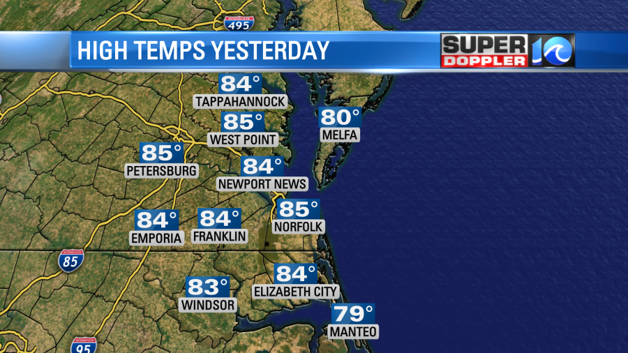
Well….. It’s happening. Just as I had foretold….It is happening. We went from Summer the last few days to late Winter weather within a 12 hour period.
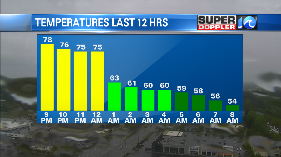
A strong cold front moved in last night. There were some scattered showers and storms just ahead of the front in the late evening.
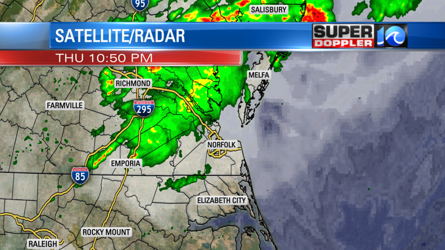
That batch of rain broke up as it moved to the southeast. However, a band of showers started to form this morning as the cold front sank more to the south.
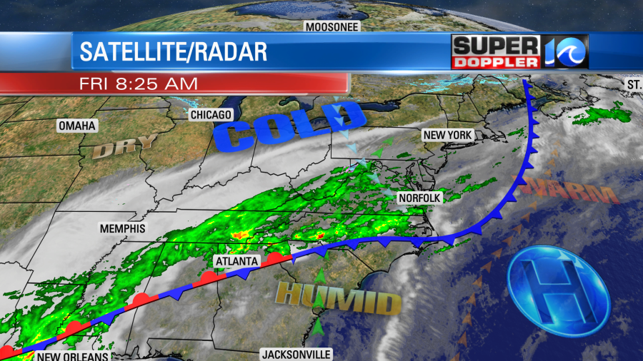
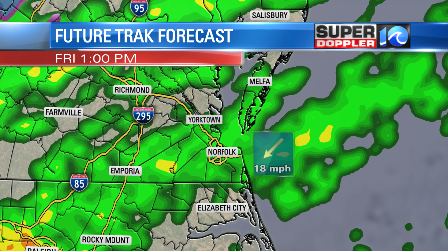
The band was local, but it actually started up around Louisiana and stretched all the way up in to our region. This is due to what we call overunning. The warm/humid air mass is pushing up north over the cooler air mass in place. This promotes condensation to the point that precipitation forms and falls in a steady band or rain shield. Today we will have on and off rain showers. They should be mostly light, but it might become moderate in some places.
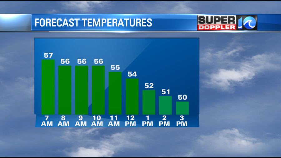
Winds will stay up out of the northeast at 10-15mph with gusts to 25mph. Therefore, all our temps will start in the mid 50s, but we’ll drop to the low 50s or near 50 by the afternoon.
Rain showers will continue overnight. Lows temps will drop to the 40s. Then tomorrow we’ll have the same pattern. The overunning precip will cover a large area at times.


The highest chance for rain will be over the Southside and northeast North Carolina. The lower chances will be north of the metro. Rain showers will continue on and off through Saturday night. High temps will only be in the low 50s tomorrow.

Winds will be out of the northeast gusting up to 25mph. Some of the gusts could be over 35mph between southern Virginia Beach and the Outer Banks. There may be some ocean overwash down there as well.
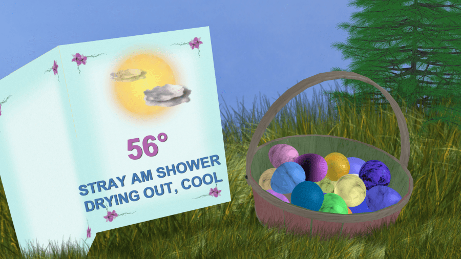
Now for some good news….There is more confidence in the Sunday forecast. We should start to dry up as the front sinks a little more to our south. After a stray shower early in the morning we should dry out through the day. High temps will still only be in the 50s. Then we’ll have some nice weather for most of next week. Temps will steadily warm up with lots of sunshine. This is good news for the kids on Spring Break. Now we just need it to continue into next weekend. We’ll see.
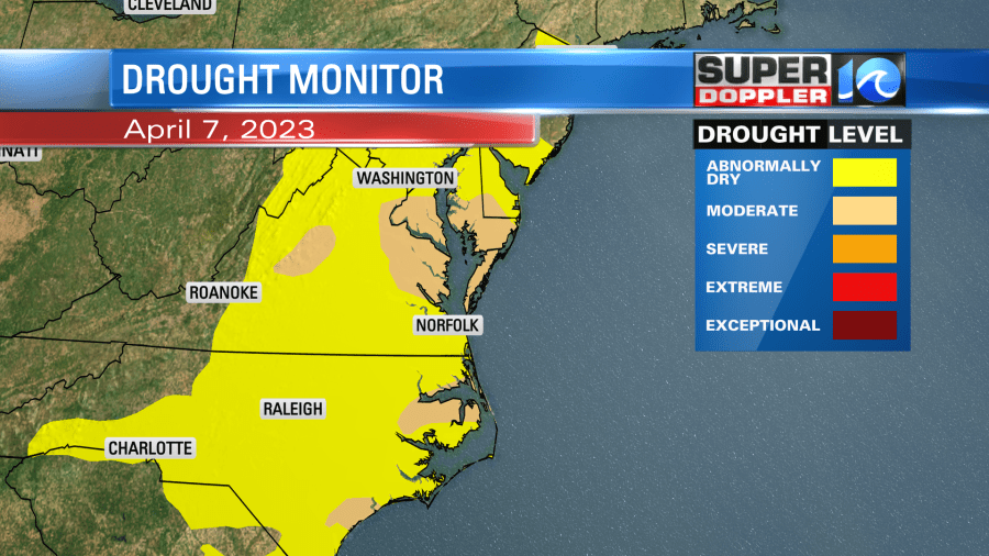
I’ve mentioned many times that we need a good/soaking rain. The update for the U.S. Drought Monitor came out yesterday. A larger portion of the region is now in a moderate drought (Level 2 out of 5).
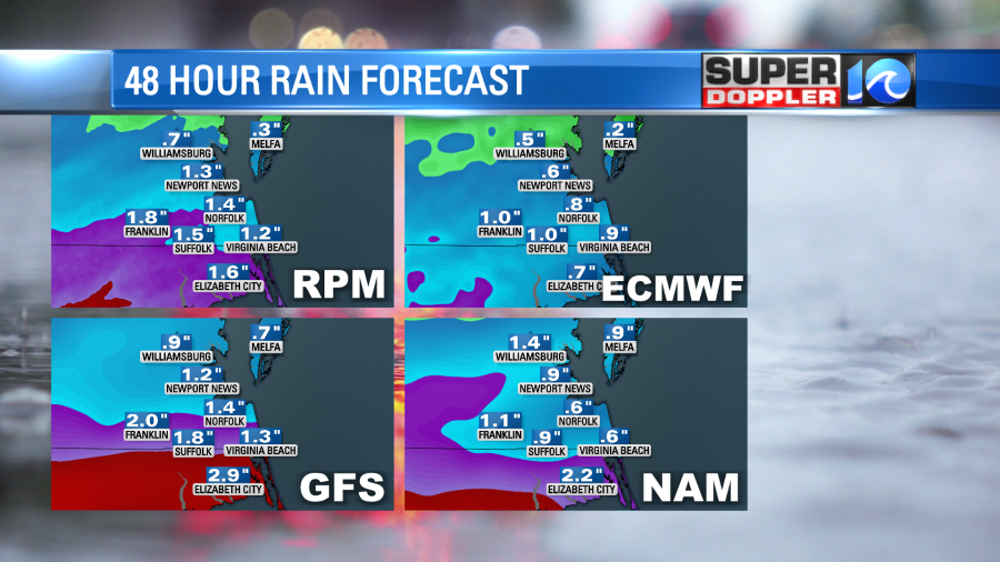
Luckily we are going to have a long stretch of a soaking rain this time. We will likely pick up an inch to an inch and a half of rainfall over much of the area. Some spots could get 2 inches.
As I mentioned, it should dry up by the time for the Eastern egg hunts Sunday morning.
Keep in mind that the showers will probably linger longer over the Outer Banks on Sunday. Stay tuned for updates over the weekend.
Meteorologist: Jeremy Wheeler