Temps are going to swing wildly over the next 36 hours. Today will be unseasonably hot and humid. High temperatures will be in low 90s this afternoon. This is about 10 degrees above average. However, it will likely be shy of the record of 98 degrees (1983). Still…the heat index will make it feel like the mid 90s to near 100 this afternoon. Don’t expect rain to cool you down today. There will be some isolated showers and storms this afternoon, but the chance for rain is only 20%. We have high pressure to the south with a very slow moving cold front to the north.
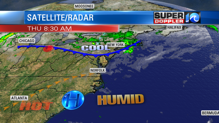
The front will move in tonight. As it comes in from the north, it will bring us scattered showers and storms. Some of the storms could be on the strong side. Possibly severe. Strong gusty winds will be the main threat.
Tomorrow will be a world of difference. The front will eventually stall out to our south, but we will definitely be on the cool side of the boundary.
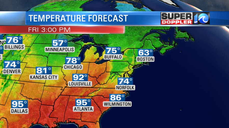
Highs will only rise to the mid 70s with some upper 70s south. That will feel great, but the trade-off is that we’ll have lots of clouds with passing showers. We likely will not have any thunderstorms. Instead these will be occasional light showers and pockets of drizzle. The breeze will be out of the northeast at 10-15mph with gusts up to 20mph. While there will be some sprinkles and a few showers for Friday night football, I think many won’t mind too much since it will be much cooler out.
Temps will rise a little on Saturday, but not too much. Highs will be in the low 80s. We’ll have a mix of sun and clouds with a few showers possible. We’ll have more sunshine on Sunday. Temps will rise back up to the upper 80s. We may see some isolated showers, but not much. Temps will be up-and-down again going into early next week.
We are carefully watching the tropics. There are two tropical disturbances in the Atlantic Basin. One is still weak. One is fairly potent already. The weaker one in the eastern Atlantic is moving generally west, but for now it has a low chance of formation in the next few days.
The other disturbance has a high chance of formation in the next couple of days. In fact, it could already be the next Potential Tropical Cyclone by the time you read this.
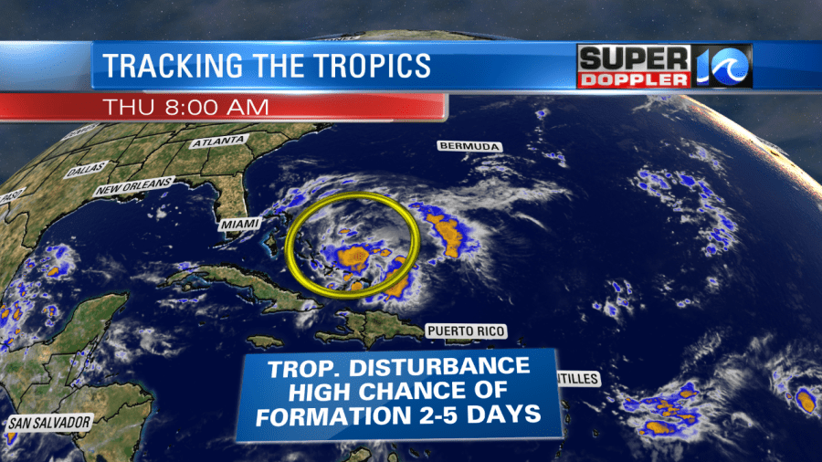
Yesterday, the models were mostly lining this up to go into the Gulf of Mexico. Now the models are more split. The European model did a complete turnaround last night. The overnight run sent it up to the north (off the coast). However, by later next week it brought it back west into the Northeast States. That track would be similar to hurricane Sandy in 2012. But now the same model takes it north of the Bahamas and then kills it off. That’s not frustrating (heavy sarcasm). Anyway, it’s still early, and the GFS still keeps it going towards the Gulf. Either way we’ll watch it closely over the next couple of days. Stay tuned for updates.
Meteorologist: Jeremy wheeler


