It’s official….Yesterday, we broke several high temperature records in the region. We ended up in the low 80s over the area with the exception of the Eastern Shore. We hit the mid 80s around Elizabeth City.
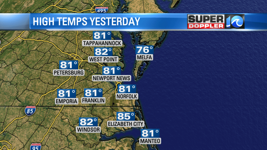
Norfolk ended up at 81 degrees which beat the old record of 79 (1975). Elizabeth city crushed its old record of 77 (1975). It hit 85 down there. Wow! This even beat the all-time record high of 82 degrees.
Today we will transition from the early Summer-like weather to some more seasonable conditions. There was a cold front to our west, but it is now starting to move into the are.

The front will move to our south by midday. This will drop the temperatures later today. We started off with fair skies and temps in the 60s this morning.
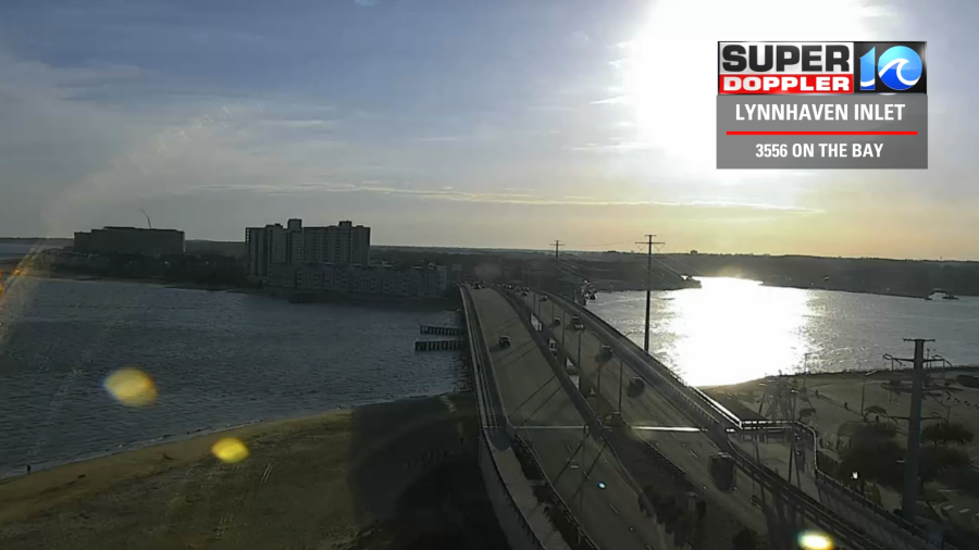
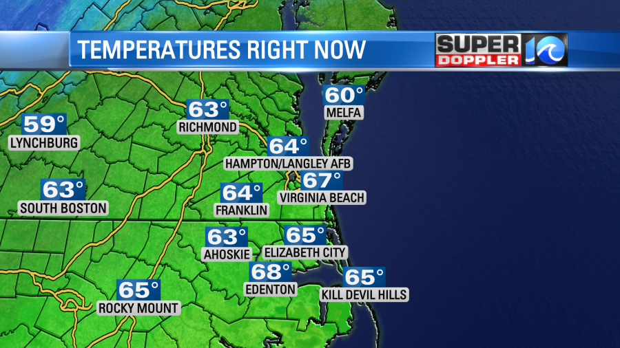
As we go through the day temps will fall to the low-mid 50s.

Clouds will increase a bit between the midday and the afternoon. However, I don’t expect much rain. There may be a couple of stray showers, but that should be about it. Winds will go from out of the west/northwest to northerly. There will some gusts to 20mph.
Tomorrow it will be a different world. The front will stall out to our south. There will be a weak area of low pressure forming along the front. It will move to near Hatteras during the day. Moisture will push north of the front. So we’ll have lots of clouds in the area through the day. Plus, there will be scattered rain showers through the day. It may start as a brief wintry mix north of the metro, but the models have backed off of that quite a bit since yesterday. (That’s no surprise). Our future Trak model also has temps in the 40s in the morning with some upper 30s north.

Temperatures will be stuck in the 40s through the day. We’ll have scattered on-and-off rain showers through the day, but it probably won’t be a total washout.
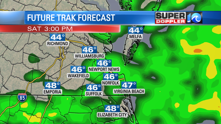
We’ll probably pick up about a quarter to a half an inch of rain.
There will be a steady north breeze tomorrow at about 8-12mph. I have to say that it will be a pretty nasty day outside. However….Sunday looks to redeem the weekend. The low will kick out to sea. The front will sink to the south, but it will weaken. Plus, we’ll have partly cloudy skies and dry air. High temps will rise to the upper 50s to near 60. It should be a nice day!
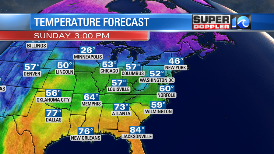
We’ll be mild most of next week with high temps in the 60s most days. We’ll have a few showers late Monday into Tuesday. The timing of that could change. So stay tuned!
There are some interesting (not necessarily good) things happening in other parts of the country. I looked up a few things about the cherry blossoms in the D.C. area. The festival up there is a big annual event. It’s no surprise that the trees are already budding. At this point they are way ahead of schedule. Here is the article with more information: Cherry blossoms early in D.C.
In another part of the country… They recently had blizzard warnings for areas around Los Angeles, California. Now they are dealing with strong winds and flooding in that whole region. This flooding could be pretty bad, but in the long-term it will help out with the terrible drought that has plagued the area for years. Here is an article with more information: Blizzards and flooding in southern California.
Finally, the snow in Minnesota has been historic for some. It has caused numerous problems up in the north/central U.S. Here is an article with some of the impressive snow totals so far. Snow in Minnesota.
Meteorologist: Jeremy Wheeler


