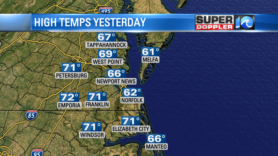
The weather was nice out yesterday. High temps made it into the 60s as expected. There were a few 70s inland.
I was in a T’shirt doing some work in the yard, and I was pretty comfortable. Today we are also going to be unseasonably warm. We have a stationary front that is turning into a warm front, and it is moving north.

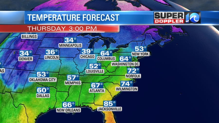
Also high pressure is to the northeast. We will have a south wind picking up today. It will run at 10-15mph with a few gusts to 20mph. We’ll have a mix of sun and clouds. This will allow temps to rise to the upper 60s to low 70s this afternoon.
There may be enough moisture for a stray shower in the region, but the chance is very low.
Tomorrow we’ll have a cold front slowly moving into the area from the west. It will gradually sink south through the day. There will be some scattered rain showers in the early morning as the front arrives.
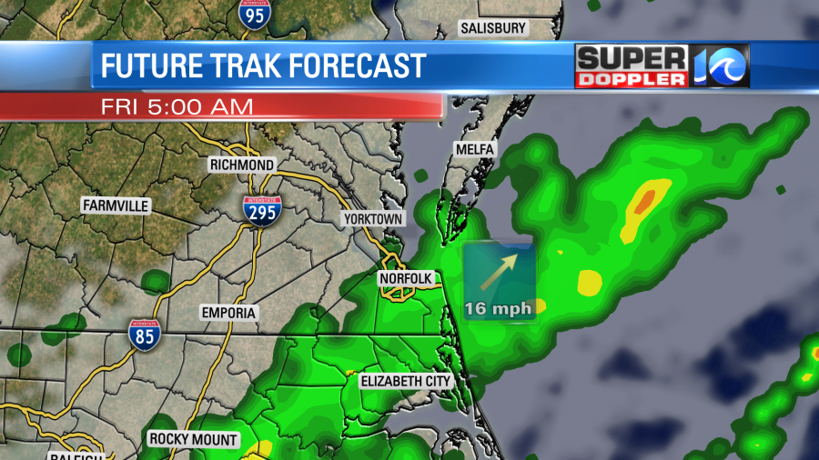
Then there will likely be a lull in the rain for a while. We’ll have quite a bit of clouds with some isolated showers possible through the mid afternoon. There should be a decent stretch of quiet weather though. High temps will be in the 60s. Winds will be mainly out of the northwest. Between the late afternoon and early evening there will be some more scattered showers moving back into the region. This will be as the front stalls out to our south, and an area of low pressure forms along the front.
On Saturday the area of low pressure will form, strengthen, and move slowly northeast.
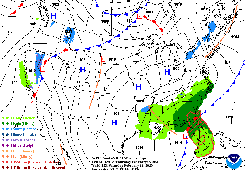
The models have been trending farther south for the low and the front during this time. So they now have most of the rain over North Carolina with very little rain over southeast Virginia.

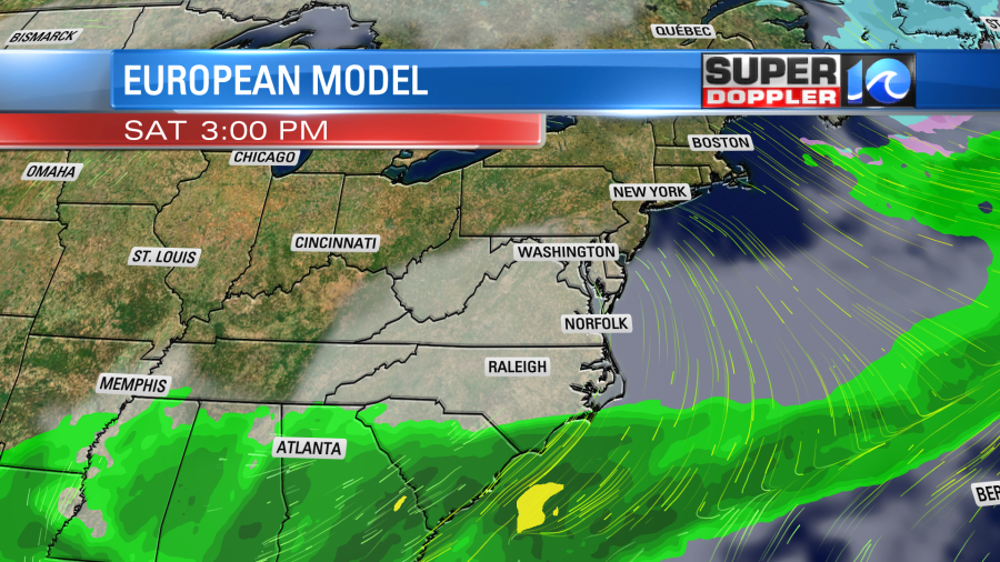
I’m still calling for a handful of showers, but I definitely have the higher chance for rain to our south. The reason I’m a bit cautious is because there will be quite a bit of overunning. In most cases overunning precip moves in (or in this case BACK in) sooner and more north than forecast. So check back for updates if you have outdoor plans. High temps will be much cooler/colder. They will only run in the upper 40s.
By Sunday a potent upper level low will move in from the west. This will move over the surface low, and that will help to strengthen it. The low will move northeast along the coast as it strengthens. So unfortunately, the Sunday weather looks wetter and wetter with each update. Low pressure will be just offshore with the upper level low overhead during the afternoon. There will be a lot of moisture getting shoved west by the system. Winds will pick up out of the northeast.

We are looking at a lot of rain through the day. There could even be a few thunderstorms along the Outer banks. However, I don’t think it will be a washout. I’m hoping that the rain showers will be more scattered by the evening. High temps will be in the 50s.
I mentioned a couple times lately that the weekend forecast seems to keep changing every 6 hours. So we still have time for the forecast to change some more before we hit the weekend.
Meteorologist: Jeremy Wheeler


