So far Dorian has behaved as forecast. Now the storm is moving to the northeast, and away from land.
It is moving to the northeast at about 15 mph.
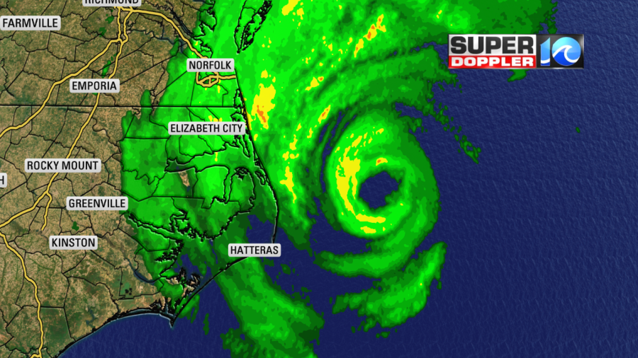
The models and the National Hurricane Center have done a great job of forecasting this storm. This morning, it officially made landfall over Cape Hatteras at 8:35 a.m.
Meteorologist Jeff Edmondson found a wind gust there to 92 mph.
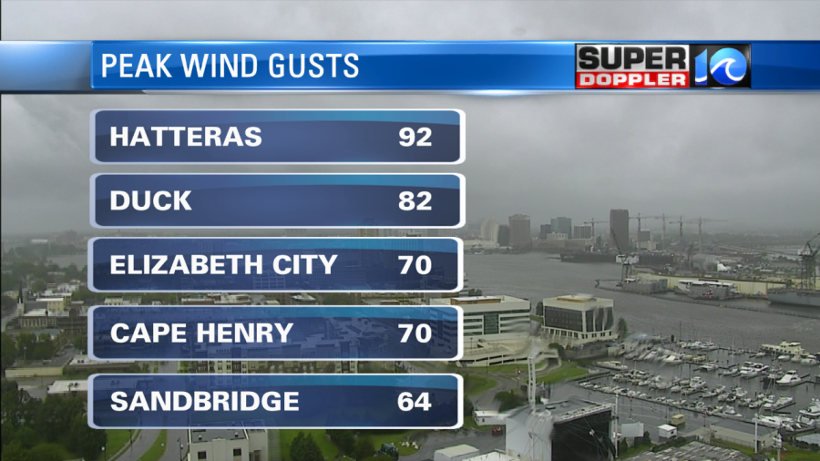
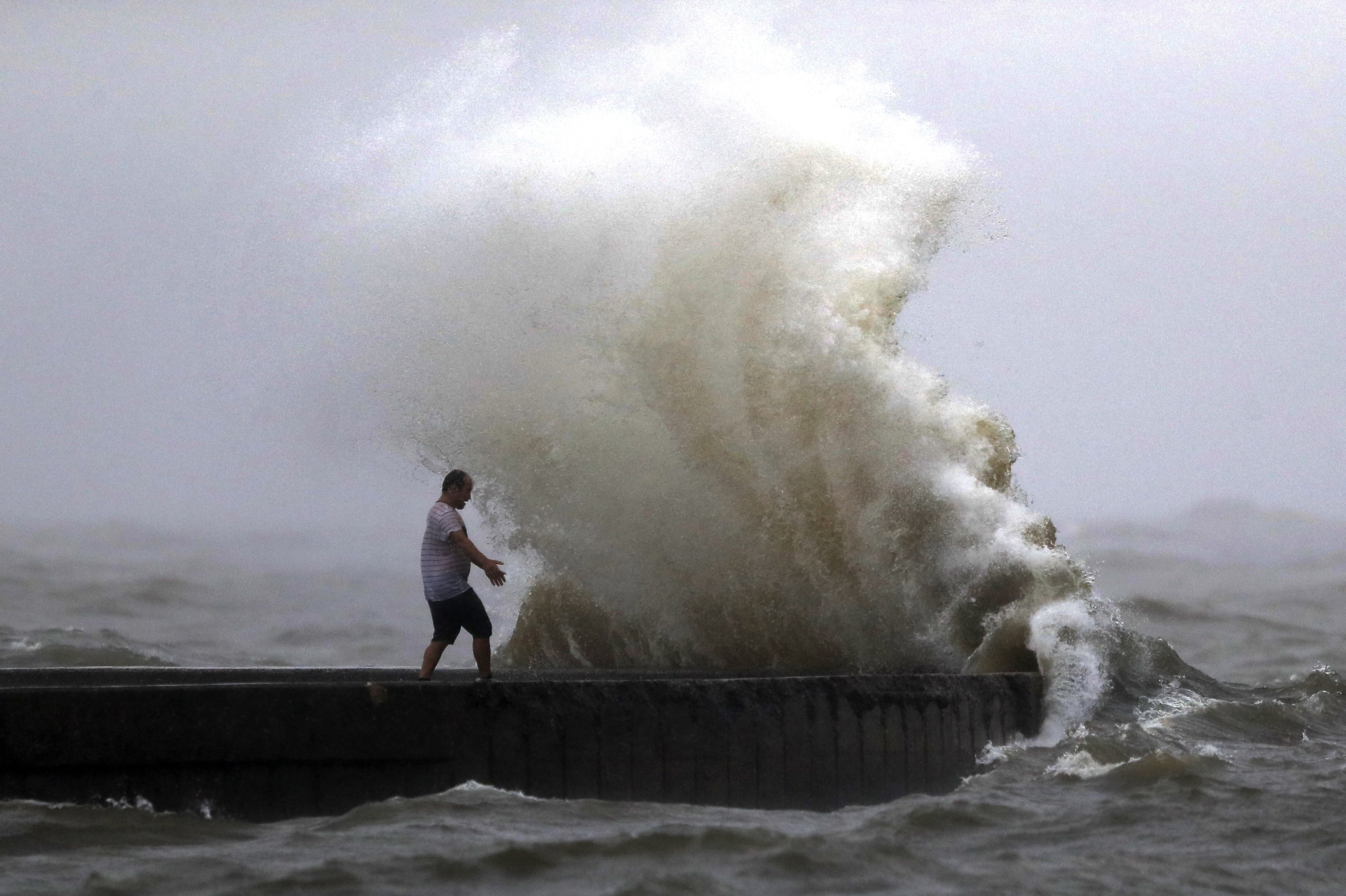
There was also a gust to 70 mph around Elizabeth City this morning. Our reporter Jason Marks used an anemometer to measure the wind in Nags Head. He clocked 86mph around 11 a.m. Gusts in Hampton Roads have been between 45 and 55 mph…so far. The wind did increase behind the storm. If Dorian were purely tropical, then the winds would just keep decreasing. However, a cold front is wrapping into the system. This has allowed the winds to expand.
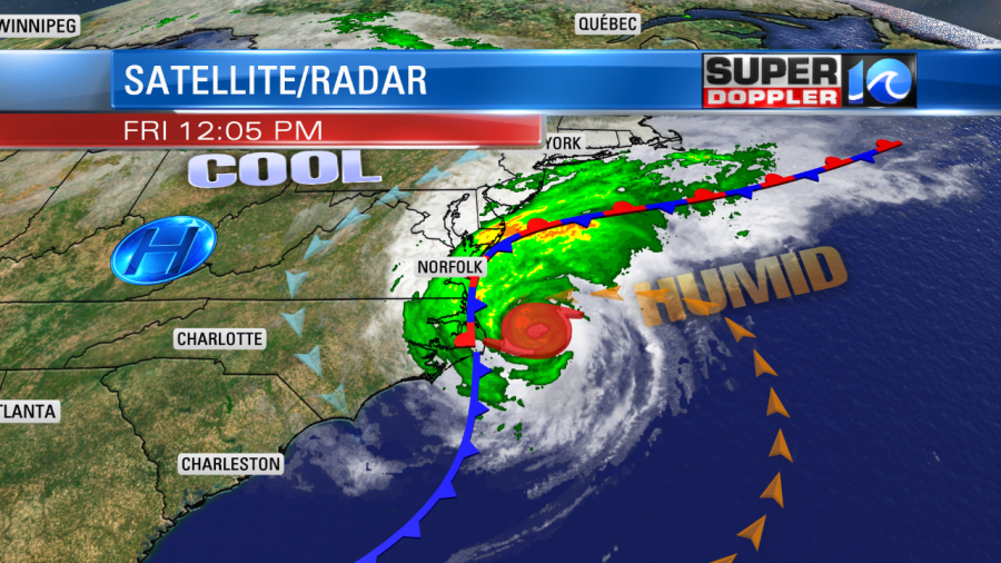
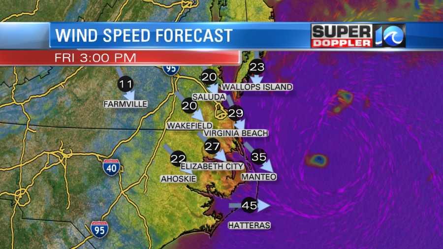
Winds could gust to 60 mph in Hampton Roads with gusts to 60-65 mph near the shore for a little while longer. However, those winds will decrease steadily through the afternoon.
We have been at low tide this morning, but there was some standing water in the low lying areas already. The tide will rise this afternoon. In fact…the tidal forecast has risen to about 7.7ft at Duck, North Carolina this afternoon. The record (we believe during Isabel) was 7.8ft. I’m calling for just a hair under 7.7ft for now.
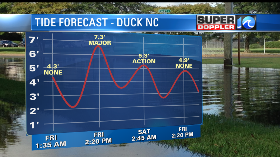
Either way, get ready for the major flooding that was earlier forecast across the Outer Banks. There is some bad flooding over parts of the Sounds already as well.
The tide forecast has not changed too much for Hampton Roads. Here’s the tide forecast for Sewell’s Point.
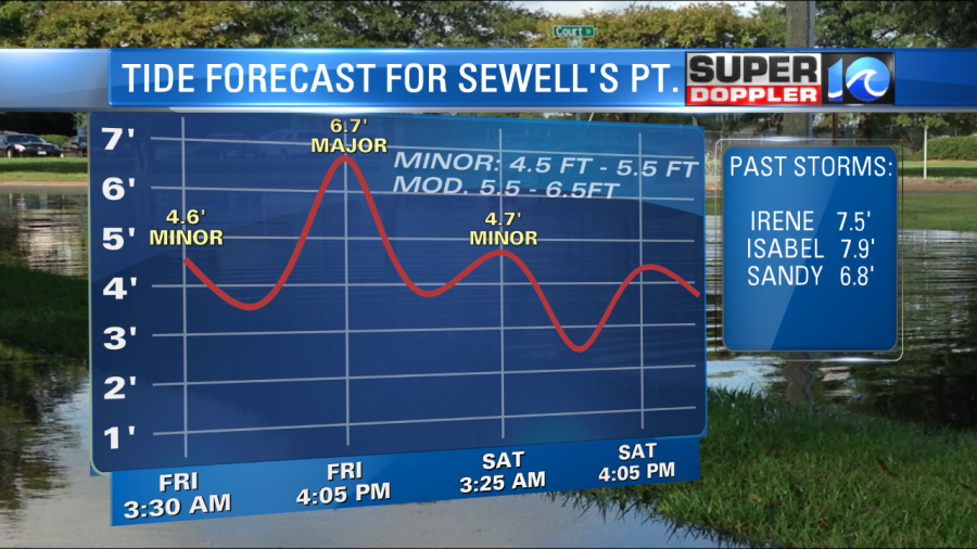
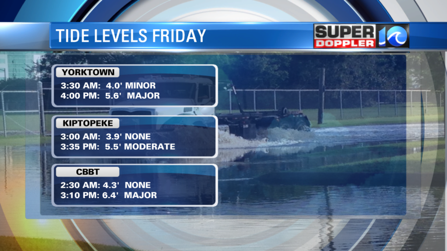
We may bring that down a little before high tide gets here, but only by a bit. So the tide may be close to the levels of Sandy over the lower Chesapeake Bay, but remember…There wasn’t much rain with Sandy. Here are some of the other tide forecsts:
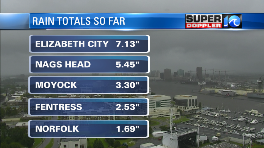
We’ve had significant rain so far, and it’s still coming down.
The edge of the rain is in sight. It will move slowly eastward over the next few hours.
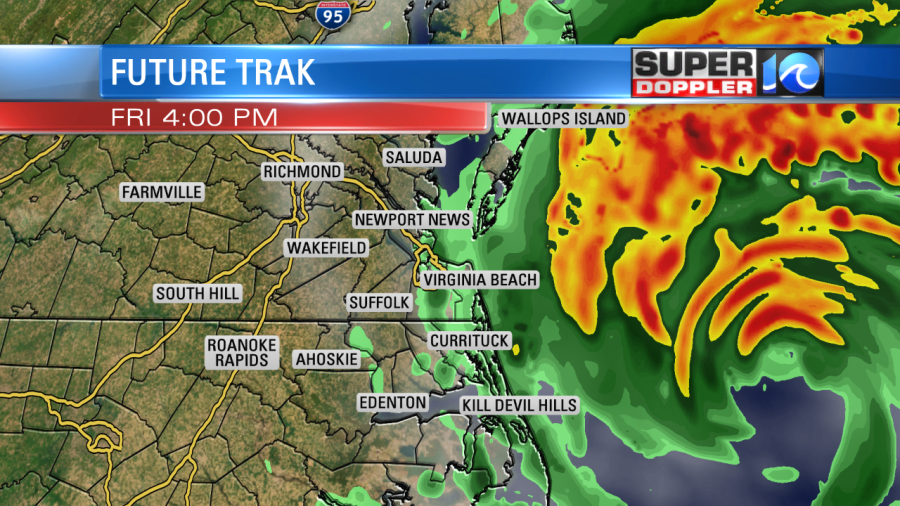
This should all move out by the evening. By tomorrow high pressure will build into the region, and we’ll be looking good. Good weather for cleanups.
Be safe out there, and stay tuned for updates.
Meteorologist: Jeremy Wheeler
