Right off the bat I’ll say that today is going to be a weird weather day. It will be Wintry this morning, and we’ll feel more like early Spring this afternoon. We started off with lots of cloud and a little sunshine.
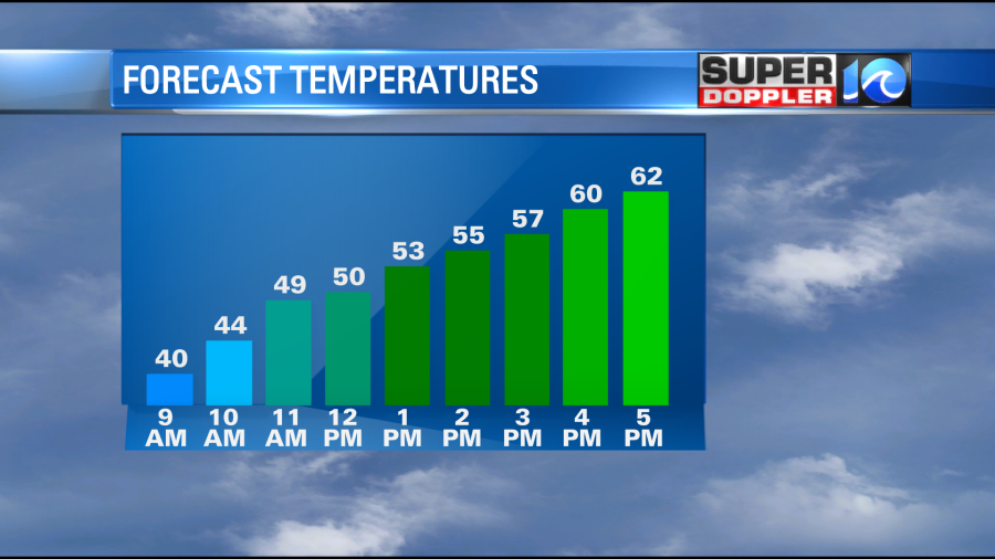
Temperatures bottomed out in the 20s and 30s, and there was some frost on some of the vehicles. However, temps will shoot up fast today. They will rocket to the 50s by midday, and then they will rise to the low 60s by the afternoon.
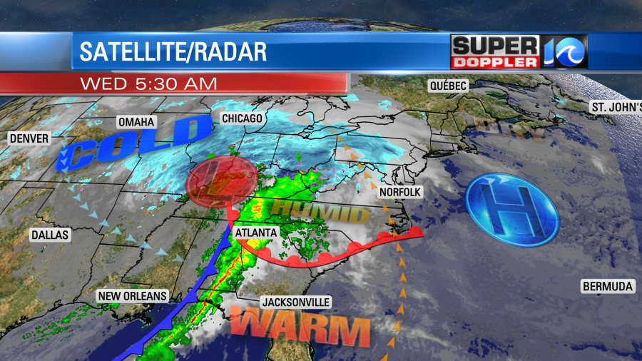
We’ll be in the upper 50s from the Peninsula northward (including the Eastern Shore), but that will still be a big warmup from this morning. A warm front is moving up from the southeast. It was near Hatteras this morning.
Wind will quickly increase out of the southeast, especially as the front comes in. Winds will gust up to 30-35mph out of the southeast during the afternoon.

These strong winds will be even without any thunderstorms. In some of the storms that form winds could gust to over 40mph. So let’s talk about the rain. Some spotty showers will be possible before noon, but the moisture won’t be that high through that time. Then this afternoon rain will become widespread.
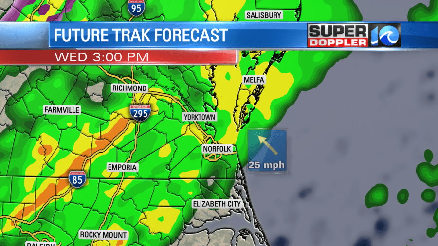
As we warm up this afternoon the air will become fairly unstable. This will allow for some scattered thunderstorms to mix in with the rain. Rain may also be heavy at times as deep/rich moisture funnels into the region. This will likely continue into the early evening, and that could really slow down the evening commute.
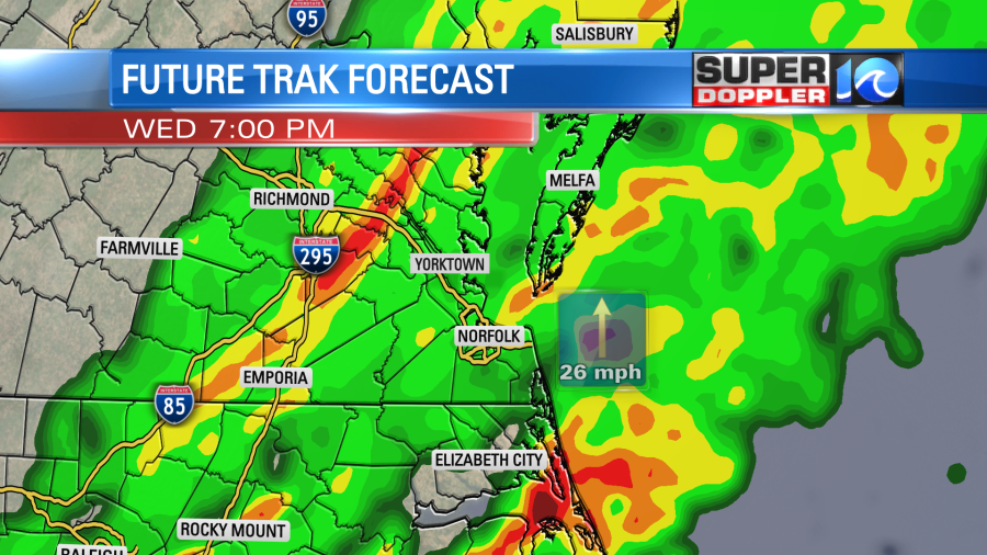
The focus for storms will then drop down to coastal North Carolina going into the 10 and 11 o’clock hours as a cold front sinks to the southeast.

Along with warm and unstable air there will also be some moderate wind shear (increasing wind speed with height). That will allow for possible severe weather. There will also be some broad rotation in the atmosphere. So there is a low potential for a tornado. The higher threat for that will be in the slight risk area which is over northeast North Carolina.
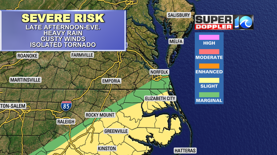
Hampton Roads is on the edge of the marginal risk.
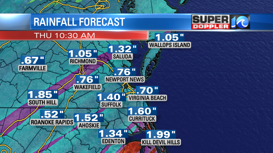
We could pick up about a half an inch up to an inch of rainfall in the next 12 hours. Some isolated locations could see an inch and a half.
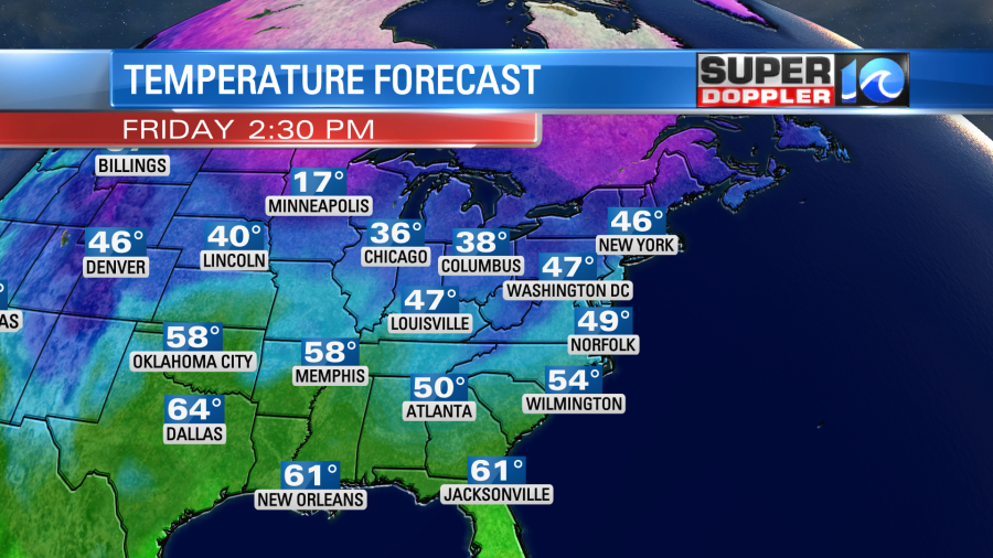
Tomorrow we’ll dry out behind the front. we’ll have a westerly breeze. High temps will be in the 50s. We’ll keep cooling down into Friday. High temps will only be in the upper 40s.
Next weekend the weather finally looks good on both days. High temps will be in the 50s, and we’ll be dry. There may be some isolated showers by Sunday evening, but the day looks dry for now.
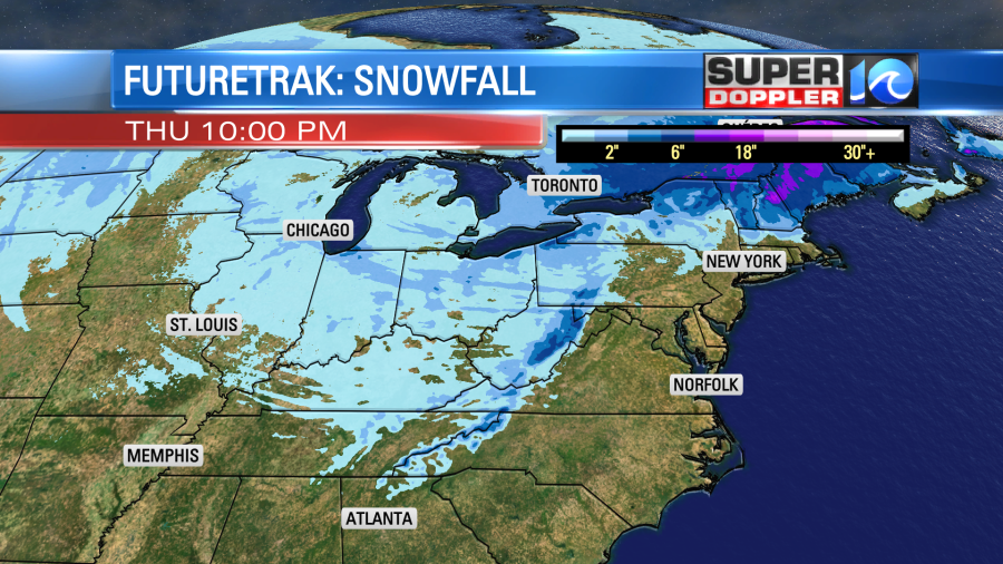
Snow will add up to our north and northwest. Some of the ski resorts could get a few inches.
Meteorologist: Jeremy Wheeler