
9 PM Update:
The models continue to be consistent with the rain moving in a bit overnight, then returning for the late morning Thursday. Here’s the latest from Chief Meteorologist Jeff Edmondson.
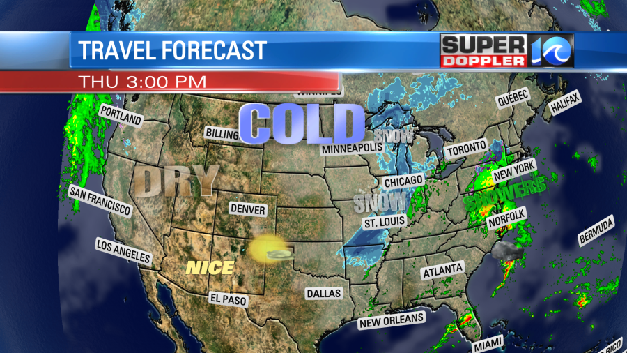
If you have some last minute holiday shopping that you need to do over the next 3 days, then I suggest you try to get it done today. We’ll still have decent weather in region, but the weather is going to be very messy and active going into Thursday, Friday, and the weekend. Today we have an area of high pressure to our north. There is a weak low to the south. It only produced some spotty showers over the southern Outer Banks, and that’s all that should fall in the region today.
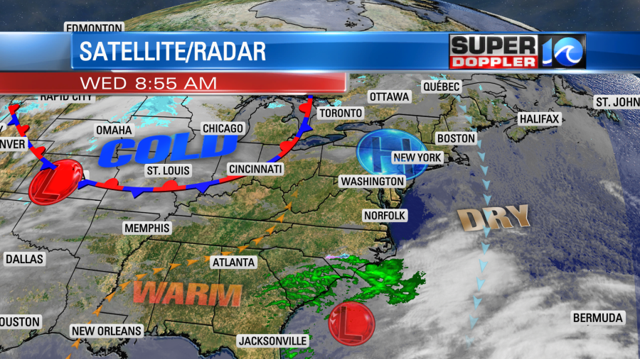
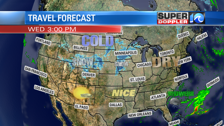
The big weather system that will affect the eastern half of the country over the next couple of days is only beginning to form over the Rockies today. This will cause some snow showers from Denver to Minneapolis as we get into the afternoon.
Most of the country will have some good weather for travel today. We’ll have good weather in our region.
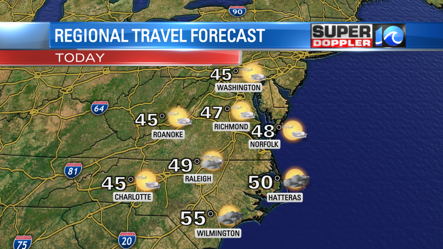
We’ll have increasing clouds locally, but there will be plenty of sun for the first half of the day. High temps will be in the upper 40s this afternoon. Meanwhile Arctic air will be pooling over the north/central U.S.

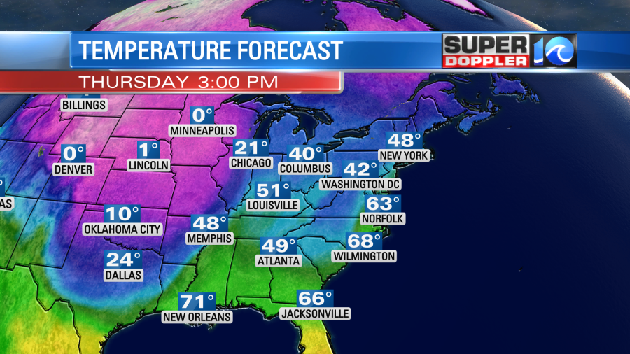
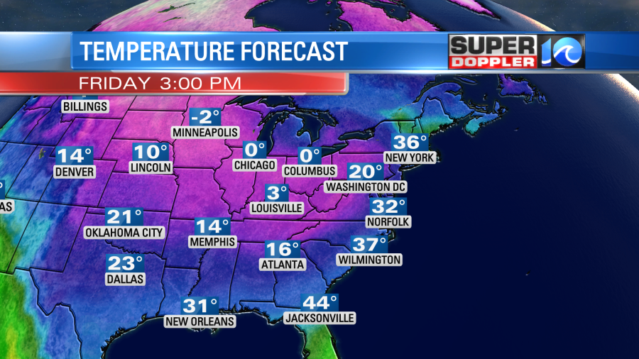
Tomorrow the big system in the Plains will get an injection of energy as a strong upper level trough drops down over the central U.S. Also, the arctic blast of air will pour to the southeast, and it will run into a milder air mass coming up out of the south. This will become a true clash of the air masses. We’ll be in that warmer zone Thursday with high temps rising to near 60 degrees. This while temps will only be near zero around parts of Minnesota.
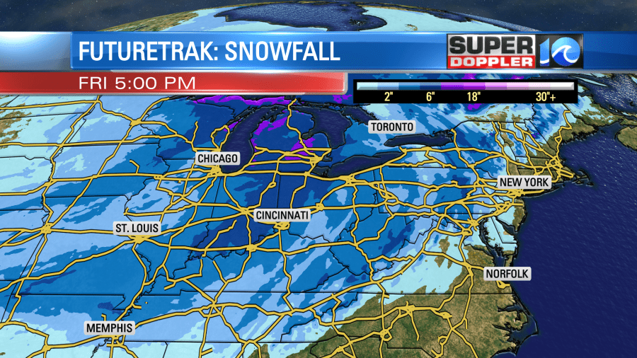
The effect from the low will be a big area of snow that will reach from Arkansas to Michigan.
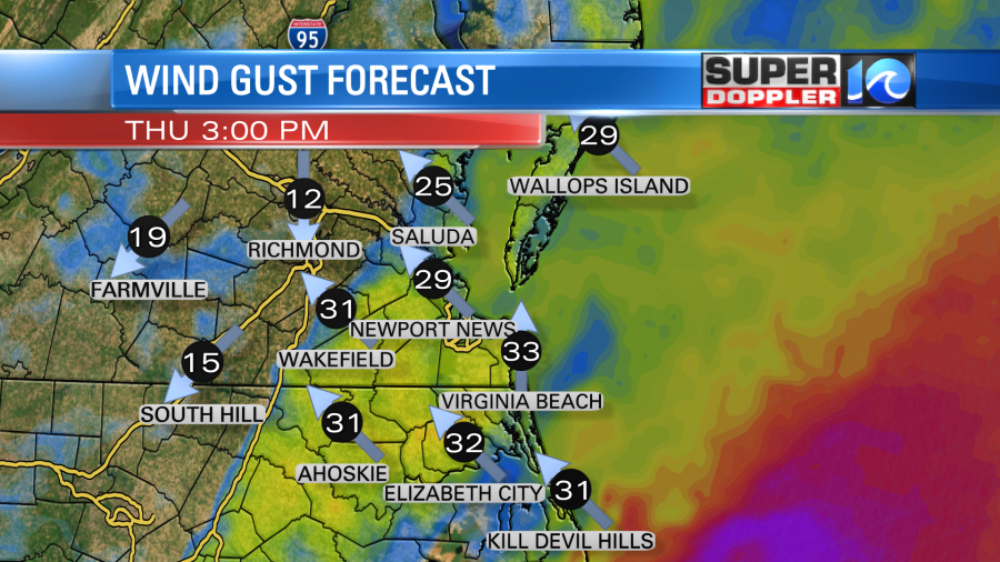
Snow could be heavy at times there, and that will definitely slow down travel. We will have a warm front lifting up from the south here. Moisture and temps will increase quickly as the winds ramp up out of the southeast. Gusts could be up to 30mph by midday.
There will be scattered rain showers in the morning. Then rain will increase during midday and the afternoon.
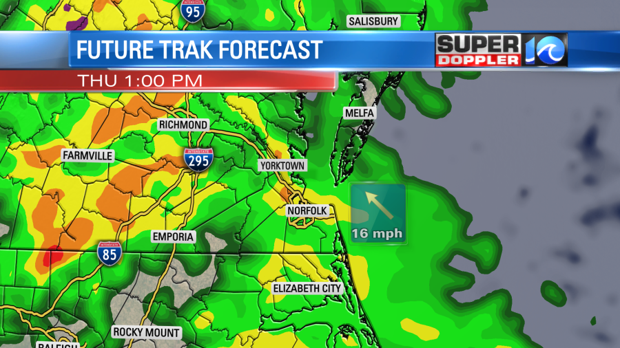
There will be some strong upper level winds overhead, and a little bit of instability at the surface. So we’ll actually have a chance for some thunderstorms tomorrow during the late afternoon into the evening along with a few heavy downpours.
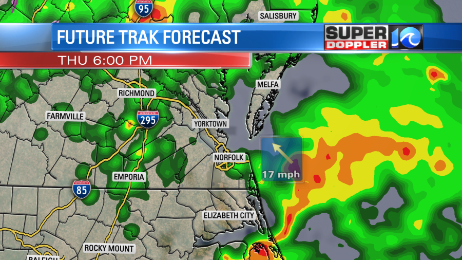
Winds could gust up to 25-30mph out of the southeast outside of any storms. So there is a low chance that some isolated storms could become severe. Remember, high temps will be near 60 or in the low 60s. So at least it will be warm.
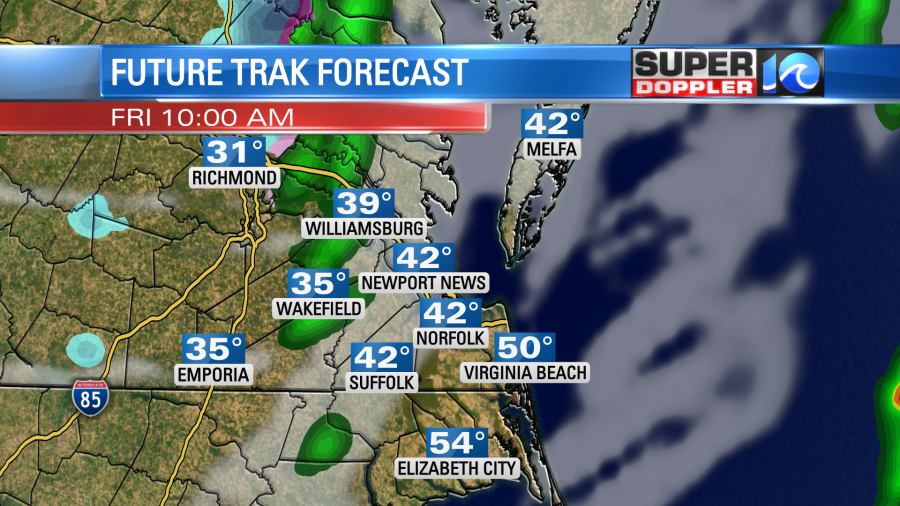
At the same time the cold air will be closing in from the west. The powerful cold front will arrive Friday morning. We’ll start off with temps in the 50s early. There will be some scattered showers at times. The big area of snow will be to our north, but a thin strip of a wintry mix will be moving in from the west as temperatures crash.

As of this time I’m seeing a thin strip of a wintry mix briefly swiping through the region between the late morning and midday.
This will be just behind the cold front. On the back side of the front winds will slam out of the west. Gusts could be up to 40mph or even higher for a time.
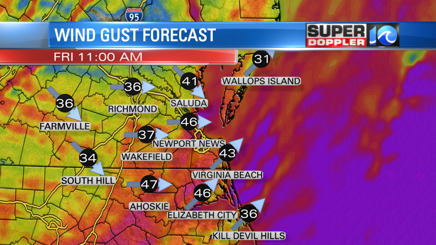
This will pull in the Arctic air mass. Temps will fall from the 50s in the morning to near 30 in the afternoon.
Again, the wintry weather is going to be at a minimum in our region because the cold air dropping in will be racing the moisture moving out. There is still a chance that the moisture lingers a little longer. The GFS model does still hint at this happening. Though the NAM and Future Trak do not. If some brief snow does fall, then it will likely melt. That is because air temps should still be above freezing during the precip fall. Also, ground temps are still above freezing. Snow will accumulate to our north and northwest. I don’t think Richmond will see accumulating snow, but the D.C. area might.
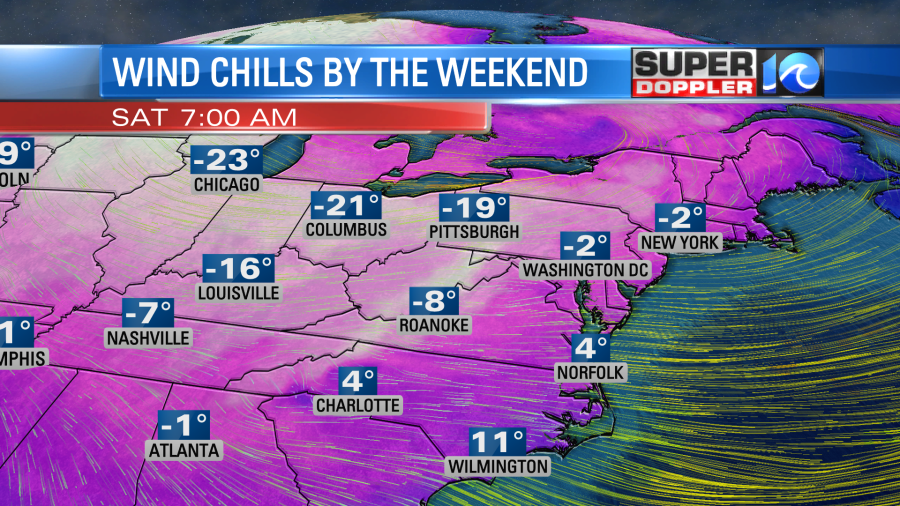
Cold air will keep rushing into the region. In fact….we’ll likely drop down to the teens and 20s by Saturday morning. Wind chills could be in the single digits, and that is looking more likely now.
It won’t be much better during the afternoon. High temps will only be in the mid 30s with a west/northwest breeze. We’ll be mostly dry. However, I can’t rule out a couple of flurries in the region as a powerful upper level trough will be sitting overhead. By Christmas that feature will move out, and high pressure will build in at the surface. So we’ll have less wind, but temps will still be cold. Low temps will be in the teens and 20s. High temps will be in the mid 30s.

You may want to winterize your house today, because you likely will forget around the holidays. Put away the hoses, and cover your faucets. You may want to put up some plastic over the drafty windows. Get out some towels or bedding to cover cracks under doors and garage doors. The weather will be cold enough this weekend that you’ll need to drip the indoor faucets. We’ll have more on that closer to the weekend.
Meteorologist: Jeremy Wheeler


