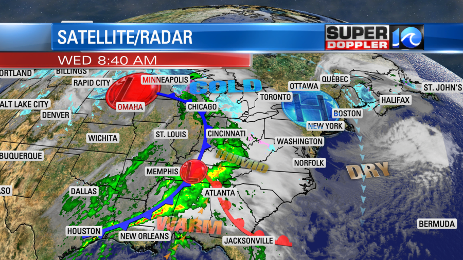
Over the last couple of days we have been dry and chilly. We are going to have one more day of that. Then we are going to have a much wetter and warmer day tomorrow. This is all coming from a large and powerful system that is churning off to our west. There is a strong area of low pressure that is attached to a cold front over the northern Plains. High pressure is still close enough to us today that we’ll stay dry, but the high will push to our north today. So clouds are going to increase.
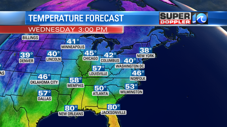
We’ll stay dry through the day. However, as the clouds increase it will slow our temperature rise. So we’ll end up in the mid-upper 40s again this afternoon.
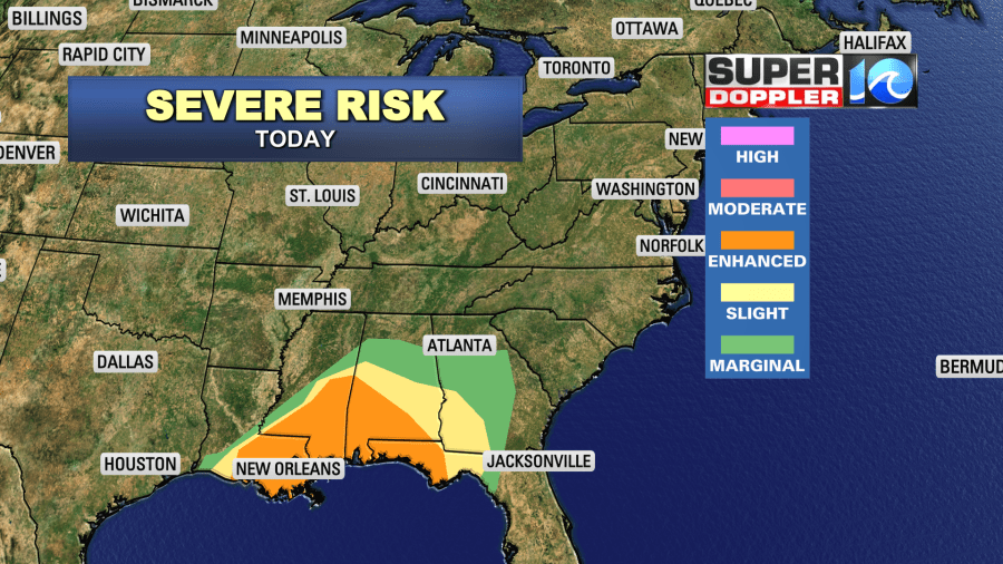
We’ll have a light north breeze. Meanwhile areas to our southwest will have some more strong to severe storms this afternoon.
There were several tornadoes reported yesterday.
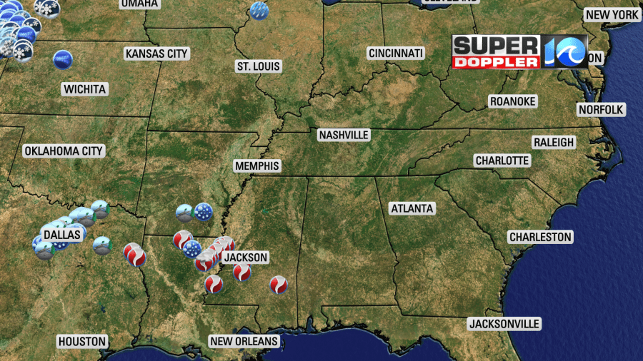
Most of them were between Louisiana and Mississippi.
Also today there will be a lot of snow falling over the northern states. There is already a tall snowpack on the ground up there. Some locations in the north/central U.S. have over a foot of snow on the ground.
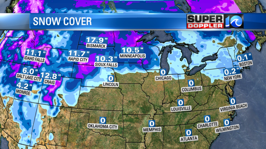
More snow is forecast to fall between the Plains states and the Great Lakes over the next 24 hours. It could really stack up with some locations forecasting over a foot of snow.
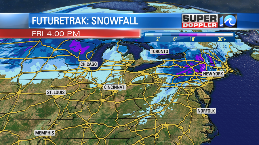
You’ll note that some snow is also forecast over the northern and northwestern part of Virginia. This won’t be a good thing as it will likely be mixed-in with freezing rain.
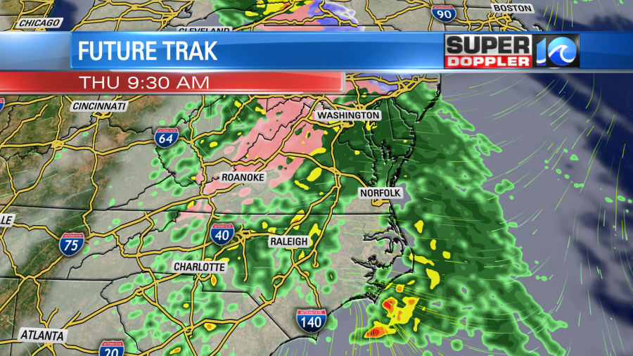
There are freezing rain warnings up for that region for tomorrow.
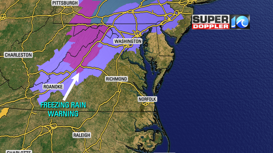
This runs from Staunton up into the eastern part of West Virginia. Keep that in mind if you are traveling up that way.
It will be too mild for that to happen here….This time. Around here we will already develop some rain overnight. But there will be a lot of rain tomorrow morning during the morning commute. The rain will be on-and-off through the day. It may even be heavy at times between midday and the afternoon.
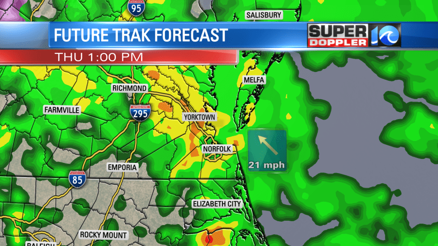
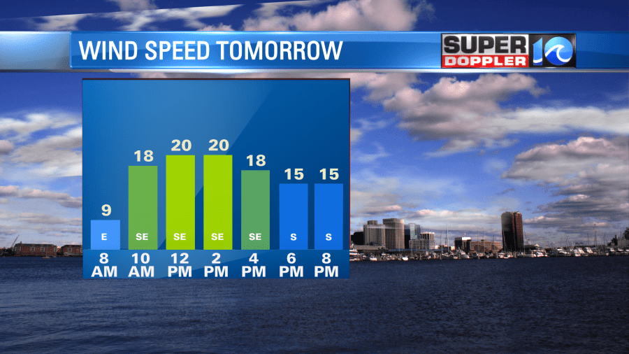
A warm front will try to lift up into our area, but it will probably stay to our south. Having said that…we will still be able to warm up to the upper 50s as the wind will be strong out of the southeast. Winds will run at 10-20mph, but the gusts will be up to 30mph.
Around the evening there will be one last line of showers. This could also contain a few strong storms.
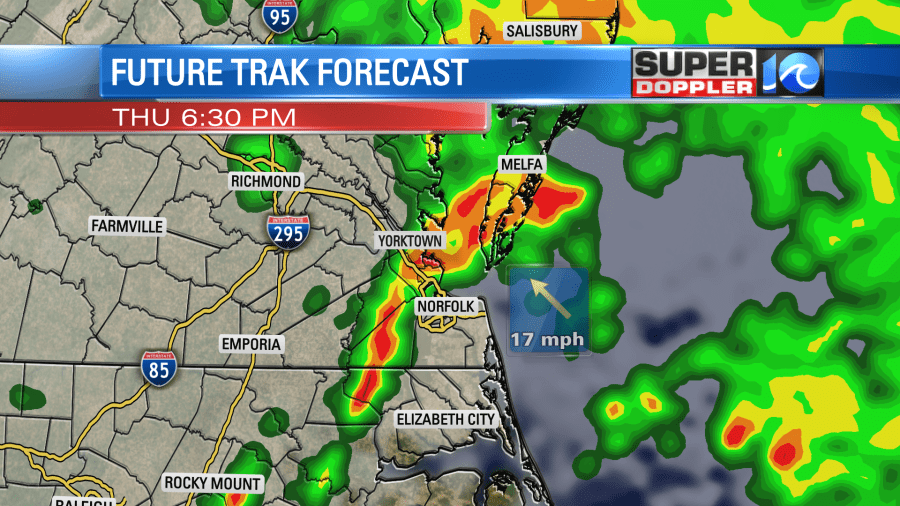
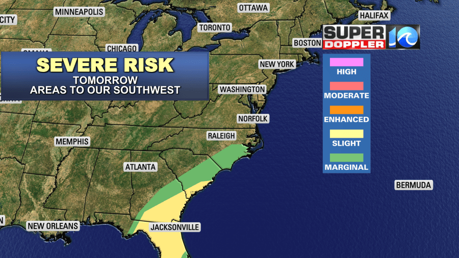
While the risk for severe weather will likely stay to our southwest, we will have some isolated thunderstorms in our area.
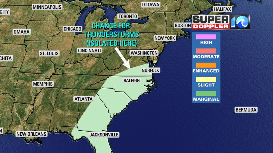
We could see an inch to an inch-and-a-half of rainfall before it wraps up tomorrow night.
We’ll dry out on Friday with highs in the 50s. We’ll be in the low 50s on Saturday with fair skies. Then we’ll be in the upper 40s Sunday into early next week.
Meteorologist: Jeremy Wheeler


