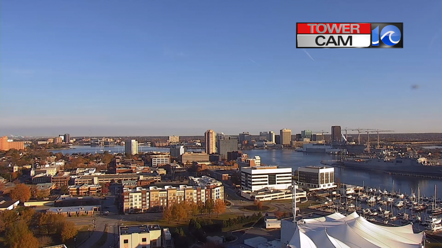
Today’s weather is looking good. We started off with lots of sunshine in the region.
Today we will have some nice Fall weather here, but there will be some severe storms off to our west. High pressure sits over the eastern U.S. This will bring us a lot of sunshine through the day.
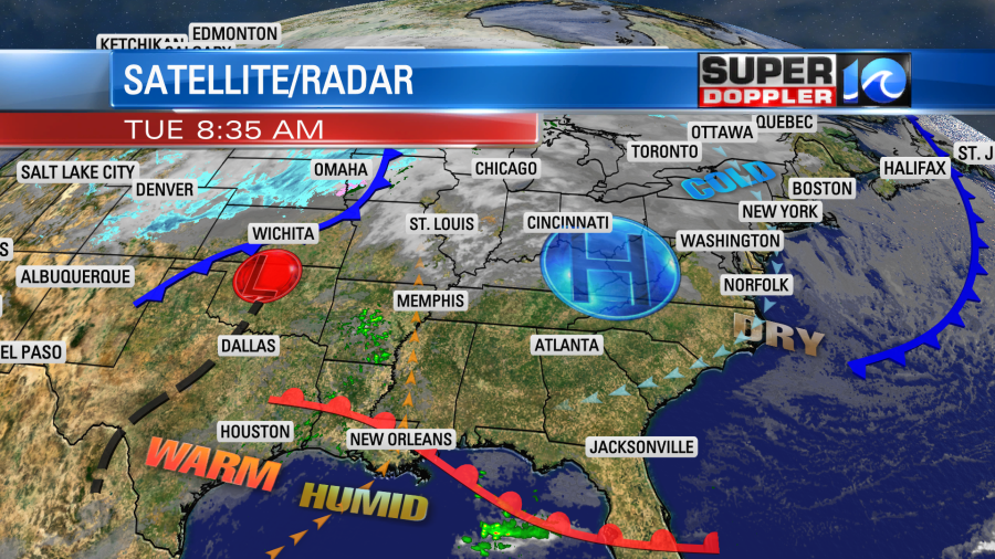
Over the deep south there is a different setup today. There is an unseasonably warm and humid air mass down there that will try to lift northward. Their high temps will rise to the 70s and 80s while we stay in the 50s here.

There is a warm front along the Gulf Coast. There is an area of low pressure over the central U.S. Plus, there is a distinct dryline over central Texas. There will be a good amount of instability and wind shear in an area between Louisiana, Mississippi, Tennessee, and Arkansas. This is where an enhanced/moderate threat for severe weather exists.

Storms will form out there this afternoon, and will increase into the evening.
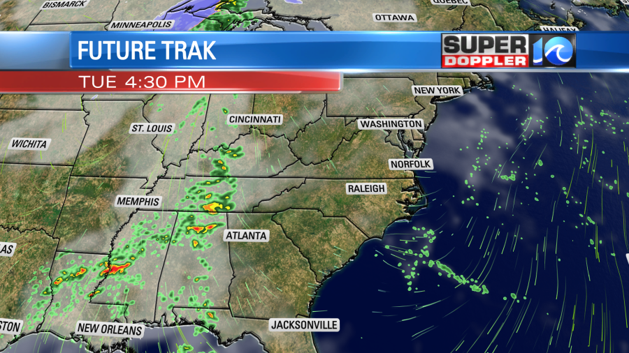
Along with those severe ingredients there will also be some broad spin in the atmosphere as well as a potent short-wave in the upper levels. A low-level jet will also develop. So they are looking at not only a chance for severe storms, but also a decent chance for tornadoes. It could be a tornado outbreak. We’ll see. Luckily that storm system will weaken as it moves east. So tomorrow we’ll mostly have rain showers with a few pm thunderstorms. We may already have a few showers in the area by the early morning.
Then as we go into the midday and early afternoon there will be a big swath of rain.
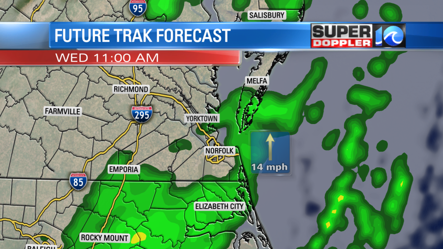
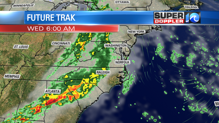
There may be a break for a bit. Then we’ll have some more scattered showers and a few storms during the afternoon.
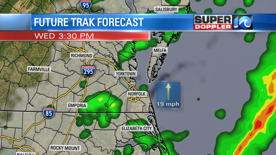
Winds will gust out of the south up to 25mph outside of any thunderstorms. This will pump up the temps into the mid-upper 60s. Humidity will rise quickly. A strong cold front will move through during the early evening. That will create the last chance for rain. Then we’ll dry out into the evening. We are looking at about a tenth of an inch or so for rain totals.
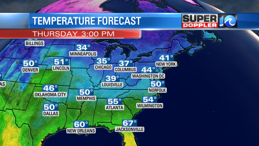
By Thursday the colder air will arrive into the eastern U.S. High temps will only be in the upper 40s to low 50s in the Mid-Atlantic.
We’ll be cool and dry on Friday. Highs will be in the 50s. Then the winds will flip around out of the south again on Saturday. We’ll be warmer and more humid again with high temps returning to the 60s. This time though we’ll only have some spotty showers later in the day.
Meteorologist: Jeremy Wheeler