Yesterday a strong cold front moved into the region. We had some showers and thunderstorms fire up during the evening as the front swept in. A few of these produced some heavy rain, and there were also a few that produced some hail.
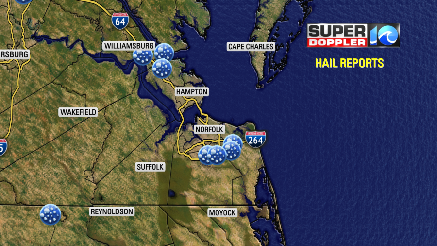
The hail was the size of quarters in a few spots. While there were a few stronger storms, the hail may have been more due to a lower than usual freezing level. The heavy rain was welcome (though the timing may not have been the best).
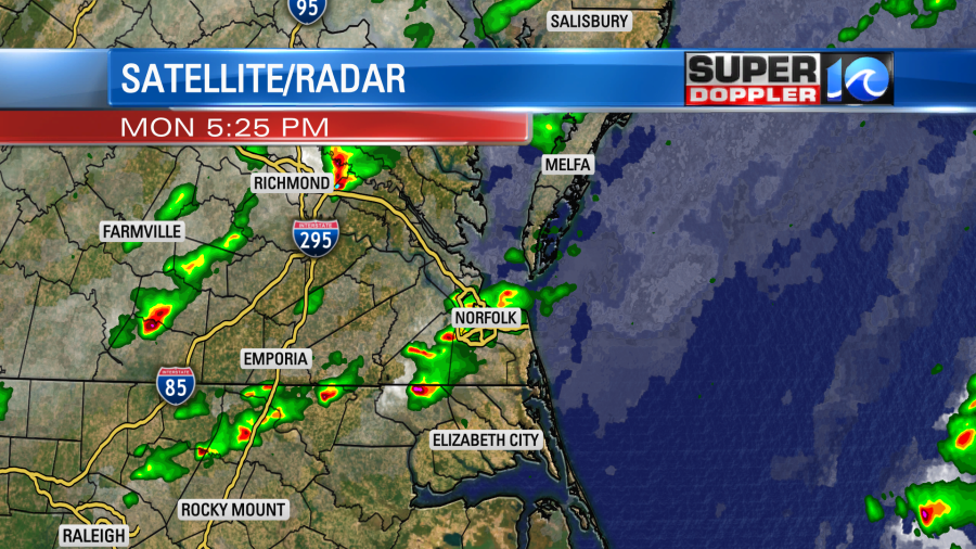
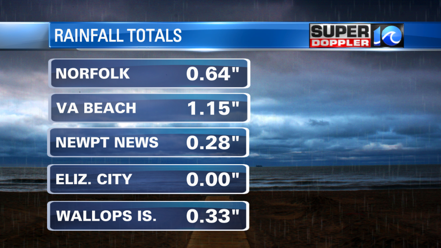
We had one round of storms in the early evening and another round in the later evening. We picked up varying amounts of rain. There were some isolated readings over 1″. However, there were also a few readings with no rain detected or a trace.
By this morning all of the rain had cleared out, but there were still some lingering clouds. Temps started in the 50s, but a few 40s developed inland. The cold front has moved offshore along with the precip.

Even though high pressure will steadily build in at the surface today. There is still an upper level low overhead. So I’m hopeful that we will have clearing skies today, but it may take a little longer than the models show. We’ll have a northwest and then westesterly breeze. This will pull in the much drier air. High temps will only rise to the upper 50s to near 60.
Tonight high pressure will be even closer to the area. Plus, the air will be super dry as dew points drop to the low 30s or even near 30. Also winds will be light and out of the west. Light winds at night allow the heat go straight up into space. So there’s no mixing. This is a recipe for some strong cooling. Temperatures will bottom out in the 30s overnight with some 40s near the shore. We’ll be in the low-mid 30s inland with upper 30s to near 40 in the metro.
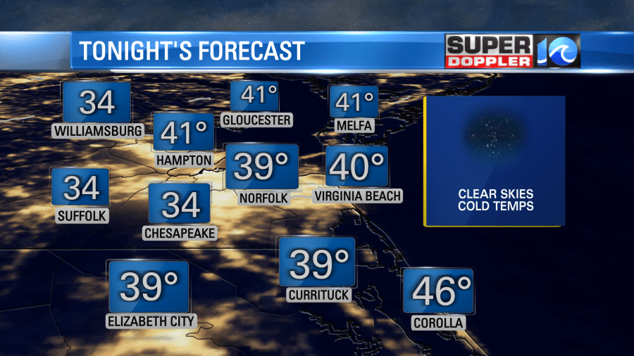
There will be some frost inland. There are some Frost Advisories there. So bring in the potted plants to be safe. While these are the forecast numbers, I’d play it safe. Especially if you live in the typical colder spots in the region. Remember, a lot of the thermometers are elevated, and that colder air sits right above the ground. So the sensors may say 33-35 degrees, but it can drop to 32 degrees above ground.

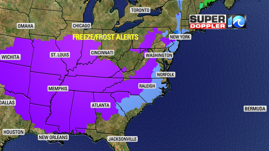
We are not alone. There are frost/freeze alerts up for almost 2/3rd’s of the country.
Through the day tomorrow we’ll have lots of sunshine in our region. We’ll also have a light west wind and lots of dry air. This may produce what I call “The Bounceup”. This is when you still have a decent sun angle, lots of sunshine, and super dry air. This allows for the temps to rise quite a bit from morning to afternoon. We’ll be in the 30s in the morning, but we may hit 60 by the afternoon. You can think of it like the desert. The heat goes straight into heating the air and less into heating up the moisture (since there is less). Also light winds at night allow the heat go straight up into space. So there’s no mixing. This causes rapid cooling.
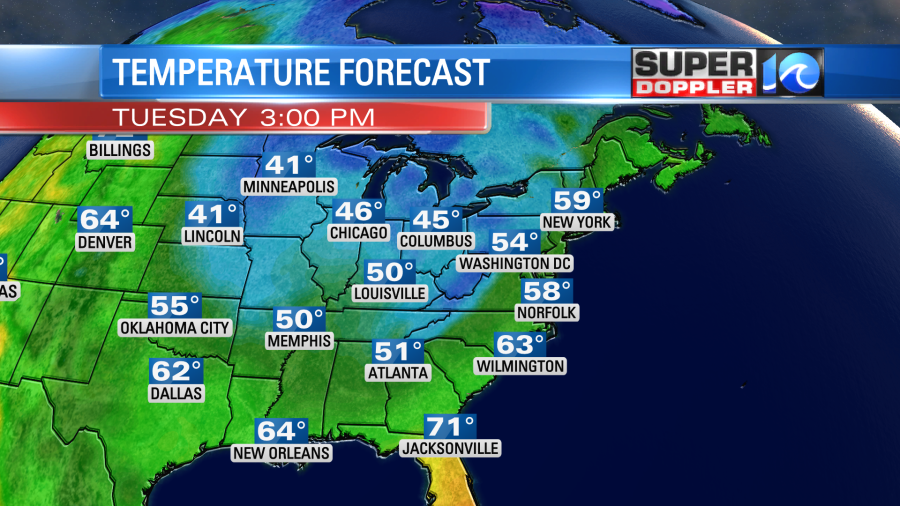
Ok enough nerd talk. We’ll warm up steadily as we go into Thursday and Friday. Highs will be in the 60s. Then we’ll be in the 70s over the weekend. We’ll be pretty dry through that time, but there may be some isolated showers by the end of the weekend. I’ll have more on that in tomorrow’s weather blog.
It’s still quiet in the tropics.
Meteorologist: Jeremy Wheeler