We are coming off of a mild and dry weekend. High temps were in the 70s both days. It was warm in the sun and cool in the shade. It was nice. Today we have one more warm day before the bottom drops out. High temps in our region will rise to the mid 70s again this afternoon.

The cold air has already reached the Midwest. The high temperatures around Chicago will only be in the upper 30s to low 40s this afternoon. These numbers are well below average.

We have a strong cold front to our west. It is slowly moving to the east.
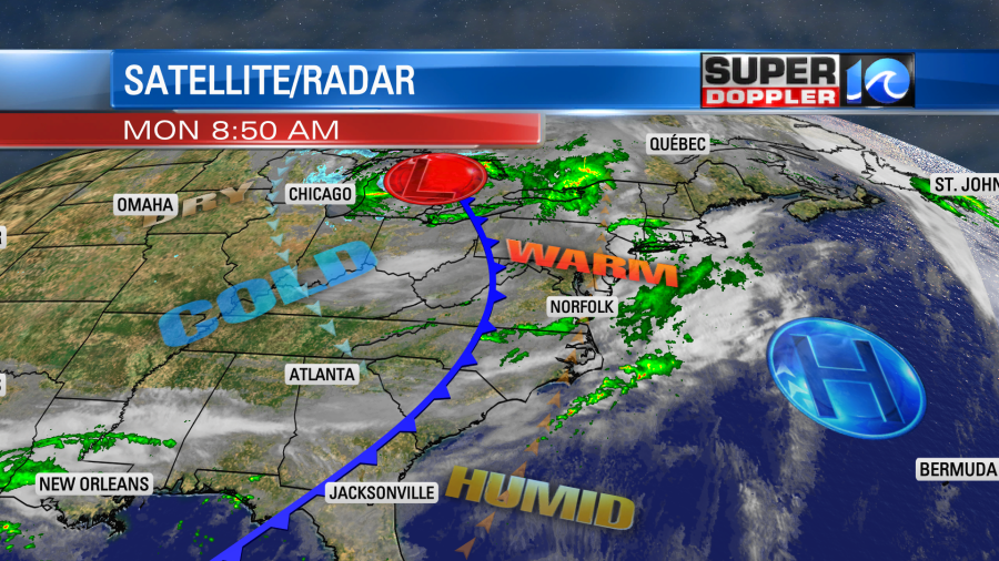
We have had a lot of moisture streaming up from the south. This has led to a lot of clouds. We had a few heavy showers and storms last night.
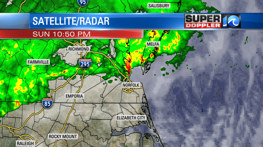
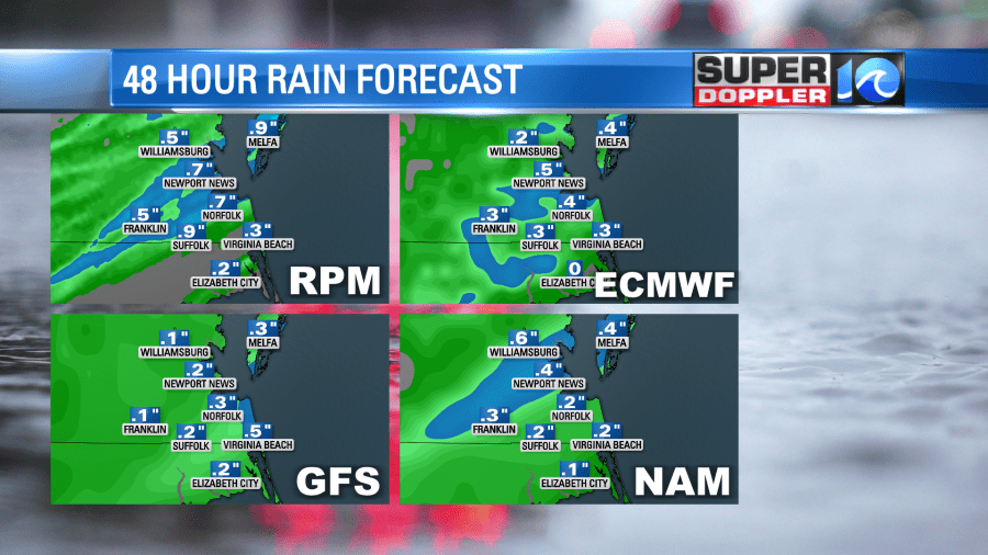
Then this morning it turned into some scattered/light rain showers for the AM commute. My weather watcher, Barry in Gloucester, had over a couple of inches of rain in the last 24 hours. Scott in Yorktown has had 0.27″ during the overnight. It looks like Norfolk has only had a trace of rain.
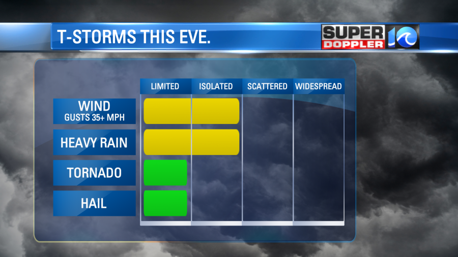
The showers from this morning will taper off by midday. Then we’ll only have some isolated showers in the area. There will be some clearing. Plus, we’ll have a steady south wind. So that will help to raise the high temps to the mid 70s. By the evening some isolated to scattered showers and thunderstorms will form.
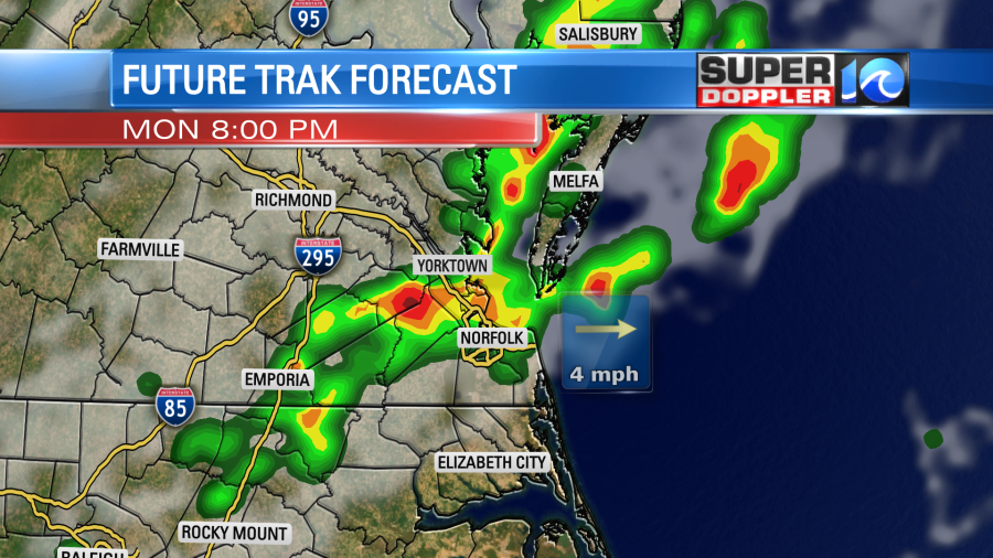
Some of these could be strong to severe as the front comes in. Brief gusty winds and heavy rain will be the main threats.
After the front moves through this evening then we’ll quickly dry out. We’ll have some clearing after midnight. Before the precip ends we could see about a quarter to a half of an inch of rainfall. Some isolated areas could see a half to three quarters of an inch.
Tomorrow will be a different season! High temps will only be in the upper 50s during the afternoon.
We’ll have a light west/northwest wind through the day. Skies will be mostly sunny. At least that’s what I’m calling for right now. However, there will be a very large upper level low overhead. It will basically be a huge pool of colder-than-average spinning air. So it’s possible that some instability clouds could build in during the afternoon. Either way we’ll be dry.
The colder air keeps sinking southward. So by Wednesday morning we will likely be starting in the 30s over most of the area with some milder temps near the shore.
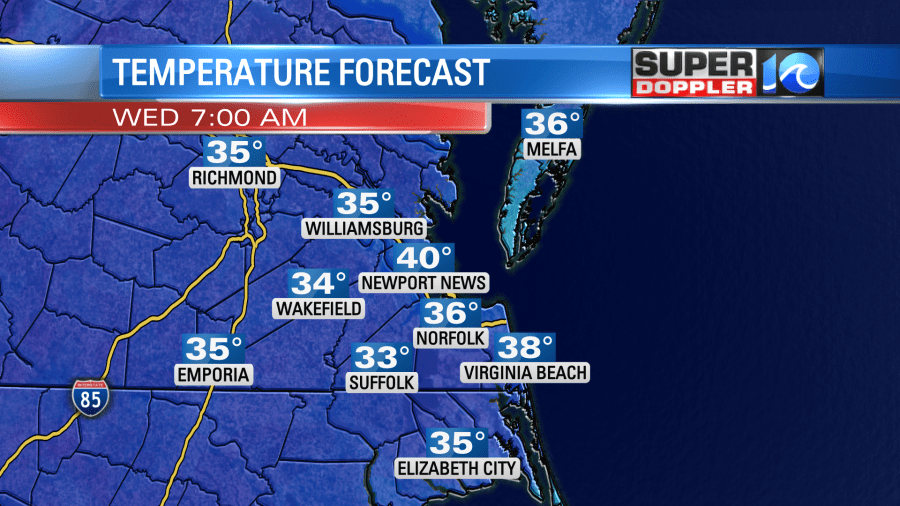
This will also likely be our first shot at some frost this season. It’s a little ahead of schedule, but it can happen. We’ll be talking some more about this over the next 24 hours.
We will have high temps in the upper 50s again Wednesday afternoon. Then we’ll warm things up Thursday into the weekend.
Meteorologist: Jeremy Wheeler