Yesterday we had some beneficial rain showers over the region. The coverage was looking promising around 11am.

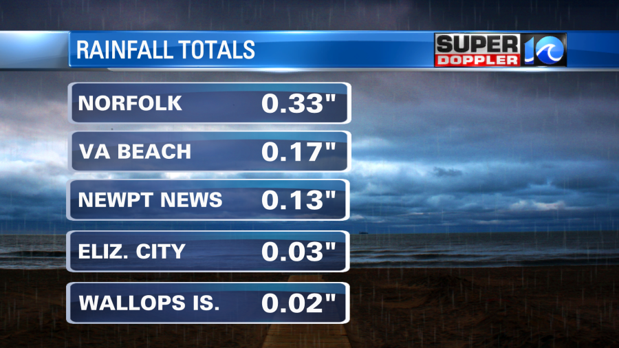
The problem was that the amounts were all on the low end of the forecast (and even below the forecast for some). Here are some of the rain amounts over the last 24 hours:
After the big batch of rain moved out, then the showers became more isolated yesterday afternoon and evening. High temps made it into the 70s. Last night we had a few more showers in the region, but they added little to the rain gauges. This morning there are some leftover clouds behind a cold front.
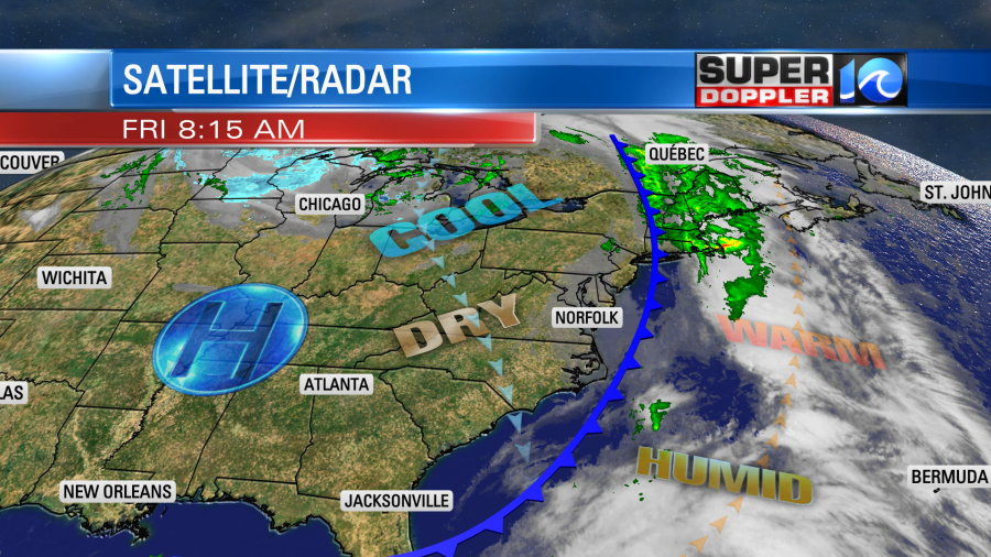
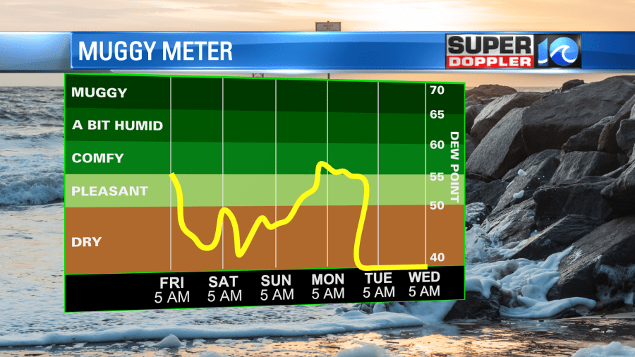
The clouds should break up nicely through the mid-morning. We’ll continue to have clearing along with rapid drying. Dew points fell from the 60s to the low 50s already since last night. They will fall some more to the low 40s by later today.
We’ll have a north wind at 8-12mph. High temps will aim for near 70 degrees. It should be a pleasant afternoon.

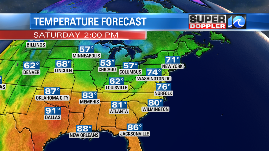
Tomorrow high pressure will sit over the region. We’ll actually get a south wind back already due to its position. We’ll also have a lot of sunshine. So high temps will rise to the mid-upper 70s.
We’ll have more dry weather on Sunday with high temps in the mid 70s. On Monday we’ll still be in the 70s, but there will be more clouds and some scattered rain showers. This will be ahead of a stronger cold front. That front will cool us down big-time going into the middle of next week. High temps will be in the upper 50s Wednesday with lows in the 30s. There may even be some frost. We have plenty of time to update you on that.
In the mean time we are still tracking tropical storm Karl in the southern Bay of Campeche.
This is moving south/southeast. It is forecast to make landfall tonight as a tropical storm over the southern coast of Mexico. Probably near the state of Tabasco.
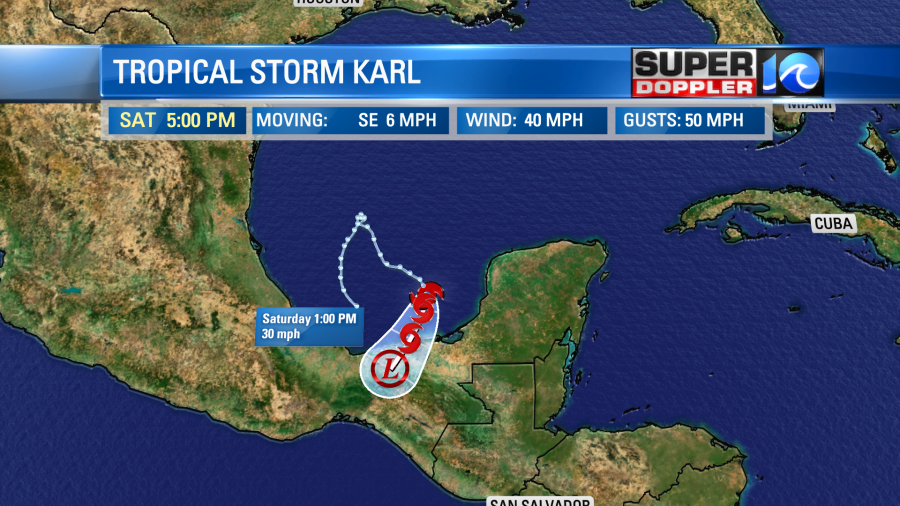
It will bring some heavy rain and gusty winds to that region. There could also be some mudslides.
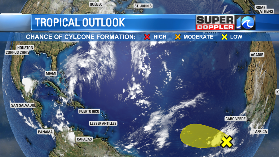
There is also a weak tropical disturbance in the eastern Atlantic. It has a low chance of formation, and it will probably stay out over the ocean anyway. However, that is not a guarantee yet.
Stay tuned for updates!
Meteorologist: Jeremy Wheeler