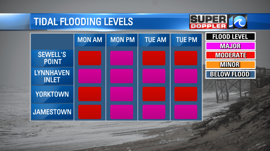
What was once Hurricane Ian has become an even more dynamic system and will continue to influence our weather over the next 48 hours (and potentially longer). The large area of low pressure is sliding over Hampton Roads Sunday night and will park itself offshore for at least Monday & Tuesday, posing problems with the high tide cycles. Flooding will be an issue for many across Hampton Roads as waters reach major flood stage levels.
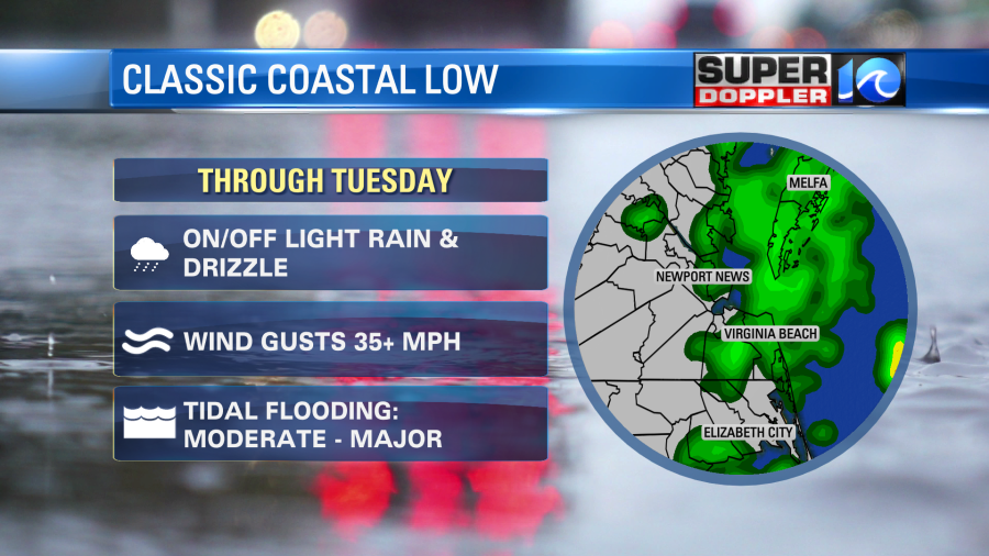
Tonight, on & off light rain showers will also persist into the early morning hours of Monday, but the wind will be the bigger story. Look for the breeze to continue to increase out of the northeast – eventually gusting over 35mph at times through the overnight, then continuing throughout our Monday.

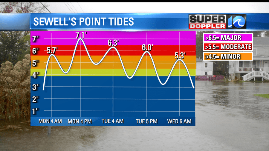
This strong, persistent northeast wind will be the driving factor of our tidal flooding issues – the already elevated water levels will get shoved into the nooks and crannies of the Chesapeake Bay over the next several high tide cycles. Monday around 4 a.m. is when we’ll start to notice some issues in the typical flood prone spots, but Monday evening’s high tide around 4/5p.m. will cause the big issues as waters will reach major flood stage levels.
The stubborn area of low pressure will still be stalled off our coastline through Tuesday – so these water levels will remain elevated and we’ll likely continue to see issues with our Tuesday morning and evening high tide cycles.
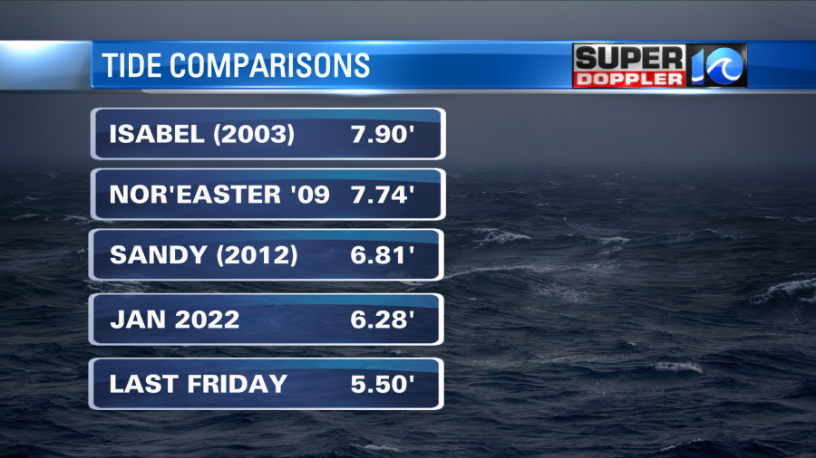
For comparison – the Super Doppler 10 Weather Team is thinking of a situation similar to Sandy (2012) in terms of high tide levels. The difference will be the rainfall.
Fortunately, we do not anticipate soaking rains like in flooding events of the past, or even like this past Friday. Expect on and off light rain, drizzle and misty conditions with low hanging clouds and lowered visibility. A raw day setting up with temperatures barely making it to 60° – Tuesday will look to be much of the same.
Winds begin to die down come Wednesday and slowly flip out of the northwest – water levels will take a bit to come down as we slowly carve out some sun Wednesday afternoon. The remainder of the week looks dry, lovely, and warm with temperatures rebounding into the 70s.
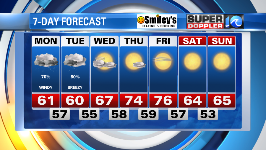
Next weekend will be quite the treat – 60s, sunshine and low humidity.
Stay with WAVY for further updates and stay safe!
Meteorologist Steve Fundaro
