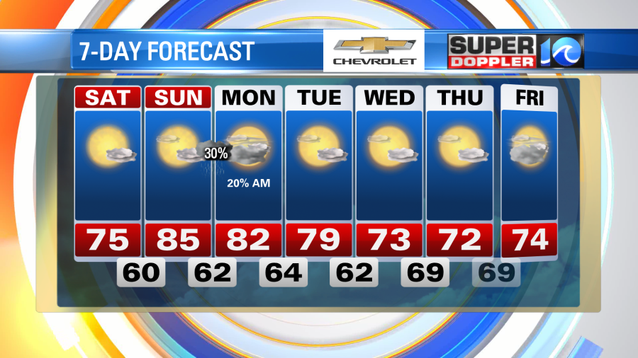
Another fantastic day of weather across the region, with low humidity, a decent amount of sunshine and low rain chances. Hopefully you’re enjoying this taste of Fall after some of the hotter days we’ve seen recently.
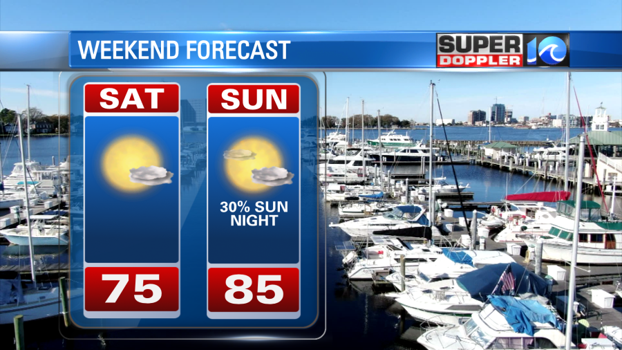
We’ll see mostly sunny to partly cloudy skies this weekend – with temperatures in the 70s and 80s. Rain-free conditions are expected through Saturday and most of Sunday. Late Sunday evening, we could see a few showers approach as a front comes into the area. Overall, a pretty nice weekend locally.
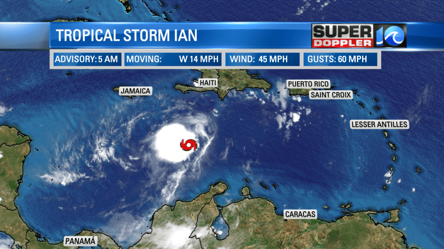
The tropics have been quite active recently, with 4 named storms in the basin as of Saturday morning. We have Fiona, Gaston, Hermine and Ian all out there.
Fiona is currently impacting Canada as of Saturday morning, with heavy rain, surf, wind and storm surge. The storm has become extra-tropical (aka a Nor’easter) as it’s moved north, meaning it’s lost some of it’s tropical characteristics, but that doesn’t really matter in terms of impacts. Remember Sandy in 2012? Sandy also become extra-tropical, but sure brought impacts to the Northeast. Fiona is doing the same to Canada. Check out some of these posts below for what it looks like there.
Hermine and Gaston are in the far eastern Atlantic and no threat to North America. Ian on the other hand, is a different story. Ian is the storm we will be talking about for the next week or so, as it moves through the Caribbean and towards Cuba and Florida.
As of Saturday morning, Ian is a relatively weak tropical storm. However, the NHC expects it to strengthen significantly over the next few days, becoming a strong hurricane before making landfall in Cuba and Florida.
5 days out, the exact path is always a bit uncertain, but there has been decent consensus on impacts being felt in Florida. The exact landfall location is still being determined though – and that can have a big impact on storm surge and where the worst winds are felt. The consensus models – which are a blend of all of the models essentially have been adjusting west a bit over the last day or so. So has the National Hurricane Center (NHC) track. Hurricane Hunter aircraft are scheduled to investigate the storm numerous times through Saturday and Sunday – so that should help improve the forecast too.
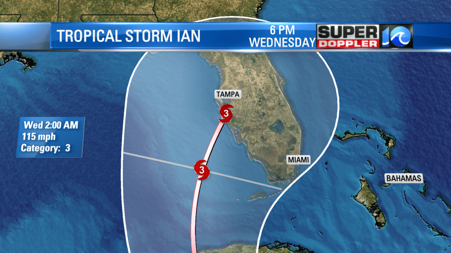
The GFS and the European models both show a strong storm on the western side of Florida as we go into next week. There are some differences through in exactly how strong and where it’ll be located. Depending on the exact track of the storm, we could see some remnant effects late next week. The GFS does show some local impact here late next week. If it’s just some rain, that could be good news for us -as we are behind on rainfall.
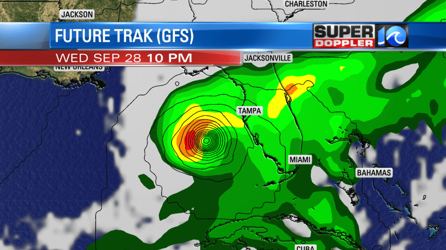
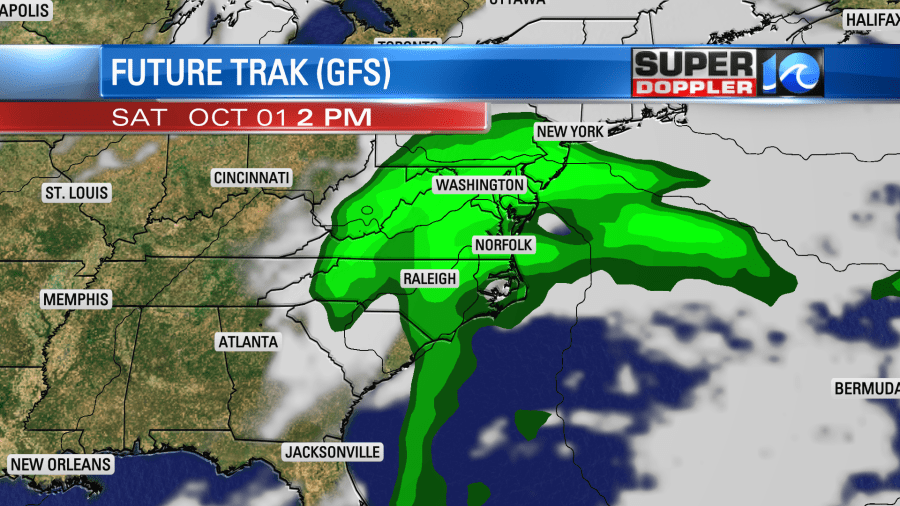
Stay tuned for updates on Ian over the weekend. As we get more hurricane hunter recon data and better model data in over the weekend, I expect some changes to the forecast. We will continue to monitor the storm and keep you updated. I’ll be sharing updates on Twitter through the weekend a lot too.
Hope you have a great weekend!
Meteorologist Ricky Matthews
Follow Ricky on Facebook and Twitter
