Our weather today is going to feel more like mid August than mid September. We are coming off of a fairly hot Sunday. (not the chocolate kind). Temps were in the mid-upper 80s, and it was humid.
Today we are continuing with the heat. Our local high temps will be in the upper 80s with a couple of 90s inland.
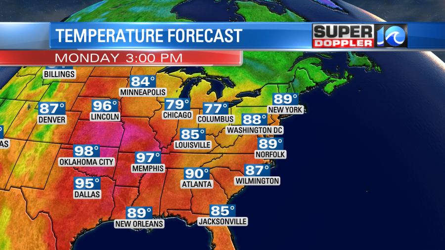
Luckily, it won’t be as hot as over parts of the Midwest. Some states will be hitting the triple digits between today and tomorrow.
We have high pressure over the region. This will give us lots of sunshine today. There is a cool front over the Midwest. It is steadily marching to the southeast.
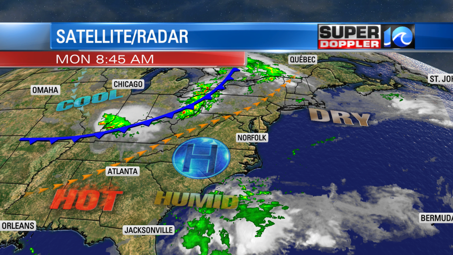
Tomorrow we’ll have a slight cool down with a little dip in the humidity. High temps will be in the mid 80s.
It should be fairly nice out, but it will be a few degrees above average. We’ll have fair skies with a light north wind. Then we’ll heat up again on Wednesday as the winds turn out of the south once more. High temps will be in the upper 80s. It will be humid again as well. HOWEVER, a much stronger cold front is going to swing through the region on Thursday. Temps will drop a little into the mid 80s. If we’re lucky then we’ll have a few rain showers along the front. However, I’m not getting my hopes up too much on that. Regardless, we will have some much cooler and drier air sink into the region Friday into Saturday. High temps will be in the low-mid 70s.

The dew points will drop to the 40s. Wow!
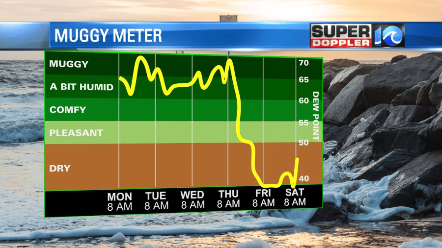
The first day of Fall is Thursday, but technically that happens in the evening. So the first full day of Fall will be Friday. The timing couldn’t be better.
Meanwhile hurricane Fiona has caused major problems over the eastern Caribbean islands. It caused one death on the small island of Guadeloupe. Then it made landfall over the extreme southwest corner of Puerto Rico yesterday afternoon.
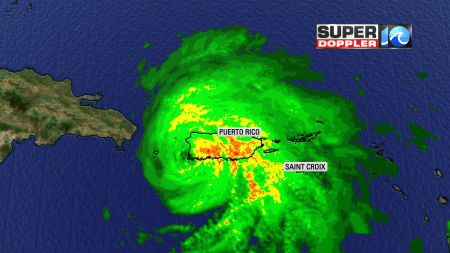
A huge amount of the heavy rain fell to the west of the eye. The rain is still falling there this morning despite making a second landfall over the eastern Dominican Republic.
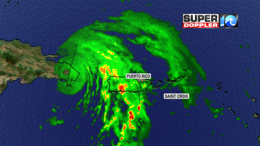
It created strong winds of category 1 strength over Puerto Rico. There were reports of flooding and widespread blackouts. Final rainfall amounts could be between 20 and 30 inches over some parts of the island.
This as they hit the 5 year anniversary of hurricane Maria which devastated the island.
Now strong winds are hitting the eastern Dominican Republic. They will get some heavy rain there as well, but it shouldn’t be as heavy as over Puerto Rico.
The hurricane is still going to the west/northwest. This is taking the center a little be more to the west of the forecast and the latest models. However, everything is in agreement that it will take a north/northwest turn soon. After that it will get very close to the Turks and Caicos islands. It is forecast to strengthen over the warm Atlantic waters as it turns more to the northeast in a couple of days.
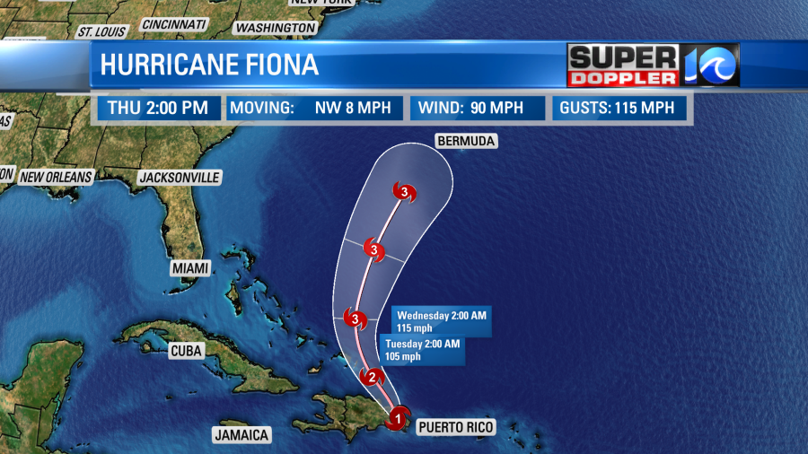
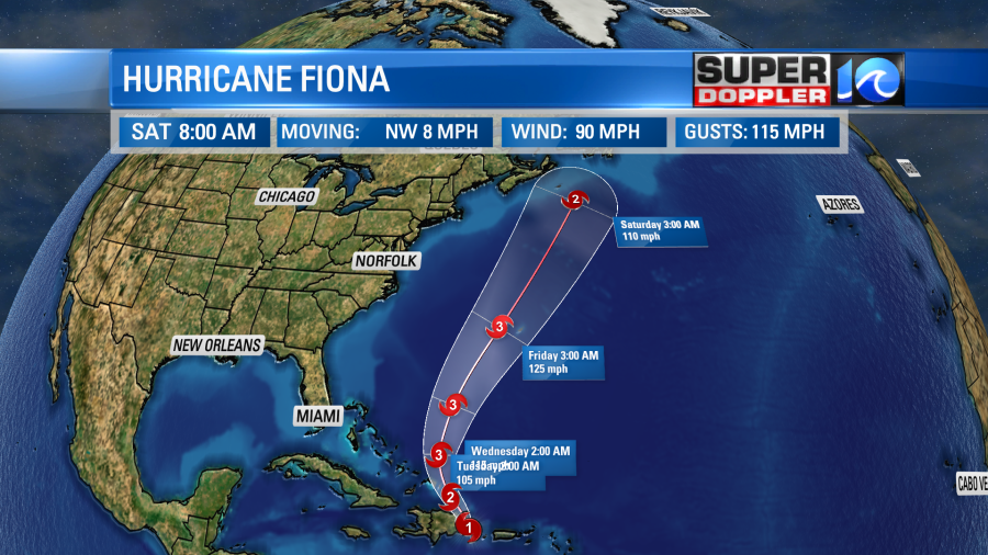
It will then take aim at Bermuda. The latest forecast has it passing just to the west of the island as a category 3 storm. Keep in mind that this track will likely be adjusted more to the west later today due to the recent jog west of the track. That would shift the northeast quadrant a little more to the west. That could be some good news for Bermuda, but it’s still too early to call. After Bermuda the storm will keep moving northeast and should weaken a bit over the north Atlantic. However, it could still hit Newfoundland as a hurricane.
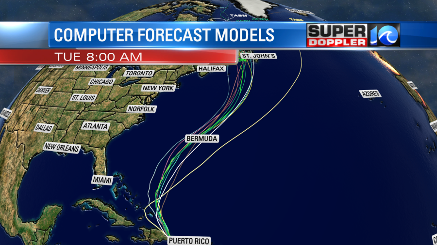
The models are pretty tightly packed together. So there is a pretty high confidence in the forecast path.
While we may breathe a sigh of relief here that the storm is not headed this way (though we could probably use the rain), we will have an indirect impact. We will see some higher waves by the end of the week. Offshore waves could be up to about 12ft. However, nearshore waves could be around 4-5 feet.

It could be higher around Hatteras. This is a guestimate on my part as I look at the latest data, but we will have an actual forecast as we get closer to Friday. Regardless, we will have a higher threat for rip currents by the end of the week.
Stay tuned for updates.
Meteorologist: Jeremy Wheeler


