Today we are tracking a weak cool front that is slipping slowly to our south.
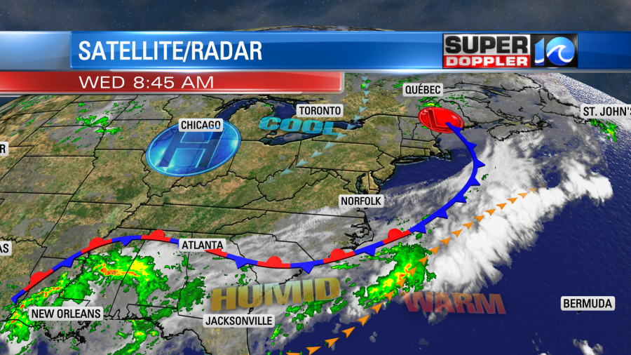
Unfortunately it is stalling out, and it is falling apart. So don’t expect a cool down in the region today. However, there will be a light northeast breeze developing. So the humidity might drop just a bit.
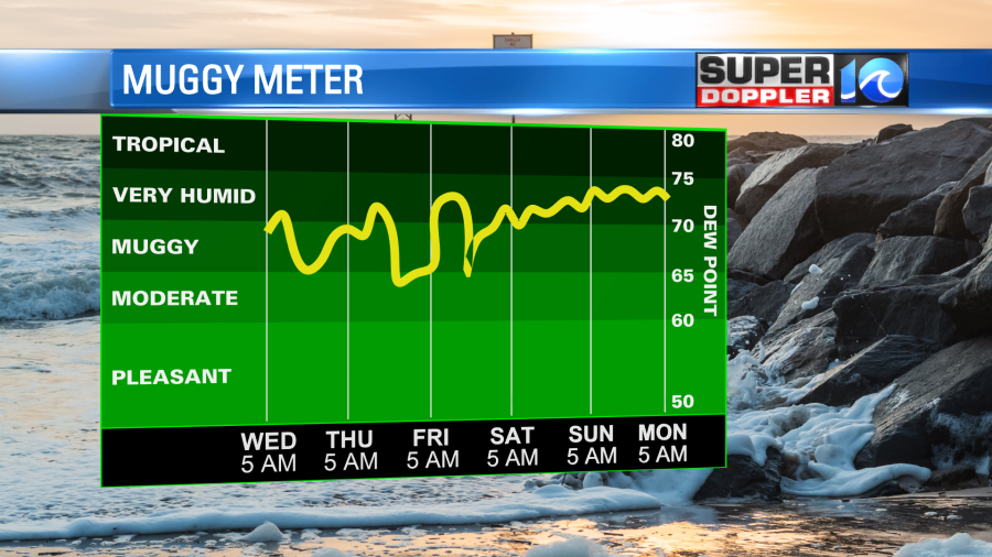
It should be a pretty decent day. High temps will rise to the mid-upper 80s. We’ll be partly cloudy with only some isolated pm showers and storms.
We’ll basically have similar weather over the next few days. We’ll be partly cloudy with a few pop up showers and storms each day. High temps will stay in the 80s. There may be a little higher chance of rain on Saturday as a slightly stronger cool front moves into the region.
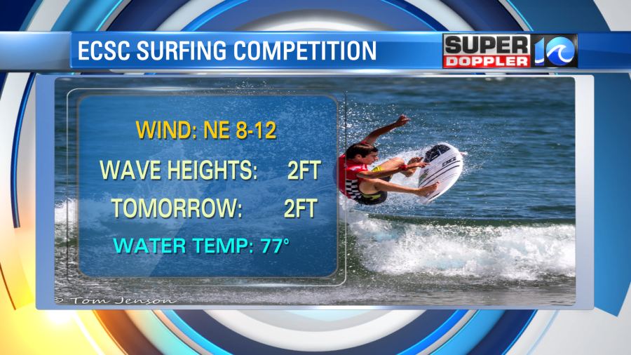
The weather looks good for the ECSC this week. I just wish the waves were a little higher.
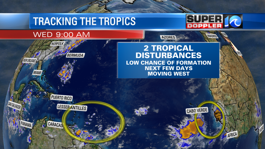
There are a couple of weak tropical disturbances in the Atlantic. They will both move generally west over the next few days. They also both have a low chance of formation through that time.
This is in sharp contrast to 30 years ago when hurricane Andrew made landfall over southern Florida.
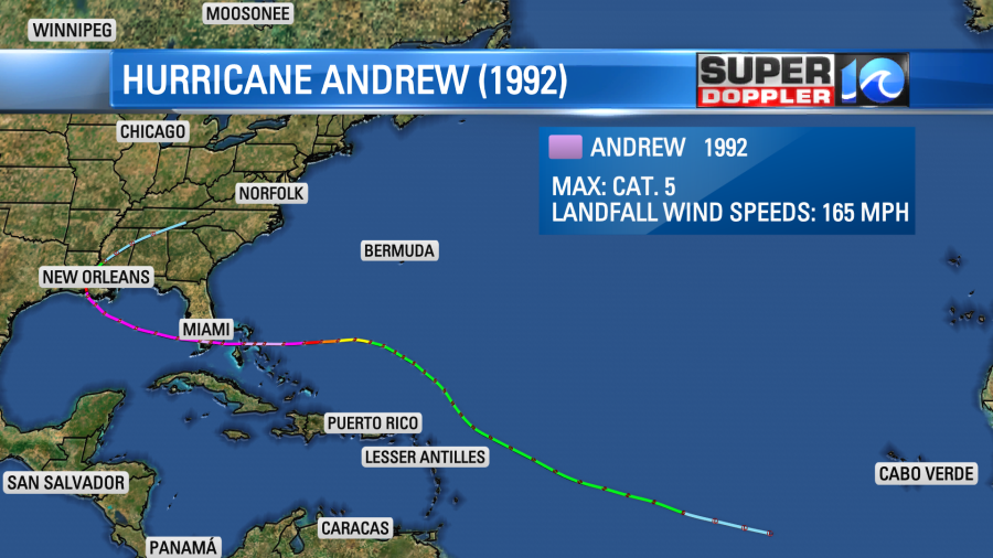
When it hit the country had witnessed the damage first-hand as cable news outlets (including CNN and the Weather Channel) had really started to take off. Initially, the hurricane was thought to have category 4 winds. However, in the early 2000s meteorologists reanalyzed the data, and they concluded that the storm actually had category 5 winds of 165mph upon landfall.
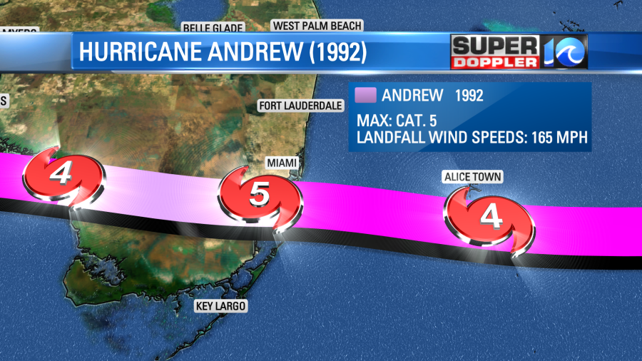
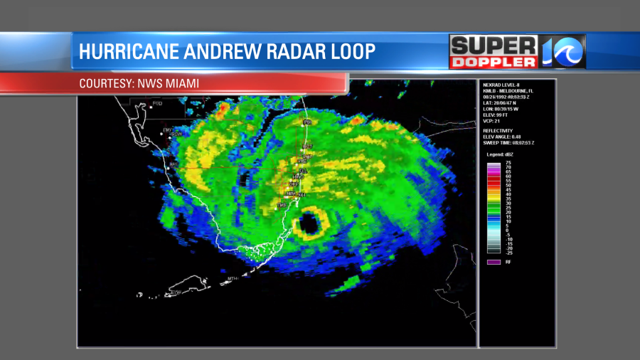
Either way it caused catastrophic damage to the region. If it had passed just a little more to the north, then Miami would have had widespread devastation. Here is what it looked like on radar near landfall.
I know we’ve had a long stretch of quiet weather in the Atlantic. However, I guarantee you that things will fire up soon. Hopefully, I’m wrong.
Meteorologist: Jeremy Wheeler


