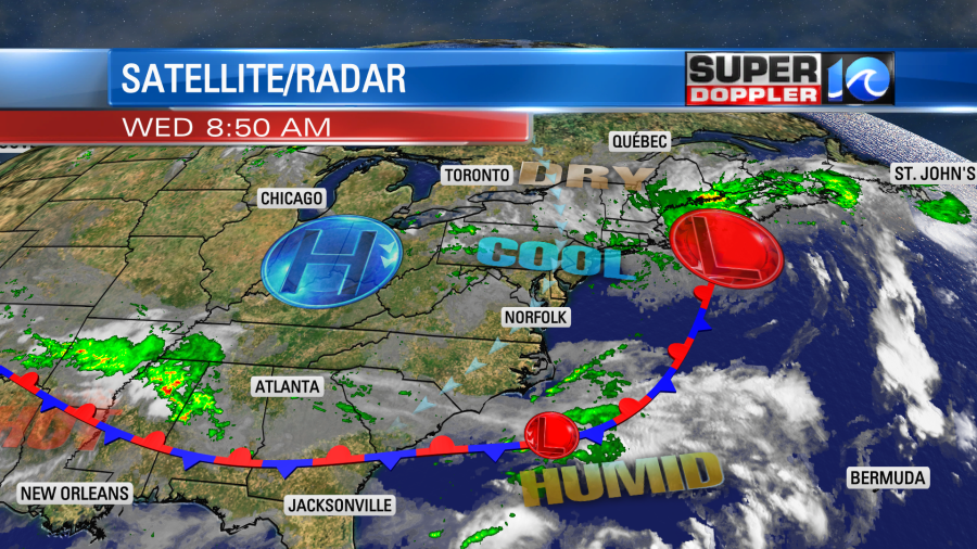
Overall the next couple of days are going to be nice, but there will be a couple of small speed bumps in the forecast. We are tracking an area of low pressure far offshore today. This was also offshore yesterday, but it was close enough to create a few showers in the region. An upper level low overhead helped as well.

There is a stationary front to our south today with high pressure over the Midwest.
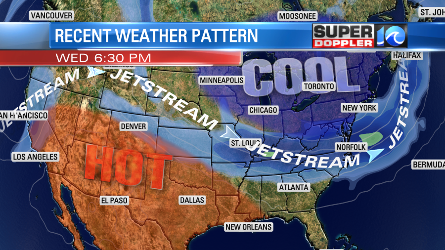
The upper level low is weaker, but it is still overhead. There is a big dip in the jetsream along with cooler temps in the eastern U.S. Meanwhile there is a rise (ridge) in the jetstream out west. This is where the hot temperatures will be this afternoon.
With the setup at the surface we’ll have a steady northeast wind through the day. We’ll have partly cloudy skies with only some isolated showers possible between the late morning and early afternoon. The chance for rain is about 15-20%. So that’s one very minor issue. We should have clearing between the late afternoon and early evening. The other bigger issue is for swimmers today. With the offshore low and the northeast wind there will be a high threat for rip currents at many of our local beaches.

It is a high threat from Virginia Beach down to Oregon Inlet. It is a moderate threat from there down to Hatteras. Remember, if you get caught in a rip current then stay relaxed as best you can. Try to signal the lifeguard if you are able. Then swim parallel to the shore. Try to swim back in towards the beach when you feel the current weaken.
Tomorrow the offshore low will rise northeast to coastal Canada. High pressure will settle in closer to our region.
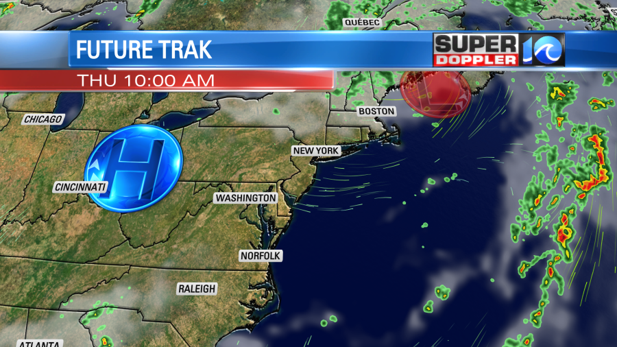
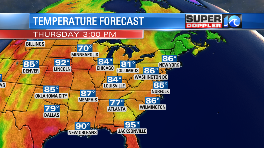
We’ll have lots of sunshine with less wind. High temps will be in the low-mid 80s.
By Friday we’ll have more of a southerly wind. An area of low pressure will come up from the south, and that will bring up the front with it. So there will be increasing clouds with some scattered showers and a few storms on Friday. Highs will be in the 80s. The low and the front will be even closer on Saturday. So we’ll be mostly cloudy with scattered showers and a few storms. Highs will be in the 80s. We’ll be drier on Sunday. I’ll have more details on the Sunday-Monday forecast in tomorrow’s weather blog.
The tropics are still pretty quiet…for now. There is a weak disturbance in the western Gulf of Mexico that may try and form over the next few days, but it is a low chance.

However, the long-range GFS model is finally showing a large tropical system forming over the central Atlantic over the next 6-10 days. We’ll see if this come to fruition. Either way I do think things are going to pick up in the Atlantic very soon.
Meteorologist: Jeremy Wheeler