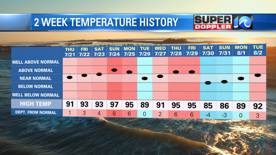
Over the past couple of weeks we had a lot of high temperatures in the 90s. The last heat wave was a decent stretch. Though last weekend we did cool down for a couple of days.
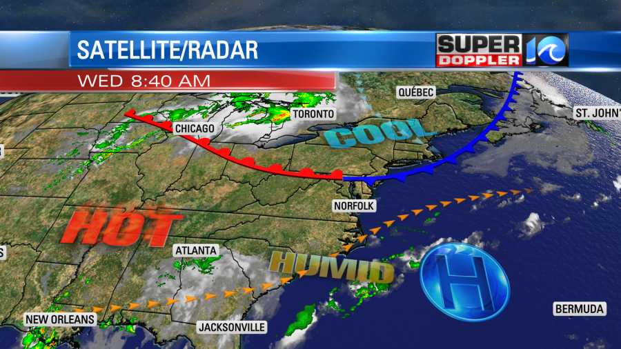
Yesterday started the next stretch of 90 degree days, and it may last for a while. Today there is a cool front to our north, but it is stalling out. High pressure is to our southeast.
We’ll be hot and humid again today with high temps aiming for the low 90s.
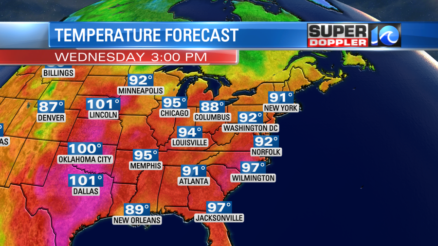
The heat index will rise up into the mid 90s. We’ll be mostly sunny for a while. Then we’ll have a few more clouds and some isolated showers and storms this afternoon. The wind will be light and variable. For a time it may be out of the north. So that could kick off a sea breeze for a bit. That might cool down a few areas in the metro by a few degrees, but we’ll see.
Tomorrow the front will lift north as a warm front. So the winds will be more consistently out of the southwest. That will boost the temperatures up into the mid 90s.
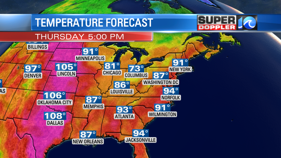
That will also push the heat index up to near 100 degrees. We’ll be partly cloudy with a couple of isolated showers or storms. We’ll have pretty similar weather through the weekend. High temps will be in the 90s. The heat index will be in the 90s and 100s. For now it looks like there will be a little higher chance for some scattered afternoon storms Friday and Saturday, but we’ll see.
Meteorologist: Jeremy Wheeler