We’re crankin’ the heat for the next two days as heat indices will reach dangerous levels. Hydrate, hydrate, hydrate!
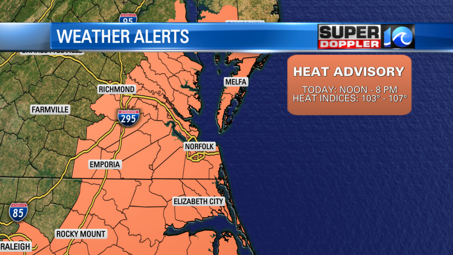
A Heat Advisory is in place for our region from noon until 8 p.m. – heat indices will range from 103° to 107° for a good portion of the afternoon.
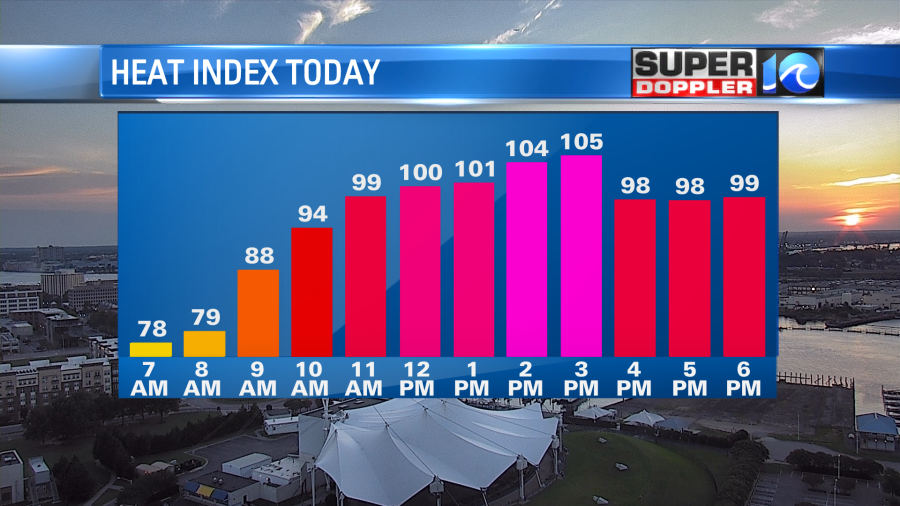
Passing clouds will take us through late morning with temperatures quickly to rise. The humidity will make it feel close to 100° as early as 10 a.m., then when our high temperatures top out in the mid to upper 90s this afternoon, it’ll feel like to low 100s easily. A spotty or isolated downpour is possibly later this afternoon, but rain chances remain pretty slim today. Not much to cool us off.
Heat holds through Friday as well with partly cloudy skies and highs back in the mid to upper 90s. Heat indices will once again be in the low 100s. There’s a better shot at some scattered showers and thunderstorms by the late day & evening hours of Friday. This, as a cool front drops into the region ever so slowly.
The front is set to stall out across the region by the weekend – this will keep things unsettled, keeping rain chances around both Saturday and Sunday. A few more clouds will be thrown into the picture as well, but temperatures drop into the 80s. Remaining muggy, so it should still feel like at least 90°, but that’s a far cry from today!
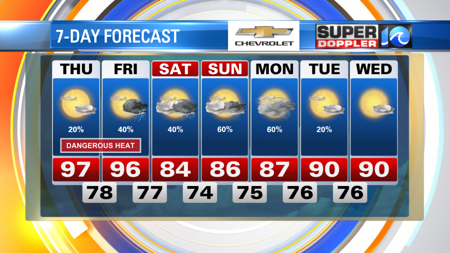
Rain chances should stay alive into early next week with temperatures hovering near our monthly normal high.
Until then, find the cool spots, stay hydrated and beat the heat!
Meteorologist Steve Fundaro