Update: A Severe Thunderstorm Watch has been issued for parts of Hampton Roads until 10pm Wednesday, for the threat of damaging wind and hail. This includes Newport News, Hampton, York, Williamsburg, Poquoson, Gloucester, Surry, Isle of Wight, Franklin, Sussex and Southampton.
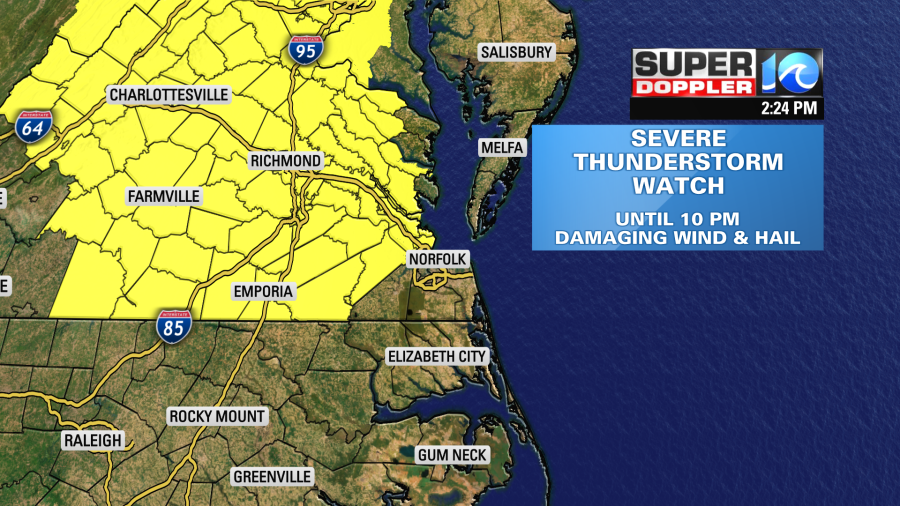
Strong to severe thunderstorms, scattered in nature, are anticipated to race into the Hampton Roads region this evening and into the night. The thunderstorm threat should diminish by the late night / overnight hours.
We’ll have a few showers and storms pop up during the early to mid afternoon. However, the chance for showers and storms goes up between the late afternoon into the evening. Our Future Trak model and the HRRR model both have a big cluster of thunderstorms dropping in by the late afternoon into the early evening.
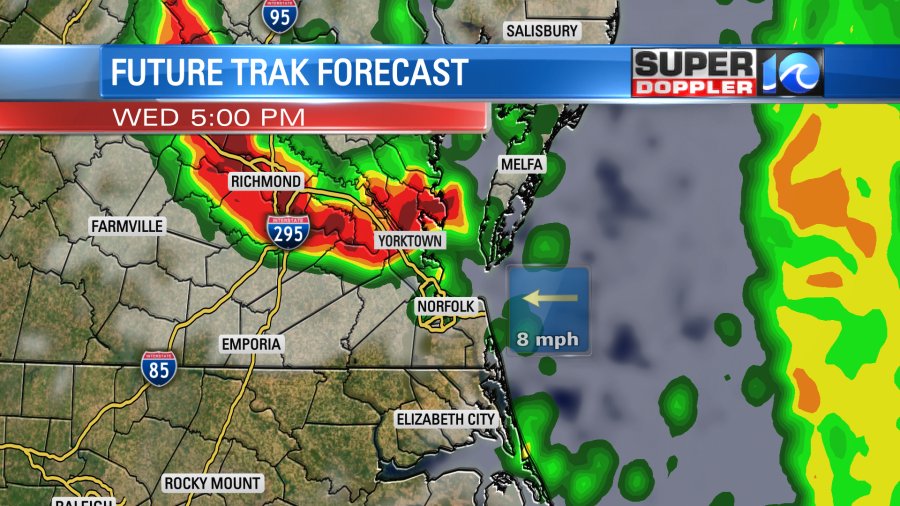
However, our earlier version of Future Trak had some scattered storms firing up between 1 and 4 p.m. So I think the theme is sound (increasing chance for rain). Heavy downpours and strong gusty winds will be the main threats with a lower threat for tornadoes. There may be some spots with hail, but I don’t think that will be a big threat.

The showers and storms will continue into later this evening.
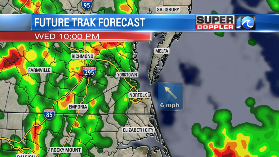
Then they will taper off to spotty showers overnight. The cold front will move through tonight, and then it will drop to our south tomorrow (slowly). We’ll hold on to some spotty/lingering showers Thursday with a mix of sun and clouds. High temps will be in the upper 70s to low 80s. We’ll have a light northeast breeze. We’ll dry out later Thursday into Thursday evening. Then we’ll be dry for the weekend. High temps will be in the 80s.
The smoke from the wildfire in Hyde County has made it up into Hampton Roads. We could smell it throughout the morning. However, it will lift higher in the sky as we heat up this morning into the afternoon. So we shouldn’t smell it as much. The southwest breeze will keep in smoky over parts of North Carolina. Tonight and tomorrow the winds will be out of the north. So that will push the smoke to the south.
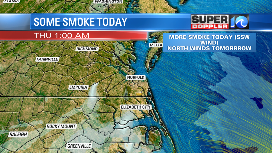
It’s possible that some heavy rain could smother the fire. The models are coming up with different estimates for rainfall over the next 24 hours. The NAM has the highest amount, but I don’t trust it as it has an area of low pressure forming offshore tomorrow. The other models have that feature as a weaker trough. So they are going more with a quarter to a half an inch.

Let’s hope we get the higher amounts.
In world news…The residents in the central U.S. aren’t the only ones experiencing a heat wave. Parts of Europe are also going through some extreme heat. Here is the story with more information: Europe heat wave.
Meteorologist: Jeremy Wheeler & Meteorologist Steve Fundaro